17672 Rockhurst Rd
Castro Valley, CA 94546
- 3Beds
- 2Baths
- 1,522ft²Living Area
- 5,880ft²Lot Size
- -Pool
- -Car
- 1969Year Built
- -DOM
- 1Permit
Property Valuations
Latest estimates for 17672 Rockhurst Rd based on TopHap automated valuation model (AVM).
TopHap Estimate
$1,441,000
$946/ft²
+$796K above Sold Price
Updated 3 months ago
Last Sold Price
$645,000
$424/ft²
9 years ago
17672 Rockhurst Rd is valued at $1,441,000 by TopHap AVM 3 months ago.
17672 Rockhurst Rd was last sold in 2014 for $645,000.
Permits
17672 Rockhurst Rd has 1 permit records.
Current Ownership
Information about the current owner(s).
Taxes Billed
Taxes billed in 2023$9,557.00From latest Total Assessed Value1.28%Total Assessed Value$745,071=Land+
Assessed Value$223,521Additions
Assessed Value$521,550
In 2023, taxes billed for 17672 Rockhurst Rd were $9,557, which is 1.28% from latest Total Assessed Value of $745,071.
Property History
17672 Rockhurst Rd has undefined property events records (listings, deeds, permits, tax, foreclosure, loan).
Environment
Environmental factors around 17672 Rockhurst Rd
Hazard Risks
Earthquake657Particulates105Nat'l Avg100Carb Mono99Air Pollution91Ozone90Lead43Tornado4Weather2Wind2Hail0Hurricane0
10 hazards (Carbon Monoxide, Earthquake Risk, Tornado Index, Air Pollution Index, Ozone Index, Wind Index, Weather Risk, Lead Index, Particulate Matter, National Average) are above the national average around 17672 Rockhurst Rd.
Walkability Index
8 /20
Most Walkable
20-18
Very Walkable
17-15
Somewhat Walkable
14-10
Car Dependent
9-0
17672 Rockhurst Rd has a walkability score of 8 out of 20, which means that it is in a car dependent area.
Temperature
Seasonal temperature sampled over multiple years
Winter
Average
Low
41°F
High
57°F
Summer
Average
Low
54°F
High
74°F
In the winter at 17672 Rockhurst Rd, temperatures range from 41.06°F to 57.47°F with an average of 49.27°F. In the summer, the temperature ranges from 53.89°F to 74.43°F with and average of 64.16°F.
School Information
Public/private schools serving 17672 Rockhurst Rd
Public Schools
Nearby public schools serving 17672 Rockhurst Rd have ratings undefined, undefined, undefined, and undefined.
Neighborhood
This property is located in Castro Valley, Castro Valley, CA 94546.
Seasonal Housing units 94546
10%of housing is for seasonal rent.
Daytime Population for 94546
-4%of people during work hours.
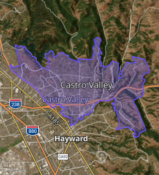
Boundary map of Castro Valley.
Crime Index for 94546
81
The crime index in 94546 is 81, which is 0.8 times lower than national average.
Market Trends
Historical market data near 17672 Rockhurst Rd over selected time period.
Nearby Properties on Rockhurst Rd
- 17912 Rockhurst Rd, Castro Valley, CA 94546 (Castro Valley) is a 1,680 square foot, 3 bedroom, 2 bathroom, 0.24 acre property. It was built in 1961 and has an estimate of $1,182,958 with a price per ft² of $704.
- 17677 Rockhurst Rd, Castro Valley, CA 94546 (Castro Valley) is a 1,611 square foot, 3 bedroom, 2 bathroom, 0.15 acre property. It was built in 1963 and has an estimate of $1,077,920 with a price per ft² of $669.
- 17864 Rockhurst Rd, Castro Valley, CA 94546 (Castro Valley) is a 3,056 square foot, 4 bedroom, 3 bathroom, 0.29 acre property. It was built in 1974 and has an estimate of $1,587,989 with a price per ft² of $520.
- 17737 Rockhurst Rd, Castro Valley, CA 94546 (Castro Valley) is a 1,492 square foot, 3 bedroom, 2 bathroom, 0.2 acre property. It was built in 1961 and has an estimate of $1,168,759 with a price per ft² of $758.
- 17761 Rockhurst Rd, Castro Valley, CA 94546 (Castro Valley) is a 1,408 square foot, 3 bedroom, 2 bathroom, 0.21 acre property. It was built in 1960 and has an estimate of $1,189,324 with a price per ft² of $845.
- 17783 Rockhurst Rd, Castro Valley, CA 94546 (Castro Valley) is a 1,424 square foot, 3 bedroom, 2 bathroom, 0.21 acre property. It was built in 1960 and has an estimate of $1,053,408 with a price per ft² of $740.
- 17976 Rockhurst Rd, Castro Valley, CA 94546 (Castro Valley) is a 1,408 square foot, 3 bedroom, 2 bathroom, 0.25 acre property. It was built in 1960 and has an estimate of $1,158,805 with a price per ft² of $628.
- 17994 Rockhurst Rd, Castro Valley, CA 94546 (Castro Valley) is a 2,154 square foot, 3 bedroom, 2 bathroom, 0.35 acre property. It was built in 1963 and has an estimate of $1,392,377 with a price per ft² of $646.
- 17957 Rockhurst Rd, Castro Valley, CA 94546 (Castro Valley) is a 1,676 square foot, 3 bedroom, 2 bathroom, 0.16 acre property. It was built in 1963 and has an estimate of $1,189,734 with a price per ft² of $710.
- 17958 Rockhurst Rd, Castro Valley, CA 94546 (Castro Valley) is a 1,837 square foot, 3 bedroom, 3 bathroom, 0.24 acre property. It was built in 1961 and has an estimate of $1,202,991 with a price per ft² of $587.
- 17672 Rockhurst Rd, Castro Valley, CA 94546 (Castro Valley) is a 1,522 square foot, 3 bedroom, 2 bathroom, 0.13 acre property. It was built in 1969 and has an estimate of $1,115,321 with a price per ft² of $733.
- 17666 Rockhurst Rd, Castro Valley, CA 94546 (Castro Valley) is a 1,693 square foot, 3 bedroom, 2 bathroom, 0.14 acre property. It was built in 1970 and has an estimate of $1,126,819 with a price per ft² of $666.
- 17760 Rockhurst Rd, Castro Valley, CA 94546 (Castro Valley) is a 1,503 square foot, 3 bedroom, 2 bathroom, 0.19 acre property. It was built in 1962 and has an estimate of $1,151,021 with a price per ft² of $766.
- 17748 Rockhurst Rd, Castro Valley, CA 94546 (Castro Valley) is a 1,398 square foot, 3 bedroom, 2 bathroom, 0.18 acre property. It was built in 1962 and has an estimate of $1,065,399 with a price per ft² of $762.
- 17736 Rockhurst Rd, Castro Valley, CA 94546 (Castro Valley) is a 1,398 square foot, 3 bedroom, 2 bathroom, 0.16 acre property. It was built in 1961 and has an estimate of $1,090,298 with a price per ft² of $780.
- 17724 Rockhurst Rd, Castro Valley, CA 94546 (Castro Valley) is a 1,408 square foot, 3 bedroom, 2 bathroom, 0.16 acre property. It was built in 1962 and has an estimate of $1,076,455 with a price per ft² of $765.
- 17712 Rockhurst Rd, Castro Valley, CA 94546 (Castro Valley) is a 1,443 square foot, 3 bedroom, 2 bathroom, 0.18 acre property. It was built in 1961 and has an estimate of $1,094,251 with a price per ft² of $758.
- 17605 Rockhurst Rd, Castro Valley, CA 94546 (Castro Valley) is a 2,634 square foot, 4 bedroom, 3 bathroom, 0.2 acre property. It was built in 1963 and has an estimate of $1,398,395 with a price per ft² of $531.
- 17882 Rockhurst Rd, Castro Valley, CA 94546 (Castro Valley) is a 1,752 square foot, 3 bedroom, 3.25 bathroom, 0.23 acre property. It was built in 1960 and has an estimate of $1,214,784 with a price per ft² of $693.
- 17896 Rockhurst Rd, Castro Valley, CA 94546 (Castro Valley) is a 1,351 square foot, 3 bedroom, 2 bathroom, 0.23 acre property. It was built in 1960 and has an estimate of $1,139,257 with a price per ft² of $843.
- 17863 Rockhurst Rd, Castro Valley, CA 94546 (Castro Valley) is a 2,368 square foot, 4 bedroom, 3 bathroom, 0.14 acre property. It was built in 1962 and has an estimate of $1,335,249 with a price per ft² of $564.
- 17827 Rockhurst Rd, Castro Valley, CA 94546 (Castro Valley) is a 2,018 square foot, 4 bedroom, 3.25 bathroom, 0.15 acre property. It was built in 1960 and has an estimate of $1,204,960 with a price per ft² of $597.
- 17797 Rockhurst Rd, Castro Valley, CA 94546 (Castro Valley) is a 1,408 square foot, 3 bedroom, 2 bathroom, 0.2 acre property. It was built in 1962 and has an estimate of $1,131,958 with a price per ft² of $804.
- 17749 Rockhurst Rd, Castro Valley, CA 94546 (Castro Valley) is a 1,829 square foot, 4 bedroom, 2 bathroom, 0.2 acre property. It was built in 1962 and has an estimate of $1,276,923 with a price per ft² of $698.
- 17725 Rockhurst Rd, Castro Valley, CA 94546 (Castro Valley) is a 1,424 square foot, 3 bedroom, 2 bathroom, 0.2 acre property. It was built in 1961 and has an estimate of $1,045,000 with a price per ft² of $734.
- View more properties on Rockhurst Rd