177 Manfre Rd
Watsonville, CA 95076
- 3Beds
- 2Baths
- 1,596ft²Living Area
- 8,799ft²Lot Size
- -Pool
- 2Car
- 1965Year Built
- -DOM
- 2Permits
Property Valuations
Latest estimates for 177 Manfre Rd based on TopHap automated valuation model (AVM).
TopHap Estimate
$935,700
$586/ft²
+$411K above Sold Price
Updated 3 months ago
Last Sold Price
$525,000
$329/ft²
8 years ago
177 Manfre Rd is valued at $935,700 by TopHap AVM 3 months ago.
177 Manfre Rd was last sold in 2015 for $525,000.
Permits
177 Manfre Rd has 2 permit records.
Current Ownership
Information about the current owner(s).
Taxes Billed
Taxes billed in 2023$6,982.56From latest Total Assessed Value1.17%Total Assessed Value$597,360=Land+
Assessed Value$426,686Additions
Assessed Value$170,674
In 2023, taxes billed for 177 Manfre Rd were $6,982.56, which is 1.17% from latest Total Assessed Value of $597,360.
Property History
177 Manfre Rd has undefined property events records (listings, deeds, permits, tax, foreclosure, loan).
Environment
Environmental factors around 177 Manfre Rd
Hazard Risks
Earthquake510Particulates102Nat'l Avg100Air Pollution84Ozone82Carb Mono76Lead43Tornado13Weather2Hail0Hurricane0Wind0
9 hazards (Carbon Monoxide, Earthquake Risk, Tornado Index, Air Pollution Index, Ozone Index, Weather Risk, Lead Index, Particulate Matter, National Average) are above the national average around 177 Manfre Rd.
Walkability Index
9 /20
Most Walkable
20-18
Very Walkable
17-15
Somewhat Walkable
14-10
Car Dependent
9-0
177 Manfre Rd has a walkability score of 9 out of 20, which means that it is in a car dependent area.
Temperature
Seasonal temperature sampled over multiple years
Winter
Average
Low
39°F
High
61°F
Summer
Average
Low
51°F
High
75°F
In the winter at 177 Manfre Rd, temperatures range from 39.48°F to 61.46°F with an average of 50.47°F. In the summer, the temperature ranges from 51.25°F to 74.77°F with and average of 63.01°F.
School Information
Public/private schools serving 177 Manfre Rd
Public Schools
Nearby public schools serving 177 Manfre Rd have ratings undefined, undefined, and undefined.
Neighborhood
This property is located in Freedom.
Seasonal Housing units 95076
51%of housing is for seasonal rent.
Daytime Population for 95076
-10%of people during work hours.
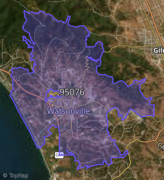
Boundary map of Freedom.
Crime Index for 95076
73
The crime index in 95076 is 73, which is 0.7 times lower than national average.
Market Trends
Historical market data near 177 Manfre Rd over selected time period.
Nearby Properties on Manfre Rd
- 241 Manfre Rd, Watsonville, CA 95076 is a 1,012 square foot, 2 bedroom, 1 bathroom, 0.41 acre property. It was built in 1959 and has an estimate of $687,797 with a price per ft² of $680.
- 309 Manfre Rd, Watsonville, CA 95076 (Manfre) is a 1,264 square foot, 3 bedroom, 2 bathroom, 0.19 acre property. It was built in 1950 and has an estimate of $911,693 with a price per ft² of $721.
- 305 Manfre Rd, Watsonville, CA 95076 (Manfre) is a 918 square foot, 2 bedroom, 1 bathroom, 0.2 acre property. It was built in 1941 and has an estimate of $632,326 with a price per ft² of $689.
- 311 Manfre Rd, Watsonville, CA 95076 (Manfre) is a 1,408 square foot, 2 bedroom, 2 bathroom, 0.2 acre property. It was built in 1952 and has an estimate of $811,311 with a price per ft² of $576.
- 303 Manfre Rd, Watsonville, CA 95076 (Manfre) is a 1,269 square foot, 3 bedroom, 1 bathroom, 0.2 acre property. It was built in 1942 and has an estimate of $689,643 with a price per ft² of $543.
- 313 Manfre Rd, Watsonville, CA 95076 (Manfre) is a 648 square foot, 2 bedroom, 1 bathroom, 0.12 acre property. It was built in 1960 and has an estimate of $555,238 with a price per ft² of $857.
- 301 Manfre Rd, Watsonville, CA 95076 (Manfre) is a 672 square foot, 1 bedroom, 1 bathroom, 0.2 acre property. It was built in 1946 and has an estimate of $586,801 with a price per ft² of $873.
- 315 Manfre Rd, Watsonville, CA 95076 (Manfre) is a 1,240 square foot, 3 bedroom, 2 bathroom, 0.13 acre property. It was built in 1961 and has an estimate of $945,889 with a price per ft² of $788.
- 308 Manfre Rd, Watsonville, CA 95076 (Manfre) is a 1,479 square foot, 3 bedroom, 2 bathroom, 0.19 acre property. It was built in 1950 and has an estimate of $790,023 with a price per ft² of $534.
- 304 Manfre Rd, Watsonville, CA 95076 (Manfre) is a 824 square foot, 2 bedroom, 1 bathroom, 0.19 acre property. It was built in 1949 and has an estimate of $697,688 with a price per ft² of $847.
- 310 Manfre Rd, Watsonville, CA 95076 (Manfre) is a 1,959 square foot, 3 bedroom, 2 bathroom, 0.14 acre property. It was built in 2018 and has an estimate of $810,707 with a price per ft² of $414.
- 65 Manfre Rd, Watsonville, CA 95076 is a 1,156 square foot, 2 bedroom, 1 bathroom, 2.8 acre property. It was built in 2006 and has an estimate of $582,230 with a price per ft² of $504.
- 237 Manfre Rd, Watsonville, CA 95076 is a 1,231 square foot, 2 bedroom, 1 bathroom, 0.61 acre property. It was built in 1925 and has an estimate of $729,202 with a price per ft² of $592.
- 249 Manfre Rd, Watsonville, CA 95076 is a 1,036 square foot, 3 bedroom, 1 bathroom, 1.13 acre property. It was built in 1944 and has an estimate of $713,603 with a price per ft² of $689.
- 244 Manfre Rd, Watsonville, CA 95076 is a 893 square foot, 2 bedroom, 1 bathroom, 0.14 acre property. It was built in 1969 and has an estimate of $645,675 with a price per ft² of $723.
- 246 Manfre Rd, Watsonville, CA 95076 is a 1,258 square foot, 3 bedroom, 2 bathroom, 0.32 acre property. It was built in 1972 and has an estimate of $775,132 with a price per ft² of $616.
- 229 Manfre Rd, Watsonville, CA 95076 is a 1,330 square foot, 3 bedroom, 1 bathroom, 0.95 acre property. It was built in 1949 and has an estimate of $750,338 with a price per ft² of $564.
- 254 Manfre Rd, Watsonville, CA 95076 is a 1,204 square foot, 3 bedroom, 1 bathroom, 0.2 acre property. It was built in 1996 and has an estimate of $705,447 with a price per ft² of $586.
- 257 Manfre Rd, Watsonville, CA 95076 (Manfre) is a 1,116 square foot, 3 bedroom, 2 bathroom, 0.17 acre property. It was built in 1953 and has an estimate of $809,716 with a price per ft² of $726.
- 256 Manfre Rd, Watsonville, CA 95076 (Manfre) is a 1,272 square foot, 2 bedroom, 1 bathroom, 0.26 acre property. It was built in 1946 and has an estimate of $646,921 with a price per ft² of $509.
- 259 Manfre Rd, Watsonville, CA 95076 (Manfre) is a 2,266 square foot, 3 bedroom, 2 bathroom, 0.17 acre property. It was built in 1954 and has an estimate of $778,841 with a price per ft² of $344.
- 265 Manfre Rd, Watsonville, CA 95076 (Manfre) is a 1,696 square foot, 4 bedroom, 2 bathroom, 0.2 acre property. It was built in 1960 and has an estimate of $870,343 with a price per ft² of $513.
- 271 Manfre Rd, Watsonville, CA 95076 (Manfre) is a 1,032 square foot, 2 bedroom, 1 bathroom, 0.2 acre property. It was built in 1957 and has an estimate of $698,423 with a price per ft² of $677.
- 261 Manfre Rd, Watsonville, CA 95076 (Manfre) is a 1,328 square foot, 2 bedroom, 1 bathroom, 0.2 acre property. It was built in 1957 and has an estimate of $572,321 with a price per ft² of $431.
- 268 Manfre Rd, Watsonville, CA 95076 (Manfre) is a 1,459 square foot, 3 bedroom, 2 bathroom, 0.19 acre property. It was built in 1998 and has an estimate of $803,459 with a price per ft² of $551.
- View more properties on Manfre Rd