1826 Lowe Dr
Woodland, CA 95776
- 4Beds
- 3Baths
- 2,310ft²Living Area
- 5,663ft²Lot Size
- -Pool
- 2Car
- 2004Year Built
- -DOM
- -Permit
Property Valuations
Latest estimates for 1826 Lowe Dr based on TopHap automated valuation model (AVM).
TopHap Estimate
$625,500
$270/ft²
+$161K above Sold Price
Updated 3 months ago
Last Sold Price
$464,500
$201/ft²
6 years ago
1826 Lowe Dr is valued at $625,500 by TopHap AVM 3 months ago.
1826 Lowe Dr was last sold in 2018 for $464,500.
Current Ownership
Information about the current owner(s).
Taxes Billed
Taxes billed in 2023$6,293.52From latest Total Assessed Value1.24%Total Assessed Value$507,995=Land+
Assessed Value$87,490Additions
Assessed Value$420,505
In 2023, taxes billed for 1826 Lowe Dr were $6,293.52, which is 1.24% from latest Total Assessed Value of $507,995.
Property History
1826 Lowe Dr has undefined property events records (listings, deeds, permits, tax, foreclosure, loan).
Environment
Environmental factors around 1826 Lowe Dr
Hazard Risks
Earthquake154Nat'l Avg100Particulates94Ozone82Air Pollution81Carb Mono71Lead41Tornado6Hail5Weather1Hurricane0Wind0
10 hazards (Carbon Monoxide, Earthquake Risk, Hail Index, Tornado Index, Air Pollution Index, Ozone Index, Weather Risk, Lead Index, Particulate Matter, National Average) are above the national average around 1826 Lowe Dr.
Walkability Index
17 /20
Most Walkable
20-18
Very Walkable
17-15
Somewhat Walkable
14-10
Car Dependent
9-0
1826 Lowe Dr has a walkability score of 17 out of 20, which means that it is in a very walkable area.
Noise Level
45 dB
Quiet Suburban Residential 0-49
Suburban Residential 50-54
Urban Residential 55-59
Noisy Urban Residential 60-64
Very Noisy Urban Residential 65+
Noise at 1826 Lowe Dr is around 45dBs, which is comparable to a Quiet Suburban Residential area.
Temperature
Seasonal temperature sampled over multiple years
Winter
Average
Low
39°F
High
56°F
Summer
Average
Low
57°F
High
93°F
In the winter at 1826 Lowe Dr, temperatures range from 38.62°F to 56.17°F with an average of 47.4°F. In the summer, the temperature ranges from 56.85°F to 92.89°F with and average of 74.87°F.
School Information
Public/private schools serving 1826 Lowe Dr
Public Schools
Nearby public schools serving 1826 Lowe Dr have ratings undefined, undefined, and undefined.
Neighborhood
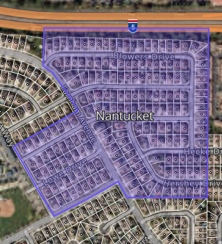
This property is located in Nantucket, Woodland, CA 95776.
Seasonal Housing units 95776
33%of housing is for seasonal rent.
Daytime Population for 95776
-1%of people during work hours.
Boundary map of Nantucket.
Crime Index for 95776
55
The crime index in 95776 is 55, which is 0.6 times lower than national average.
Market Trends
Historical market data near 1826 Lowe Dr over selected time period.
Nearby Properties on Lowe Dr
- 1818 Lowe Dr, Woodland, CA 95776 (Nantucket) is a 1,627 square foot, 3 bedroom, 2 bathroom, 0.13 acre property. It was built in 2004 and has an estimate of $478,238 with a price per ft² of $294.
- 1822 Lowe Dr, Woodland, CA 95776 (Nantucket) is a 3,225 square foot, 6 bedroom, 3 bathroom, 0.13 acre property. It was built in 2004 and has an estimate of $673,869 with a price per ft² of $209.
- 1802 Lowe Dr, Woodland, CA 95776 (Nantucket) is a 1,627 square foot, 3 bedroom, 2 bathroom, 0.15 acre property. It was built in 2004 and has an estimate of $508,520 with a price per ft² of $313.
- 1810 Lowe Dr, Woodland, CA 95776 (Nantucket) is a 2,870 square foot, 4 bedroom, 3.25 bathroom, 0.13 acre property. It was built in 2004 and has an estimate of $570,735 with a price per ft² of $199.
- 1805 Lowe Dr, Woodland, CA 95776 (Nantucket) is a 2,395 square foot, 4 bedroom, 3 bathroom, 0.13 acre property. It was built in 2004 and has an estimate of $601,221 with a price per ft² of $251.
- 1806 Lowe Dr, Woodland, CA 95776 (Nantucket) is a 3,225 square foot, 5 bedroom, 3 bathroom, 0.13 acre property. It was built in 2004 and has an estimate of $623,304 with a price per ft² of $193.
- 1809 Lowe Dr, Woodland, CA 95776 (Nantucket) is a 2,884 square foot, 5 bedroom, 3 bathroom, 0.13 acre property. It was built in 2004 and has an estimate of $603,473 with a price per ft² of $209.
- 1813 Lowe Dr, Woodland, CA 95776 (Nantucket) is a 1,218 square foot, 3 bedroom, 2 bathroom, 0.13 acre property. It was built in 2004 and has an estimate of $456,406 with a price per ft² of $375.
- 1814 Lowe Dr, Woodland, CA 95776 (Nantucket) is a 2,565 square foot, 4 bedroom, 3 bathroom, 0.13 acre property. It was built in 2004 and has an estimate of $571,378 with a price per ft² of $223.
- 1817 Lowe Dr, Woodland, CA 95776 (Nantucket) is a 2,884 square foot, 5 bedroom, 3 bathroom, 0.13 acre property. It was built in 2004 and has an estimate of $618,666 with a price per ft² of $215.
- 1825 Lowe Dr, Woodland, CA 95776 (Nantucket) is a 2,395 square foot, 4 bedroom, 3 bathroom, 0.13 acre property. It was built in 2004 and has an estimate of $606,192 with a price per ft² of $253.
- 1826 Lowe Dr, Woodland, CA 95776 (Nantucket) is a 2,310 square foot, 4 bedroom, 3.25 bathroom, 0.13 acre property. It was built in 2004 and has an estimate of $584,683 with a price per ft² of $253.
- 1830 Lowe Dr, Woodland, CA 95776 (Nantucket) is a 2,884 square foot, 5 bedroom, 3 bathroom, 0.13 acre property. It was built in 2004 and has an estimate of $624,347 with a price per ft² of $216.
- 1833 Lowe Dr, Woodland, CA 95776 (Nantucket) is a 1,857 square foot, 3 bedroom, 2 bathroom, 0.15 acre property. It was built in 2004 and has an estimate of $547,753 with a price per ft² of $295.
- 1829 Lowe Dr, Woodland, CA 95776 (Nantucket) is a 2,884 square foot, 5 bedroom, 3 bathroom, 0.13 acre property. It was built in 2004 and has an estimate of $642,609 with a price per ft² of $223.
- 1821 Lowe Dr, Woodland, CA 95776 (Nantucket) is a 2,012 square foot, 3 bedroom, 3.25 bathroom, 0.13 acre property. It was built in 2004 and has an estimate of $520,243 with a price per ft² of $259.
- 1801 Lowe Dr, Woodland, CA 95776 (Nantucket) is a 1,857 square foot, 3 bedroom, 2 bathroom, 0.15 acre property. It was built in 2004 and has an estimate of $542,352 with a price per ft² of $292.
- 1834 Lowe Dr, Woodland, CA 95776 (Nantucket) is a 1,218 square foot, 3 bedroom, 2 bathroom, 0.15 acre property. It was built in 2004 and has an estimate of $485,926 with a price per ft² of $399.