1834 White Sands Ln
Davis, CA 95616
- 3Beds
- 2Baths
- 1,498ft²Living Area
- 4,500ft²Lot Size
- -Pool
- 2Car
- 1996Year Built
- -DOM
- 6Permits
Property Valuations
Latest estimates for 1834 White Sands Ln based on TopHap automated valuation model (AVM).
TopHap Estimate
$787,864
$525/ft²
-$13K below Sold Price
Updated 3 months ago
Last Sold Price
$801,000
$535/ft²
10 months ago
1834 White Sands Ln is valued at $787,864 by TopHap AVM 3 months ago.
1834 White Sands Ln was last sold in 2023 for $801,000.
Permits
1834 White Sands Ln has 6 permit records of total value of $16,666.
Current Ownership
Information about the current owner(s).
Taxes Billed
Taxes billed in 2023$4,951.06From latest Total Assessed Value1.76%Total Assessed Value$280,974=Land+
Assessed Value$101,741Additions
Assessed Value$179,233
In 2023, taxes billed for 1834 White Sands Ln were $4,951.06, which is 1.76% from latest Total Assessed Value of $280,974.
Property History
1834 White Sands Ln has undefined property events records (listings, deeds, permits, tax, foreclosure, loan).
Environment
Environmental factors around 1834 White Sands Ln
Hazard Risks
Earthquake179Nat'l Avg100Particulates93Ozone84Air Pollution82Carb Mono74Lead41Hail2Tornado1Weather1Hurricane0Wind0
10 hazards (Carbon Monoxide, Earthquake Risk, Hail Index, Tornado Index, Air Pollution Index, Ozone Index, Weather Risk, Lead Index, Particulate Matter, National Average) are above the national average around 1834 White Sands Ln.
Walkability Index
14 /20
Most Walkable
20-18
Very Walkable
17-15
Somewhat Walkable
14-10
Car Dependent
9-0
1834 White Sands Ln has a walkability score of 14 out of 20, which means that it is in a somewhat walkable area.
Temperature
Seasonal temperature sampled over multiple years
Winter
Average
Low
38°F
High
56°F
Summer
Average
Low
56°F
High
92°F
In the winter at 1834 White Sands Ln, temperatures range from 38.43°F to 56.48°F with an average of 47.46°F. In the summer, the temperature ranges from 56.15°F to 92.39°F with and average of 74.27°F.
School Information
Public/private schools serving 1834 White Sands Ln
Public Schools
Nearby public schools serving 1834 White Sands Ln have ratings undefined, undefined, and undefined.
Neighborhood
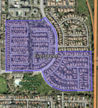
This property is located in West Davis, Davis, CA 95616.
Seasonal Housing units 95616
12%of housing is for seasonal rent.
Daytime Population for 95616
-9%of people during work hours.
Boundary map of West Davis.
Crime Index for 95616
107
The crime index in 95616 is 107, which is 1.1 times higher than national average.
Market Trends
Historical market data near 1834 White Sands Ln over selected time period.
Nearby Properties on White Sands Ln
- 1828 White Sands Ln, Davis, CA 95616 (Evergreen) is a 1,498 square foot, 3 bedroom, 2 bathroom, 0.1 acre property. It was built in 1996 and has an estimate of $851,260 with a price per ft² of $568.
- 1843 White Sands Ln, Davis, CA 95616 (Evergreen) is a 2,013 square foot, 4 bedroom, 3.25 bathroom, 0.1 acre property. It was built in 1996 and has an estimate of $866,482 with a price per ft² of $430.
- 1849 White Sands Ln, Davis, CA 95616 (Evergreen) is a 2,306 square foot, 5 bedroom, 3 bathroom, 0.18 acre property. It was built in 1996 and has an estimate of $952,322 with a price per ft² of $413.
- 1816 White Sands Ln, Davis, CA 95616 (Evergreen) is a 1,498 square foot, 3 bedroom, 2 bathroom, 0.1 acre property. It was built in 1996 and has an estimate of $853,919 with a price per ft² of $570.
- 1819 White Sands Ln, Davis, CA 95616 (Evergreen) is a 2,021 square foot, 4 bedroom, 3.25 bathroom, 0.1 acre property. It was built in 1996 and has an estimate of $868,851 with a price per ft² of $430.
- 1801 White Sands Ln, Davis, CA 95616 (Evergreen) is a 2,175 square foot, 3 bedroom, 3 bathroom, 0.1 acre property. It was built in 1996 and has an estimate of $993,918 with a price per ft² of $457.
- 1804 White Sands Ln, Davis, CA 95616 (Evergreen) is a 1,498 square foot, 3 bedroom, 2 bathroom, 0.12 acre property. It was built in 1996 and has an estimate of $856,798 with a price per ft² of $572.
- 1840 White Sands Ln, Davis, CA 95616 (Evergreen) is a 2,013 square foot, 3 bedroom, 3.25 bathroom, 0.12 acre property. It was built in 1996 and has an estimate of $942,912 with a price per ft² of $468.
- 1825 White Sands Ln, Davis, CA 95616 (Evergreen) is a 1,498 square foot, 3 bedroom, 2 bathroom, 0.1 acre property. It was built in 1996 and has an estimate of $780,425 with a price per ft² of $521.
- 1813 White Sands Ln, Davis, CA 95616 (Evergreen) is a 1,498 square foot, 3 bedroom, 2 bathroom, 0.1 acre property. It was built in 1996 and has an estimate of $722,237 with a price per ft² of $482.
- 1834 White Sands Ln, Davis, CA 95616 (Evergreen) is a 1,498 square foot, 3 bedroom, 2 bathroom, 0.1 acre property. It was built in 1996 and has an estimate of $821,042 with a price per ft² of $548.
- 1822 White Sands Ln, Davis, CA 95616 (Evergreen) is a 2,013 square foot, 3 bedroom, 3.25 bathroom, 0.1 acre property. It was built in 1996 and has an estimate of $958,470 with a price per ft² of $476.
- 1810 White Sands Ln, Davis, CA 95616 (Evergreen) is a 2,013 square foot, 3 bedroom, 3.25 bathroom, 0.1 acre property. It was built in 1996 and has an estimate of $967,225 with a price per ft² of $480.
- 1807 White Sands Ln, Davis, CA 95616 (Evergreen) is a 1,498 square foot, 3 bedroom, 2 bathroom, 0.1 acre property. It was built in 1996 and has an estimate of $739,722 with a price per ft² of $494.
- 1831 White Sands Ln, Davis, CA 95616 (Evergreen) is a 2,013 square foot, 3 bedroom, 3.25 bathroom, 0.1 acre property. It was built in 1996 and has an estimate of $859,921 with a price per ft² of $427.
- 1837 White Sands Ln, Davis, CA 95616 (Evergreen) is a 1,498 square foot, 3 bedroom, 2 bathroom, 0.1 acre property. It was built in 1996 and has an estimate of $732,690 with a price per ft² of $489.