186 Coral Dr
Woodland, CA 95695
- 3Beds
- 2Baths
- 1,234ft²Living Area
- 7,128ft²Lot Size
- 1Pool
- 2Car
- 1960Year Built
- -DOM
- -Permit
Property Valuations
Latest estimates for 186 Coral Dr based on TopHap automated valuation model (AVM).
TopHap Estimate
$432,250
$350/ft²
+$194K above Sold Price
Updated 3 months ago
Last Sold Price
$238,500
$193/ft²
20 years ago
186 Coral Dr is valued at $432,250 by TopHap AVM 3 months ago.
186 Coral Dr was last sold in 2004 for $238,500.
Current Ownership
Information about the current owner(s).
Taxes Billed
Taxes billed in 2023$3,478.96From latest Total Assessed Value1.07%Total Assessed Value$325,908=Land+
Assessed Value$129,815Additions
Assessed Value$196,093
In 2023, taxes billed for 186 Coral Dr were $3,478.96, which is 1.07% from latest Total Assessed Value of $325,908.
Property History
186 Coral Dr has undefined property events records (listings, deeds, permits, tax, foreclosure, loan).
Environment
Environmental factors around 186 Coral Dr
Hazard Risks
Earthquake171Nat'l Avg100Particulates93Ozone85Air Pollution84Carb Mono74Lead43Hail2Tornado2Weather1Hurricane0Wind0
10 hazards (Carbon Monoxide, Earthquake Risk, Hail Index, Tornado Index, Air Pollution Index, Ozone Index, Weather Risk, Lead Index, Particulate Matter, National Average) are above the national average around 186 Coral Dr.
Walkability Index
18 /20
Most Walkable
20-18
Very Walkable
17-15
Somewhat Walkable
14-10
Car Dependent
9-0
186 Coral Dr has a walkability score of 18 out of 20, which means that it is in a most walkable area.
Temperature
Seasonal temperature sampled over multiple years
Winter
Average
Low
38°F
High
56°F
Summer
Average
Low
57°F
High
93°F
In the winter at 186 Coral Dr, temperatures range from 38.36°F to 56.43°F with an average of 47.4°F. In the summer, the temperature ranges from 57.1°F to 92.85°F with and average of 74.98°F.
School Information
Public/private schools serving 186 Coral Dr
Public Schools
Nearby public schools serving 186 Coral Dr have ratings undefined, undefined, and undefined.
Neighborhood
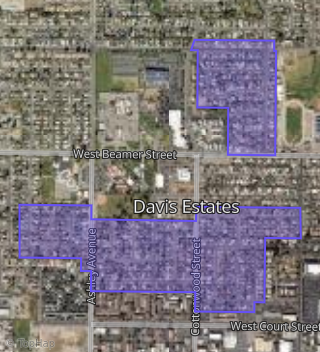
This property is located in Davis Estates, Woodland, CA 95695.
Seasonal Housing units 95695
9%of housing is for seasonal rent.
Daytime Population for 95695
-13%of people during work hours.
Boundary map of Davis Estates.
Crime Index for 95695
106
The crime index in 95695 is 106, which is 1.1 times higher than national average.
Market Trends
Historical market data near 186 Coral Dr over selected time period.
Nearby Properties on Coral Dr
- 154 Coral Dr, Woodland, CA 95695 (Davis Estates) is a 1,234 square foot, 3 bedroom, 2 bathroom, 0.13 acre property. It was built in 1960 and has an estimate of $414,610 with a price per ft² of $336.
- 102 Coral Dr, Woodland, CA 95695 (Davis Estates) is a 1,690 square foot, 4 bedroom, 3 bathroom, 0.16 acre property. It was built in 1960 and has an estimate of $452,535 with a price per ft² of $268.
- 106 Coral Dr, Woodland, CA 95695 (Davis Estates) is a 1,234 square foot, 3 bedroom, 2 bathroom, 0.13 acre property. It was built in 1960 and has an estimate of $432,426 with a price per ft² of $350.
- 150 Coral Dr, Woodland, CA 95695 (Davis Estates) is a 1,221 square foot, 3 bedroom, 1 bathroom, 0.13 acre property. It was built in 1960 and has an estimate of $374,041 with a price per ft² of $306.
- 146 Coral Dr, Woodland, CA 95695 (Davis Estates) is a 1,234 square foot, 3 bedroom, 2 bathroom, 0.13 acre property. It was built in 1960 and has an estimate of $414,638 with a price per ft² of $336.
- 142 Coral Dr, Woodland, CA 95695 (Davis Estates) is a 1,000 square foot, 3 bedroom, 1 bathroom, 0.13 acre property. It was built in 1960 and has an estimate of $379,169 with a price per ft² of $379.
- 162 Coral Dr, Woodland, CA 95695 (Davis Estates) is a 1,440 square foot, 3 bedroom, 1 bathroom, 0.13 acre property. It was built in 1960 and has an estimate of $387,888 with a price per ft² of $269.
- 158 Coral Dr, Woodland, CA 95695 (Davis Estates) is a 1,229 square foot, 3 bedroom, 2 bathroom, 0.13 acre property. It was built in 1960 and has an estimate of $423,589 with a price per ft² of $345.
- 166 Coral Dr, Woodland, CA 95695 (Davis Estates) is a 1,614 square foot, 3 bedroom, 2 bathroom, 0.13 acre property. It was built in 1960 and has an estimate of $401,058 with a price per ft² of $248.
- 114 Coral Dr, Woodland, CA 95695 (Davis Estates) is a 1,000 square foot, 3 bedroom, 1 bathroom, 0.13 acre property. It was built in 1960 and has an estimate of $400,970 with a price per ft² of $401.
- 110 Coral Dr, Woodland, CA 95695 (Davis Estates) is a 1,494 square foot, 3 bedroom, 2 bathroom, 0.13 acre property. It was built in 1960 and has an estimate of $428,761 with a price per ft² of $287.
- 130 Coral Dr, Woodland, CA 95695 (Davis Estates) is a 1,234 square foot, 3 bedroom, 2 bathroom, 0.13 acre property. It was built in 1960 and has an estimate of $421,957 with a price per ft² of $342.
- 126 Coral Dr, Woodland, CA 95695 (Davis Estates) is a 1,020 square foot, 3 bedroom, 1 bathroom, 0.13 acre property. It was built in 1960 and has an estimate of $379,622 with a price per ft² of $372.
- 122 Coral Dr, Woodland, CA 95695 (Davis Estates) is a 1,234 square foot, 3 bedroom, 2 bathroom, 0.13 acre property. It was built in 1960 and has an estimate of $431,375 with a price per ft² of $350.
- 174 Coral Dr, Woodland, CA 95695 (Davis Estates) is a 1,000 square foot, 3 bedroom, 1 bathroom, 0.13 acre property. It was built in 1960 and has an estimate of $409,636 with a price per ft² of $410.
- 178 Coral Dr, Woodland, CA 95695 (Davis Estates) is a 1,234 square foot, 3 bedroom, 2 bathroom, 0.13 acre property. It was built in 1960 and has an estimate of $495,921 with a price per ft² of $402.
- 182 Coral Dr, Woodland, CA 95695 (Davis Estates) is a 1,000 square foot, 3 bedroom, 1 bathroom, 0.13 acre property. It was built in 1960 and has an estimate of $368,750 with a price per ft² of $369.
- 186 Coral Dr, Woodland, CA 95695 (Davis Estates) is a 1,234 square foot, 3 bedroom, 2 bathroom, 0.16 acre property. It was built in 1960 and has an estimate of $414,343 with a price per ft² of $336.
- 170 Coral Dr, Woodland, CA 95695 (Davis Estates) is a 1,330 square foot, 3 bedroom, 2 bathroom, 0.13 acre property. It was built in 1960 and has an estimate of $546,506 with a price per ft² of $411.
- 138 Coral Dr, Woodland, CA 95695 (Davis Estates) is a 1,234 square foot, 3 bedroom, 2 bathroom, 0.13 acre property. It was built in 1960 and has an estimate of $437,950 with a price per ft² of $355.
- 134 Coral Dr, Woodland, CA 95695 (Davis Estates) is a 1,234 square foot, 3 bedroom, 2 bathroom, 0.13 acre property. It was built in 1960 and has an estimate of $417,580 with a price per ft² of $338.
- 118 Coral Dr, Woodland, CA 95695 (Davis Estates) is a 1,538 square foot, 3 bedroom, 2 bathroom, 0.13 acre property. It was built in 1960 and has an estimate of $440,877 with a price per ft² of $287.