1903 Aircraft Ct
Odenton, MD 21113
- -Bed
- 3Baths
- 1,700ft²Living Area
- 7,181ft²Lot Size
- -Pool
- 2Car
- 1993Year Built
- -DOM
- 4Permits
Property Valuations
Latest estimates for 1903 Aircraft Ct based on TopHap automated valuation model (AVM).
TopHap Estimate
$479,433
$282/ft²
+$258K above Sold Price
Updated 3 months ago
Last Sold Price
$221,000
$130/ft²
22 years ago
1903 Aircraft Ct is valued at $479,433 by TopHap AVM 3 months ago.
1903 Aircraft Ct was last sold in 2001 for $221,000.
Permits
1903 Aircraft Ct has 4 permit records of total value of $12,097.
Current Ownership
Information about the current owner(s).
Taxes Billed
Taxes billed in 2023$3,124.57From latest Total Assessed Value0.83%Total Assessed Value$374,400=Land+
Assessed Value$0Additions
Assessed Value$0
In 2023, taxes billed for 1903 Aircraft Ct were $3,124.57, which is 0.83% from latest Total Assessed Value of $374,400.
Property History
1903 Aircraft Ct has undefined property events records (listings, deeds, permits, tax, foreclosure, loan).
Environment
Environmental factors around 1903 Aircraft Ct
Hazard Risks
Wind282Hail242Weather109Carb Mono103Nat'l Avg100Hurricane92Air Pollution86Tornado85Ozone84Particulates76Lead50Earthquake39
12 hazards (Carbon Monoxide, Earthquake Risk, Hail Index, Tornado Index, Hurricane Index, Air Pollution Index, Ozone Index, Wind Index, Weather Risk, Lead Index, Particulate Matter, National Average) are above the national average around 1903 Aircraft Ct.
Walkability Index
6 /20
Most Walkable
20-18
Very Walkable
17-15
Somewhat Walkable
14-10
Car Dependent
9-0
1903 Aircraft Ct has a walkability score of 6 out of 20, which means that it is in a car dependent area.
Temperature
Seasonal temperature sampled over multiple years
Winter
Average
Low
26°F
High
45°F
Summer
Average
Low
64°F
High
86°F
In the winter at 1903 Aircraft Ct, temperatures range from 26.08°F to 44.97°F with an average of 35.53°F. In the summer, the temperature ranges from 63.68°F to 85.67°F with and average of 74.68°F.
School Information
Public/private schools serving 1903 Aircraft Ct
Public Schools
Nearby public schools serving 1903 Aircraft Ct have ratings undefined, undefined, and undefined.
Neighborhood
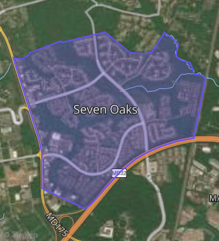
This property is located in Odenton, Odenton, MD 21113.
Seasonal Housing units 21113
17%of housing is for seasonal rent.
Daytime Population for 21113
-25%of people during work hours.
Boundary map of Odenton.
Crime Index for 21113
89
The crime index in 21113 is 89, which is 0.9 times lower than national average.
Market Trends
Historical market data near 1903 Aircraft Ct over selected time period.
Nearby Properties on Aircraft Ct
- 1904 Aircraft Ct, Odenton, MD 21113 (Seven Oaks) is a 1,872 square foot, 3.25 bathroom, 0.23 acre property. It was built in 1994 and has an estimate of $556,913 with a price per ft² of $297.
- 1902 Aircraft Ct, Odenton, MD 21113 (Seven Oaks) is a 2,210 square foot, 3.25 bathroom, 0.22 acre property. It was built in 1992 and has an estimate of $574,648 with a price per ft² of $260.
- 1905 Aircraft Ct, Odenton, MD 21113 (Seven Oaks) is a 1,826 square foot, 3.25 bathroom, 0.21 acre property. It was built in 1994 and has an estimate of $538,228 with a price per ft² of $295.
- 1903 Aircraft Ct, Odenton, MD 21113 (Seven Oaks) is a 1,700 square foot, 3.25 bathroom, 0.16 acre property. It was built in 1993 and has an estimate of $534,271 with a price per ft² of $314.