1969 Gaspar Dr
Oakland, CA 94611
- 4Beds
- 3Baths
- 3,445ft²Living Area
- 9,427ft²Lot Size
- 1Pool
- 2Car
- 1994Year Built
- -DOM
- 15Permits
Property Valuations
Latest estimates for 1969 Gaspar Dr based on TopHap automated valuation model (AVM).
TopHap Estimate
$1,955,750
$567/ft²
+$741K above Sold Price
Updated 3 months ago
Last Sold Price
$1,215,000
$353/ft²
9 years ago
1969 Gaspar Dr is valued at $1,955,750 by TopHap AVM 3 months ago.
1969 Gaspar Dr was last sold in 2014 for $1,215,000.
Permits
1969 Gaspar Dr has 15 permit records of total value of $1,711,448.
Current Ownership
Information about the current owner(s).
Taxes Billed
Taxes billed in 2023$21,788.76From latest Total Assessed Value1.49%Total Assessed Value$1,458,389=Land+
Assessed Value$429,461Additions
Assessed Value$1,028,928
In 2023, taxes billed for 1969 Gaspar Dr were $21,788.76, which is 1.49% from latest Total Assessed Value of $1,458,389.
Property History
1969 Gaspar Dr has undefined property events records (listings, deeds, permits, tax, foreclosure, loan).
Environment
Environmental factors around 1969 Gaspar Dr
Hazard Risks
Earthquake584Particulates101Nat'l Avg100Carb Mono99Ozone85Air Pollution84Lead43Tornado11Weather7Hail0Hurricane0Wind0
9 hazards (Carbon Monoxide, Earthquake Risk, Tornado Index, Air Pollution Index, Ozone Index, Weather Risk, Lead Index, Particulate Matter, National Average) are above the national average around 1969 Gaspar Dr.
Walkability Index
18 /20
Most Walkable
20-18
Very Walkable
17-15
Somewhat Walkable
14-10
Car Dependent
9-0
1969 Gaspar Dr has a walkability score of 18 out of 20, which means that it is in a most walkable area.
Temperature
Seasonal temperature sampled over multiple years
Winter
Average
Low
42°F
High
56°F
Summer
Average
Low
53°F
High
74°F
In the winter at 1969 Gaspar Dr, temperatures range from 42.02°F to 56.44°F with an average of 49.23°F. In the summer, the temperature ranges from 53.42°F to 73.86°F with and average of 63.64°F.
School Information
Public/private schools serving 1969 Gaspar Dr
Public Schools
Nearby public schools serving 1969 Gaspar Dr have ratings undefined, undefined, and undefined.
Neighborhood
This property is located in Montclair, Oakland, CA 94611.
Seasonal Housing units 94611
9%of housing is for seasonal rent.
Daytime Population for 94611
+11%of people during work hours.
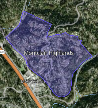
Boundary map of Montclair.
Crime Index for 94611
91
The crime index in 94611 is 91, which is 0.9 times lower than national average.
Market Trends
Historical market data near 1969 Gaspar Dr over selected time period.
Nearby Properties on Gaspar Dr
- 1848 Gaspar Dr, Oakland, CA 94611 (Montclair Highlands) is a 1,976 square foot, 3 bedroom, 2.5 bathroom, 0.14 acre property. It was built in 1969 and has an estimate of $1,556,250 with a price per ft² of $788.
- 1829 Gaspar Dr, Oakland, CA 94611 (Montclair Highlands) is a 2,184 square foot, 3 bedroom, 3.25 bathroom, 0.18 acre property. It was built in 1977 and has an estimate of $1,409,412 with a price per ft² of $645.
- 1907 Gaspar Dr, Oakland, CA 94611 (Montclair Highlands) is a 3,383 square foot, 4 bedroom, 4.25 bathroom, 0.15 acre property. It was built in 2004 and has an estimate of $2,102,050 with a price per ft² of $621.
- 1915 Gaspar Dr, Oakland, CA 94611 (Montclair Highlands) is a 2,576 square foot, 3 bedroom, 4.25 bathroom, 0.17 acre property. It was built in 1989 and has an estimate of $1,550,775 with a price per ft² of $602.
- 1927 Gaspar Dr, Oakland, CA 94611 (Montclair Highlands) is a 1,578 square foot, 3 bedroom, 2 bathroom, 0.19 acre property. It was built in 1973 and has an estimate of $1,195,987 with a price per ft² of $758.
- 1901 Gaspar Dr, Oakland, CA 94611 (Montclair Highlands) is a 1,606 square foot, 2 bedroom, 3.25 bathroom, 0.14 acre property. It was built in 1951 and has an estimate of $1,378,650 with a price per ft² of $858.
- 1961 Gaspar Dr, Oakland, CA 94611 (Montclair Highlands) is a 2,844 square foot, 4 bedroom, 3 bathroom, 0.2 acre property. It was built in 1937 and has an estimate of $1,438,217 with a price per ft² of $506.
- 1900 Gaspar Dr, Oakland, CA 94611 (Montclair Highlands) is a 2,600 square foot, 5 bedroom, 4 bathroom, 0.17 acre property. It was built in 1982 and has an estimate of $1,268,125 with a price per ft² of $488.
- 1969 Gaspar Dr, Oakland, CA 94611 (Montclair Highlands) is a 3,445 square foot, 4 bedroom, 3 bathroom, 0.18 acre property. It was built in 1994 and has an estimate of $1,694,922 with a price per ft² of $492.
- 1957 Gaspar Dr, Oakland, CA 94611 (Montclair Highlands) is a 2,309 square foot, 4 bedroom, 2 bathroom, 0.18 acre property. It was built in 1942 and has an estimate of $1,659,662 with a price per ft² of $719.
- 1836 Gaspar Dr, Oakland, CA 94611 (Montclair Highlands) is a 1,621 square foot, 3 bedroom, 2 bathroom, 0.32 acre property. It was built in 1959 and has an estimate of $1,368,245 with a price per ft² of $844.
- 1842 Gaspar Dr, Oakland, CA 94611 (Montclair Highlands) is a 1,256 square foot, 3 bedroom, 2 bathroom, 0.14 acre property. It was built in 1968 and has an estimate of $1,202,511 with a price per ft² of $957.
- 1854 Gaspar Dr, Oakland, CA 94611 (Montclair Highlands) is a 2,810 square foot, 4 bedroom, 4 bathroom, 0.15 acre property. It was built in 1979 and has an estimate of $1,517,428 with a price per ft² of $540.
- 1833 Gaspar Dr, Oakland, CA 94611 (Montclair Highlands) is a 1,232 square foot, 3 bedroom, 2 bathroom, 0.18 acre property. It was built in 1963 and has an estimate of $1,069,054 with a price per ft² of $868.
- 1843 Gaspar Dr, Oakland, CA 94611 (Montclair Highlands) is a 1,780 square foot, 3 bedroom, 2 bathroom, 0.19 acre property. It was built in 1937 and has an estimate of $1,243,450 with a price per ft² of $699.
- 1921 Gaspar Dr, Oakland, CA 94611 (Montclair Highlands) is a 1,898 square foot, 3 bedroom, 2 bathroom, 0.15 acre property. It was built in 1969 and has an estimate of $1,450,968 with a price per ft² of $764.
- 1933 Gaspar Dr, Oakland, CA 94611 (Montclair Highlands) is a 1,668 square foot, 2 bedroom, 2 bathroom, 0.2 acre property. It was built in 1963 and has an estimate of $1,391,215 with a price per ft² of $834.
- 1939 Gaspar Dr, Oakland, CA 94611 (Montclair Highlands) is a 1,876 square foot, 3 bedroom, 2 bathroom, 0.23 acre property. It was built in 1963 and has an estimate of $1,445,509 with a price per ft² of $771.
- 1945 Gaspar Dr, Oakland, CA 94611 (Montclair Highlands) is a 1,229 square foot, 2 bedroom, 2 bathroom, 0.21 acre property. It was built in 1951 and has an estimate of $1,185,608 with a price per ft² of $965.
- 1951 Gaspar Dr, Oakland, CA 94611 (Montclair Highlands) is a 275 square foot, 2 bedroom, 0.5 bathroom, 0.18 acre property. It was built in 1955 and has an estimate of $297,253 with a price per ft² of $1,081.
- 1965 Gaspar Dr, Oakland, CA 94611 (Montclair Highlands) is a 1,488 square foot, 3 bedroom, 2.25 bathroom, 0.21 acre property. It was built in 1937 and has an estimate of $1,258,432 with a price per ft² of $846.
- 1985 Gaspar Dr, Oakland, CA 94611 (Montclair Highlands) is a 1,156 square foot, 2 bedroom, 1.5 bathroom, 0.1 acre property. It was built in 1939 and has an estimate of $1,186,504 with a price per ft² of $1,026.
- 1991 Gaspar Dr, Oakland, CA 94611 (Montclair Highlands) is a 1,159 square foot, 2 bedroom, 1 bathroom, 0.12 acre property. It was built in 1957 and has an estimate of $1,184,758 with a price per ft² of $1,022.
- 1999 Gaspar Dr, Oakland, CA 94611 (Montclair Highlands) is a 988 square foot, 2 bedroom, 2 bathroom, 0.13 acre property. It was built in 1957 and has an estimate of $1,080,159 with a price per ft² of $1,093.
- 1977 Gaspar Dr, Oakland, CA 94611 (Montclair Highlands) is a 1,741 square foot, 3 bedroom, 2 bathroom, 0.17 acre property. It was built in 1940 and has an estimate of $1,381,367 with a price per ft² of $825.
- View more properties on Gaspar Dr