1994 Ashwood Dr
Merced, CA 95340
- 3Beds
- 1Bath
- 1,247ft²Living Area
- 6,100ft²Lot Size
- -Pool
- 1Car
- 1950Year Built
- -DOM
- 1Permit
Property Valuations
Latest estimates for 1994 Ashwood Dr based on TopHap automated valuation model (AVM).
TopHap Estimate
$314,500
$252/ft²
+$115K above Sold Price
Updated 3 months ago
Last Sold Price
$200,000
$160/ft²
19 years ago
1994 Ashwood Dr is valued at $314,500 by TopHap AVM 3 months ago.
1994 Ashwood Dr was last sold in 2004 for $200,000.
Permits
1994 Ashwood Dr has 1 permit records of total value of $11,000.
Current Ownership
Information about the current owner(s).
Taxes Billed
Taxes billed in 2023$2,904.44From latest Total Assessed Value1.08%Total Assessed Value$267,943=Land+
Assessed Value$87,079Additions
Assessed Value$180,864
In 2023, taxes billed for 1994 Ashwood Dr were $2,904.44, which is 1.08% from latest Total Assessed Value of $267,943.
Property History
1994 Ashwood Dr has undefined property events records (listings, deeds, permits, tax, foreclosure, loan).
Environment
Environmental factors around 1994 Ashwood Dr
Hazard Risks
Earthquake106Nat'l Avg100Particulates97Ozone81Air Pollution80Carb Mono78Lead44Tornado15Weather4Wind2Hail0Hurricane0
10 hazards (Carbon Monoxide, Earthquake Risk, Tornado Index, Air Pollution Index, Ozone Index, Wind Index, Weather Risk, Lead Index, Particulate Matter, National Average) are above the national average around 1994 Ashwood Dr.
Walkability Index
15 /20
Most Walkable
20-18
Very Walkable
17-15
Somewhat Walkable
14-10
Car Dependent
9-0
1994 Ashwood Dr has a walkability score of 15 out of 20, which means that it is in a very walkable area.
Temperature
Seasonal temperature sampled over multiple years
Winter
Average
Low
38°F
High
57°F
Summer
Average
Low
59°F
High
93°F
In the winter at 1994 Ashwood Dr, temperatures range from 37.75°F to 56.87°F with an average of 47.31°F. In the summer, the temperature ranges from 59.49°F to 93.13°F with and average of 76.31°F.
School Information
Public/private schools serving 1994 Ashwood Dr
Public Schools
Nearby public schools serving 1994 Ashwood Dr have ratings undefined, undefined, and undefined.
Neighborhood
This property is located in Ashwood, Merced, CA 95340.
Seasonal Housing units 95340
7%of housing is for seasonal rent.
Daytime Population for 95340
-0%of people during work hours.
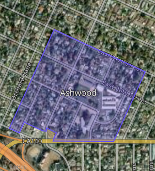
Boundary map of Ashwood.
Crime Index for 95340
105
The crime index in 95340 is 105, which is 1.1 times higher than national average.
Market Trends
Historical market data near 1994 Ashwood Dr over selected time period.
Nearby Properties on Ashwood Dr
- 1990 Ashwood Dr, Merced, CA 95340 (Ashwood) is a 1,346 square foot, 4 bedroom, 1 bathroom, 0.14 acre property. It was built in 1951 and has an estimate of $291,493 with a price per ft² of $217.
- 1994 Ashwood Dr, Merced, CA 95340 (Ashwood) is a 1,247 square foot, 3 bedroom, 1 bathroom, 0.14 acre property. It was built in 1951 and has an estimate of $290,614 with a price per ft² of $233.
- 1980 Ashwood Dr, Merced, CA 95340 (Ashwood) is a 1,063 square foot, 3 bedroom, 2 bathroom, 0.14 acre property. It was built in 1951 and has an estimate of $275,181 with a price per ft² of $259.
- 1930 Ashwood Dr, Merced, CA 95340 (Ashwood) is a 1,615 square foot, 4 bedroom, 2.25 bathroom, 0.24 acre property. It was built in 1977 and has an estimate of $292,682 with a price per ft² of $181.
- 1940 Ashwood Dr, Merced, CA 95340 (Ashwood) is a 1,174 square foot, 3 bedroom, 2.25 bathroom, 0.26 acre property. It was built in 1940 and has an estimate of $260,231 with a price per ft² of $222.
- 1970 Ashwood Dr, Merced, CA 95340 (Ashwood) is a 851 square foot, 2 bedroom, 1 bathroom, 0.14 acre property. It was built in 1949 and has an estimate of $257,379 with a price per ft² of $302.
- 1960 Ashwood Dr, Merced, CA 95340 (Ashwood) is a 1,332 square foot, 3 bedroom, 1 bathroom, 0.15 acre property. It was built in 1950 and has an estimate of $249,301 with a price per ft² of $187.
- 1950 Ashwood Dr, Merced, CA 95340 (Ashwood) is a 1,459 square foot, 3 bedroom, 1 bathroom, 0.18 acre property. It was built in 1950 and has an estimate of $291,801 with a price per ft² of $200.
- 1900 Ashwood Dr, Merced, CA 95340 (Ashwood) is a 1,270 square foot, 3 bedroom, 1 bathroom, 0.23 acre property. It was built in 1950 and has an estimate of $289,446 with a price per ft² of $228.
- 1920 Ashwood Dr, Merced, CA 95340 (Ashwood) is a 1,467 square foot, 3 bedroom, 2 bathroom, 0.18 acre property. It was built in 1950 and has an estimate of $286,232 with a price per ft² of $195.
- 1910 Ashwood Dr, Merced, CA 95340 (Ashwood) is a 1,087 square foot, 3 bedroom, 1 bathroom, 0.18 acre property. It was built in 1950 and has an estimate of $273,461 with a price per ft² of $252.