20 Roache Rd
Freedom, CA 95019
- 3Beds
- 1Bath
- 1,512ft²Living Area
- 0.5acLot Size
- -Pool
- 4Car
- 1947Year Built
- -DOM
- -Permit
Property Valuations
Latest estimates for 20 Roache Rd based on TopHap automated valuation model (AVM).
TopHap Estimate
$775,500
$512/ft²
+$481K above Sold Price
Updated 3 months ago
Last Sold Price
$295,000
$195/ft²
14 years ago
20 Roache Rd is valued at $775,500 by TopHap AVM 3 months ago.
20 Roache Rd was last sold in 2009 for $295,000.
Current Ownership
Information about the current owner(s).
Taxes Billed
Taxes billed in 2023$4,298.46From latest Total Assessed Value1.17%Total Assessed Value$366,008=Land+
Assessed Value$210,920Additions
Assessed Value$155,088
In 2023, taxes billed for 20 Roache Rd were $4,298.46, which is 1.17% from latest Total Assessed Value of $366,008.
Property History
20 Roache Rd has undefined property events records (listings, deeds, permits, tax, foreclosure, loan).
Environment
Environmental factors around 20 Roache Rd
Hazard Risks
Earthquake552Nat'l Avg100Particulates99Air Pollution84Ozone79Carb Mono75Lead42Tornado11Weather7Hail0Hurricane0Wind0
9 hazards (Carbon Monoxide, Earthquake Risk, Tornado Index, Air Pollution Index, Ozone Index, Weather Risk, Lead Index, Particulate Matter, National Average) are above the national average around 20 Roache Rd.
Walkability Index
16 /20
Most Walkable
20-18
Very Walkable
17-15
Somewhat Walkable
14-10
Car Dependent
9-0
20 Roache Rd has a walkability score of 16 out of 20, which means that it is in a very walkable area.
Noise Level
49 dB
Quiet Suburban Residential 0-49
Suburban Residential 50-54
Urban Residential 55-59
Noisy Urban Residential 60-64
Very Noisy Urban Residential 65+
Noise at 20 Roache Rd is around 49dBs, which is comparable to a Quiet Suburban Residential area.
Temperature
Seasonal temperature sampled over multiple years
Winter
Average
Low
40°F
High
61°F
Summer
Average
Low
52°F
High
72°F
In the winter at 20 Roache Rd, temperatures range from 39.71°F to 61.25°F with an average of 50.48°F. In the summer, the temperature ranges from 51.73°F to 71.6°F with and average of 61.67°F.
School Information
Public/private schools serving 20 Roache Rd
Public Schools
Nearby public schools serving 20 Roache Rd have ratings undefined, undefined, and undefined.
Neighborhood
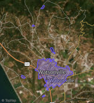
This property is located in Watsonville.
Seasonal Housing units 95019
13%of housing is for seasonal rent.
Daytime Population for 95019
-35%of people during work hours.
Boundary map of Watsonville.
Crime Index for 95019
114
The crime index in 95019 is 114, which is 1.1 times higher than national average.
Market Trends
Historical market data near 20 Roache Rd over selected time period.
Nearby Properties on Roache Rd
- 110 Roache Rd, Freedom, CA 95019 is a 1,361 square foot, 3 bedroom, 1 bathroom, 0.45 acre property. It was built in 1955 and has an estimate of $632,878 with a price per ft² of $460.
- 117 Roache Rd, Freedom, CA 95019 is a 1,260 square foot, 3 bedroom, 2 bathroom, 0.16 acre property. It was built in 1980 and has an estimate of $729,492 with a price per ft² of $579.
- 19 Roache Rd, Freedom, CA 95019 is a 1,602 square foot, 2 bedroom, 1 bathroom, 0.53 acre property. It was built in 1926 and has an estimate of $658,184 with a price per ft² of $411.
- 30 Roache Rd, Freedom, CA 95019 is a 1,248 square foot, 2 bedroom, 1 bathroom, 0.82 acre property. It was built in 1952 and has an estimate of $635,437 with a price per ft² of $509.
- 20 Roache Rd, Freedom, CA 95019 is a 1,512 square foot, 3 bedroom, 1 bathroom, 0.46 acre property. It was built in 1947 and has an estimate of $698,582 with a price per ft² of $460.
- 8 Roache Rd, Freedom, CA 95019 is a 1,260 square foot, 2 bedroom, 1 bathroom, 0.31 acre property. It was built in 1952 and has an estimate of $574,640 with a price per ft² of $456.
- 26 Roache Rd, Freedom, CA 95019 is a 696 square foot, 2 bedroom, 1 bathroom, 0.24 acre property.
- 27 Roache Rd, Freedom, CA 95019 is a 946 square foot, 2 bedroom, 1 bathroom, 0.24 acre property. It was built in 1929 and has an estimate of $618,741 with a price per ft² of $654.
- 13 Roache Rd, Freedom, CA 95019 is a 1,249 square foot, 2 bedroom, 2 bathroom, 0.19 acre property. It was built in 1991 and has an estimate of $675,798 with a price per ft² of $541.
- 29 Roache Rd, Freedom, CA 95019 is a 954 square foot, 2 bedroom, 1 bathroom, 0.2 acre property. It was built in 1927 and has an estimate of $601,707 with a price per ft² of $631.
- 34 Roache Rd, Freedom, CA 95019 is a 1,200 square foot, 2 bedroom, 1 bathroom, 0.85 acre property.
- 104 Roache Rd, Freedom, CA 95019 is a 5,760 square foot, 3 bedroom, 1 bathroom, 0.71 acre property.
- 16 Roache Rd, Freedom, CA 95019 is a 1,278 square foot, 3 bedroom, 1 bathroom, 0.44 acre property. It was built in 1920 and has an estimate of $663,484 with a price per ft² of $519.
- 22 Roache Rd # A, Freedom, CA 95019 is a 6,048 square foot and 0.28 acre property.
- 22 Roache Rd # D, Freedom, CA 95019 is a 4,896 square foot and 0.25 acre property.
- 7 Roache Rd, Freedom, CA 95019 is a 1,332 square foot, 2 bedroom, 1 bathroom, 0.37 acre property. It was built in 1931 and has an estimate of $604,574 with a price per ft² of $454.
- 119 Roache Rd, Freedom, CA 95019 is a 1,152 square foot, 3 bedroom, 2 bathroom, 0.2 acre property. It was built in 1965 and has an estimate of $737,746 with a price per ft² of $640.
- 119 Roache Rd # A, Freedom, CA 95019 is a 1,442 square foot, 2 bedroom, 1 bathroom, 0.19 acre property. It was built in 1951 and has an estimate of $533,732 with a price per ft² of $370.
- 81 Roache Rd, Freedom, CA 95019 (The Harkins Ranch) is a 6.65 acre property.
- View more properties on Roache Rd