2013 Fieldstone Ct
Fairfield, CA 94534
- 4Beds
- 3Baths
- 2,041ft²Living Area
- 10,399ft²Lot Size
- -Pool
- 2Car
- 1990Year Built
- -DOM
- 3Permits
Property Valuations
Latest estimates for 2013 Fieldstone Ct based on TopHap automated valuation model (AVM).
TopHap Estimate
$633,966
$310/ft²
-$39K below Sold Price
Updated 3 months ago
Last Sold Price
$673,000
$330/ft²
14 months ago
2013 Fieldstone Ct is valued at $633,966 by TopHap AVM 3 months ago.
2013 Fieldstone Ct was last sold in 2023 for $673,000.
Permits
2013 Fieldstone Ct has 3 permit records.
Current Ownership
Information about the current owner(s).
Taxes Billed
Taxes billed in 2022$7,429.66From latest Total Assessed Value1.17%Total Assessed Value$634,644=Land+
Assessed Value$156,060Additions
Assessed Value$478,584
In 2022, taxes billed for 2013 Fieldstone Ct were $7,429.66, which is 1.17% from latest Total Assessed Value of $634,644.
Property History
2013 Fieldstone Ct has undefined property events records (listings, deeds, permits, tax, foreclosure, loan).
Environment
Environmental factors around 2013 Fieldstone Ct
Hazard Risks
Earthquake489Nat'l Avg100Particulates95Carb Mono90Ozone87Air Pollution83Lead38Hail2Tornado1Hurricane0Weather0Wind0
9 hazards (Carbon Monoxide, Earthquake Risk, Hail Index, Tornado Index, Air Pollution Index, Ozone Index, Lead Index, Particulate Matter, National Average) are above the national average around 2013 Fieldstone Ct.
Walkability Index
6 /20
Most Walkable
20-18
Very Walkable
17-15
Somewhat Walkable
14-10
Car Dependent
9-0
2013 Fieldstone Ct has a walkability score of 6 out of 20, which means that it is in a car dependent area.
Temperature
Seasonal temperature sampled over multiple years
Winter
Average
Low
39°F
High
57°F
Summer
Average
Low
55°F
High
87°F
In the winter at 2013 Fieldstone Ct, temperatures range from 39.22°F to 56.95°F with an average of 48.09°F. In the summer, the temperature ranges from 55.25°F to 86.86°F with and average of 71.06°F.
School Information
Public/private schools serving 2013 Fieldstone Ct
Public Schools
Nearby public schools serving 2013 Fieldstone Ct have ratings undefined, undefined, undefined, undefined, and undefined.
Neighborhood
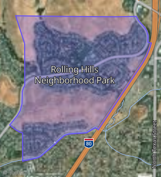
This property is located in Rolling Hills Neighborhood Park, Fairfield, CA 94534.
Seasonal Housing units 94534
17%of housing is for seasonal rent.
Daytime Population for 94534
-5%of people during work hours.
Boundary map of Rolling Hills Neighborhood Park.
Crime Index for 94534
58
The crime index in 94534 is 58, which is 0.6 times lower than national average.
Market Trends
Historical market data near 2013 Fieldstone Ct over selected time period.
Nearby Properties on Fieldstone Ct
- 2009 Fieldstone Ct, Fairfield, CA 94534 (Rolling Hills Neighborhood Park) is a 2,096 square foot, 4 bedroom, 3.25 bathroom, 0.24 acre property. It was built in 1990 and has an estimate of $694,010 with a price per ft² of $331.
- 2012 Fieldstone Ct, Fairfield, CA 94534 (Rolling Hills Neighborhood Park) is a 2,364 square foot, 4 bedroom, 2 bathroom, 0.23 acre property. It was built in 1990 and has an estimate of $743,703 with a price per ft² of $315.
- 2024 Fieldstone Ct, Fairfield, CA 94534 (Rolling Hills Neighborhood Park) is a 2,041 square foot, 4 bedroom, 3.25 bathroom, 0.18 acre property. It was built in 1989 and has an estimate of $728,321 with a price per ft² of $357.
- 2016 Fieldstone Ct, Fairfield, CA 94534 (Rolling Hills Neighborhood Park) is a 2,822 square foot, 4 bedroom, 3 bathroom, 0.2 acre property. It was built in 1990 and has an estimate of $802,000 with a price per ft² of $284.
- 2021 Fieldstone Ct, Fairfield, CA 94534 (Rolling Hills Neighborhood Park) is a 2,255 square foot, 4 bedroom, 3 bathroom, 0.18 acre property. It was built in 1989 and has an estimate of $722,707 with a price per ft² of $320.
- 2008 Fieldstone Ct, Fairfield, CA 94534 (Rolling Hills Neighborhood Park) is a 2,588 square foot, 4 bedroom, 3.25 bathroom, 0.2 acre property. It was built in 1990 and has an estimate of $762,741 with a price per ft² of $295.
- 2020 Fieldstone Ct, Fairfield, CA 94534 (Rolling Hills Neighborhood Park) is a 2,479 square foot, 5 bedroom, 4.25 bathroom, 0.22 acre property. It was built in 1989 and has an estimate of $727,430 with a price per ft² of $293.
- 2017 Fieldstone Ct, Fairfield, CA 94534 (Rolling Hills Neighborhood Park) is a 1,921 square foot, 4 bedroom, 2.5 bathroom, 0.18 acre property. It was built in 1990 and has an estimate of $695,423 with a price per ft² of $362.
- 2013 Fieldstone Ct, Fairfield, CA 94534 (Rolling Hills Neighborhood Park) is a 2,041 square foot, 4 bedroom, 3.25 bathroom, 0.24 acre property. It was built in 1990 and has an estimate of $734,107 with a price per ft² of $360.