2013 Mayfair Dr
Hanford, CA 93230
- 3Beds
- 2Baths
- 1,150ft²Living Area
- 7,920ft²Lot Size
- -Pool
- 2Car
- 1958Year Built
- -DOM
- 1Permit
Property Valuations
Latest estimates for 2013 Mayfair Dr based on TopHap automated valuation model (AVM).
TopHap Estimate
$323,500
$281/ft²
+$224K above Sold Price
Updated 3 months ago
Last Sold Price
$100,000
$87/ft²
12 years ago
2013 Mayfair Dr is valued at $323,500 by TopHap AVM 3 months ago.
2013 Mayfair Dr was last sold in 2011 for $100,000.
Permits
2013 Mayfair Dr has 1 permit records.
Current Ownership
Information about the current owner(s).
Taxes Billed
Taxes billed in 2023$1,229.00From latest Total Assessed Value1.02%Total Assessed Value$120,728=Land+
Assessed Value$60,364Additions
Assessed Value$60,364
In 2023, taxes billed for 2013 Mayfair Dr were $1,229, which is 1.02% from latest Total Assessed Value of $120,728.
Property History
2013 Mayfair Dr has undefined property events records (listings, deeds, permits, tax, foreclosure, loan).
Environment
Environmental factors around 2013 Mayfair Dr
Hazard Risks
Earthquake121Particulates119Nat'l Avg100Carb Mono97Air Pollution93Ozone92Lead53Tornado27Weather13Hail0Hurricane0Wind0
9 hazards (Carbon Monoxide, Earthquake Risk, Tornado Index, Air Pollution Index, Ozone Index, Weather Risk, Lead Index, Particulate Matter, National Average) are above the national average around 2013 Mayfair Dr.
Walkability Index
15 /20
Most Walkable
20-18
Very Walkable
17-15
Somewhat Walkable
14-10
Car Dependent
9-0
2013 Mayfair Dr has a walkability score of 15 out of 20, which means that it is in a very walkable area.
Temperature
Seasonal temperature sampled over multiple years
Winter
Average
Low
37°F
High
57°F
Summer
Average
Low
61°F
High
96°F
In the winter at 2013 Mayfair Dr, temperatures range from 36.76°F to 57.29°F with an average of 47.03°F. In the summer, the temperature ranges from 61.35°F to 95.6°F with and average of 78.48°F.
School Information
Public/private schools serving 2013 Mayfair Dr
Public Schools
Nearby public schools serving 2013 Mayfair Dr have ratings undefined, undefined, and undefined.
Neighborhood
This property is located in Kensington Acres, Hanford, CA 93230.
Seasonal Housing units 93230
7%of housing is for seasonal rent.
Daytime Population for 93230
-12%of people during work hours.
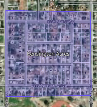
Boundary map of Kensington Acres.
Crime Index for 93230
109
The crime index in 93230 is 109, which is 1.1 times higher than national average.
Market Trends
Historical market data near 2013 Mayfair Dr over selected time period.
Nearby Properties on Mayfair Dr
- 2033 N Mayfair Dr, Hanford, CA 93230 (Kensington Acres) is a 1,174 square foot, 3 bedroom, 1.5 bathroom, 0.18 acre property. It was built in 1960 and has an estimate of $362,788 with a price per ft² of $309.
- 2009 N Mayfair Dr, Hanford, CA 93230 (Kensington Acres) is a 1,150 square foot, 3 bedroom, 2.25 bathroom, 0.18 acre property. It was built in 1958 and has an estimate of $280,797 with a price per ft² of $244.
- 2025 N Mayfair Dr, Hanford, CA 93230 (Kensington Acres) is a 1,381 square foot, 3 bedroom, 2 bathroom, 0.18 acre property. It was built in 1970 and has an estimate of $318,158 with a price per ft² of $230.
- 2001 N Mayfair Dr, Hanford, CA 93230 (Kensington Acres) is a 1,356 square foot, 3 bedroom, 2 bathroom, 0.18 acre property. It was built in 1954 and has an estimate of $276,982 with a price per ft² of $204.
- 1931 N Mayfair Dr, Hanford, CA 93230 (Kensington Acres) is a 1,327 square foot, 3 bedroom, 2.25 bathroom, 0.18 acre property. It was built in 1954 and has an estimate of $276,995 with a price per ft² of $209.
- 2225 N Mayfair Dr, Hanford, CA 93230 (Kings Manor) is a 1,281 square foot, 3 bedroom, 2 bathroom, 0.15 acre property. It was built in 1961 and has an estimate of $262,201 with a price per ft² of $205.
- 2017 N Mayfair Dr, Hanford, CA 93230 (Kensington Acres) is a 1,167 square foot, 3 bedroom, 2 bathroom, 0.18 acre property. It was built in 1966 and has an estimate of $303,846 with a price per ft² of $260.
- 2013 N Mayfair Dr, Hanford, CA 93230 (Kensington Acres) is a 1,150 square foot, 3 bedroom, 2.25 bathroom, 0.18 acre property. It was built in 1958 and has an estimate of $281,128 with a price per ft² of $244.
- 2005 N Mayfair Dr, Hanford, CA 93230 (Kensington Acres) is a 1,054 square foot, 3 bedroom, 1 bathroom, 0.18 acre property. It was built in 1955 and has an estimate of $259,474 with a price per ft² of $246.
- 2021 N Mayfair Dr, Hanford, CA 93230 (Kensington Acres) is a 1,887 square foot, 3 bedroom, 2 bathroom, 0.18 acre property. It was built in 1965 and has an estimate of $318,823 with a price per ft² of $169.
- 1939 N Mayfair Dr, Hanford, CA 93230 (Kensington Acres) is a 1,416 square foot, 3 bedroom, 2 bathroom, 0.18 acre property. It was built in 1954 and has an estimate of $274,233 with a price per ft² of $194.
- 1935 N Mayfair Dr, Hanford, CA 93230 (Kensington Acres) is a 1,016 square foot, 3 bedroom, 2 bathroom, 0.18 acre property. It was built in 1954 and has an estimate of $256,592 with a price per ft² of $253.
- 2215 N Mayfair Dr, Hanford, CA 93230 (Kings Manor) is a 1,227 square foot, 3 bedroom, 2 bathroom, 0.16 acre property. It was built in 1961 and has an estimate of $256,997 with a price per ft² of $209.
- 2235 N Mayfair Dr, Hanford, CA 93230 (Kings Manor) is a 1,317 square foot, 3 bedroom, 2 bathroom, 0.17 acre property. It was built in 1961 and has an estimate of $265,467 with a price per ft² of $202.
- 2245 N Mayfair Dr, Hanford, CA 93230 (Kings Manor) is a 1,345 square foot, 3 bedroom, 2 bathroom, 0.15 acre property. It was built in 1961 and has an estimate of $244,803 with a price per ft² of $182.
- 2029 N Mayfair Dr, Hanford, CA 93230 (Kensington Acres) is a 1,174 square foot, 3 bedroom, 1.5 bathroom, 0.19 acre property. It was built in 1972 and has an estimate of $346,709 with a price per ft² of $295.
- 1927 N Mayfair Dr, Hanford, CA 93230 (Kensington Acres) is a 1,078 square foot, 3 bedroom, 2 bathroom, 0.18 acre property. It was built in 1954 and has an estimate of $267,709 with a price per ft² of $248.