203 Kimberly Ln
Watsonville, CA 95076
- 3Beds
- 2Baths
- 1,436ft²Living Area
- 5,097ft²Lot Size
- -Pool
- 2Car
- 1997Year Built
- -DOM
- -Permit
Property Valuations
Latest estimates for 203 Kimberly Ln based on TopHap automated valuation model (AVM).
TopHap Estimate
$822,250
$572/ft²
+$626K above Sold Price
Updated 3 months ago
Last Sold Price
$196,500
$137/ft²
27 years ago
203 Kimberly Ln is valued at $822,250 by TopHap AVM 3 months ago.
203 Kimberly Ln was last sold in 1997 for $196,500.
Current Ownership
Information about the current owner(s).
Taxes Billed
Taxes billed in 2023$3,619.50From latest Total Assessed Value1.18%Total Assessed Value$307,444=Land+
Assessed Value$114,890Additions
Assessed Value$192,554
In 2023, taxes billed for 203 Kimberly Ln were $3,619.5, which is 1.18% from latest Total Assessed Value of $307,444.
Property History
203 Kimberly Ln has undefined property events records (listings, deeds, permits, tax, foreclosure, loan).
Environment
Environmental factors around 203 Kimberly Ln
Hazard Risks
Earthquake510Particulates102Nat'l Avg100Air Pollution84Ozone82Carb Mono76Lead43Tornado13Weather2Hail0Hurricane0Wind0
9 hazards (Carbon Monoxide, Earthquake Risk, Tornado Index, Air Pollution Index, Ozone Index, Weather Risk, Lead Index, Particulate Matter, National Average) are above the national average around 203 Kimberly Ln.
Walkability Index
17 /20
Most Walkable
20-18
Very Walkable
17-15
Somewhat Walkable
14-10
Car Dependent
9-0
203 Kimberly Ln has a walkability score of 17 out of 20, which means that it is in a very walkable area.
Temperature
Seasonal temperature sampled over multiple years
Winter
Average
Low
39°F
High
61°F
Summer
Average
Low
51°F
High
75°F
In the winter at 203 Kimberly Ln, temperatures range from 39.48°F to 61.46°F with an average of 50.47°F. In the summer, the temperature ranges from 51.25°F to 74.77°F with and average of 63.01°F.
School Information
Public/private schools serving 203 Kimberly Ln
Public Schools
Nearby public schools serving 203 Kimberly Ln have ratings undefined, undefined, and undefined.
Neighborhood
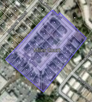
This property is located in Miles Court, Watsonville, CA 95076.
Seasonal Housing units 95076
51%of housing is for seasonal rent.
Daytime Population for 95076
-10%of people during work hours.
Boundary map of Miles Court.
Crime Index for 95076
73
The crime index in 95076 is 73, which is 0.7 times lower than national average.
Market Trends
Historical market data near 203 Kimberly Ln over selected time period.
Nearby Properties on Kimberly Ln
- 220 Kimberly Ln, Watsonville, CA 95076 (Miles Court) is a 1,925 square foot, 3 bedroom, 2 bathroom, 0.12 acre property. It was built in 1997 and has an estimate of $786,021 with a price per ft² of $529.
- 216 Kimberly Ln, Watsonville, CA 95076 (Miles Court) is a 1,328 square foot, 3 bedroom, 2 bathroom, 0.12 acre property. It was built in 1997 and has an estimate of $757,300 with a price per ft² of $574.
- 214 Kimberly Ln, Watsonville, CA 95076 (Miles Court) is a 1,484 square foot, 3 bedroom, 2 bathroom, 0.12 acre property. It was built in 1997 and has an estimate of $816,419 with a price per ft² of $550.
- 210 Kimberly Ln, Watsonville, CA 95076 (Miles Court) is a 1,328 square foot, 3 bedroom, 2 bathroom, 0.12 acre property. It was built in 1997 and has an estimate of $767,518 with a price per ft² of $578.
- 206 Kimberly Ln, Watsonville, CA 95076 (Miles Court) is a 1,485 square foot, 3 bedroom, 2 bathroom, 0.12 acre property. It was built in 1997 and has an estimate of $837,160 with a price per ft² of $564.
- 221 Kimberly Ln, Watsonville, CA 95076 (Miles Court) is a 1,398 square foot, 3 bedroom, 2 bathroom, 0.13 acre property. It was built in 1997 and has an estimate of $771,040 with a price per ft² of $552.
- 225 Kimberly Ln, Watsonville, CA 95076 (Miles Court) is a 1,398 square foot, 3 bedroom, 2 bathroom, 0.18 acre property. It was built in 1997 and has an estimate of $715,451 with a price per ft² of $512.
- 205 Kimberly Ln, Watsonville, CA 95076 (Miles Court) is a 1,116 square foot, 3 bedroom, 2 bathroom, 0.12 acre property. It was built in 1997 and has an estimate of $755,042 with a price per ft² of $677.
- 209 Kimberly Ln, Watsonville, CA 95076 (Miles Court) is a 1,307 square foot, 3 bedroom, 2 bathroom, 0.12 acre property. It was built in 1997 and has an estimate of $710,161 with a price per ft² of $533.
- 203 Kimberly Ln, Watsonville, CA 95076 (Miles Court) is a 1,436 square foot, 3 bedroom, 2 bathroom, 0.12 acre property. It was built in 1997 and has an estimate of $799,309 with a price per ft² of $557.
- 211 Kimberly Ln, Watsonville, CA 95076 (Miles Court) is a 1,437 square foot, 3 bedroom, 2 bathroom, 0.12 acre property. It was built in 1997 and has an estimate of $805,043 with a price per ft² of $560.
- 215 Kimberly Ln, Watsonville, CA 95076 (Miles Court) is a 1,116 square foot, 3 bedroom, 2 bathroom, 0.12 acre property. It was built in 1997 and has an estimate of $732,808 with a price per ft² of $657.
- 217 Kimberly Ln, Watsonville, CA 95076 (Miles Court) is a 1,410 square foot, 3 bedroom, 2 bathroom, 0.12 acre property. It was built in 1997 and has an estimate of $718,566 with a price per ft² of $510.
- 202 Kimberly Ln, Watsonville, CA 95076 (Miles Court) is a 2,071 square foot, 3 bedroom, 2 bathroom, 0.12 acre property. It was built in 2017 and has an estimate of $806,928 with a price per ft² of $495.