212 Harder Rd
Hayward, CA 94544
- 3Beds
- 1Bath
- 1,042ft²Living Area
- 5,130ft²Lot Size
- -Pool
- 1Car
- 1952Year Built
- -DOM
- 2Permits
Property Valuations
Latest estimates for 212 Harder Rd based on TopHap automated valuation model (AVM).
TopHap Estimate
$756,750
$726/ft²
+$577K above Sold Price
Updated 3 months ago
Last Sold Price
$180,000
$173/ft²
12 years ago
212 Harder Rd is valued at $756,750 by TopHap AVM 3 months ago.
212 Harder Rd was last sold in 2011 for $180,000.
Permits
212 Harder Rd has 2 permit records.
Current Ownership
Information about the current owner(s).
Taxes Billed
Taxes billed in 2023$2,960.06From latest Total Assessed Value1.36%Total Assessed Value$217,300=Land+
Assessed Value$65,190Additions
Assessed Value$152,110
In 2023, taxes billed for 212 Harder Rd were $2,960.06, which is 1.36% from latest Total Assessed Value of $217,300.
Property History
212 Harder Rd has undefined property events records (listings, deeds, permits, tax, foreclosure, loan).
Environment
Environmental factors around 212 Harder Rd
Hazard Risks
Earthquake615Particulates101Nat'l Avg100Carb Mono98Ozone90Air Pollution87Lead42Tornado3Weather2Wind2Hail0Hurricane0
10 hazards (Carbon Monoxide, Earthquake Risk, Tornado Index, Air Pollution Index, Ozone Index, Wind Index, Weather Risk, Lead Index, Particulate Matter, National Average) are above the national average around 212 Harder Rd.
Walkability Index
12 /20
Most Walkable
20-18
Very Walkable
17-15
Somewhat Walkable
14-10
Car Dependent
9-0
212 Harder Rd has a walkability score of 12 out of 20, which means that it is in a somewhat walkable area.
Noise Level
59 dB
Quiet Suburban Residential 0-49
Suburban Residential 50-54
Urban Residential 55-59
Noisy Urban Residential 60-64
Very Noisy Urban Residential 65+
Noise at 212 Harder Rd is around 59dBs, which is comparable to a Urban Residential area.
Temperature
Seasonal temperature sampled over multiple years
Winter
Average
Low
42°F
High
58°F
Summer
Average
Low
54°F
High
77°F
In the winter at 212 Harder Rd, temperatures range from 41.59°F to 57.9°F with an average of 49.75°F. In the summer, the temperature ranges from 54.4°F to 76.58°F with and average of 65.49°F.
School Information
Public/private schools serving 212 Harder Rd
Public Schools
Nearby public schools serving 212 Harder Rd have ratings undefined, undefined, and undefined.
Neighborhood
This property is located in Harder Tennyson, Hayward, CA 94544.
Seasonal Housing units 94544
15%of housing is for seasonal rent.
Daytime Population for 94544
-12%of people during work hours.
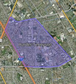
Boundary map of Harder-Tennyson.
Crime Index for 94544
77
The crime index in 94544 is 77, which is 0.8 times lower than national average.
Market Trends
Historical market data near 212 Harder Rd over selected time period.
Nearby Properties on Harder Rd
- 36 Harder Rd, Hayward, CA 94544 (Jackson Triangle) is a 2,261 square foot, 4 bedroom, 5.25 bathroom, 0.15 acre property. It was built in 1946 and has an estimate of $982,126 with a price per ft² of $434.
- 220 W Harder Rd, Hayward, CA 94544 (Harder-Tennyson) is a 1,059 square foot, 3 bedroom, 1 bathroom, 0.12 acre property. It was built in 1952 and has an estimate of $728,721 with a price per ft² of $688.
- 228 W Harder Rd, Hayward, CA 94544 (Harder-Tennyson) is a 1,041 square foot, 3 bedroom, 1 bathroom, 0.12 acre property. It was built in 1952 and has an estimate of $751,278 with a price per ft² of $722.
- 212 W Harder Rd, Hayward, CA 94544 (Harder-Tennyson) is a 1,042 square foot, 3 bedroom, 1 bathroom, 0.12 acre property. It was built in 1952 and has an estimate of $741,130 with a price per ft² of $711.
- 204 W Harder Rd, Hayward, CA 94544 (Harder-Tennyson) is a 1,059 square foot, 3 bedroom, 1 bathroom, 0.12 acre property. It was built in 1952 and has an estimate of $728,952 with a price per ft² of $688.
- 236 W Harder Rd, Hayward, CA 94544 (Harder-Tennyson) is a 1,407 square foot, 3 bedroom, 1 bathroom, 0.12 acre property. It was built in 1952 and has an estimate of $727,840 with a price per ft² of $517.
- 244 W Harder Rd, Hayward, CA 94544 (Harder-Tennyson) is a 1,059 square foot, 3 bedroom, 1 bathroom, 0.12 acre property. It was built in 1952 and has an estimate of $716,916 with a price per ft² of $677.
- 383 Harder Rd, Hayward, CA 94544 (Whitman-Mocine) is a 1,086 square foot, 3 bedroom, 1 bathroom, 0.14 acre property. It was built in 1952 and has an estimate of $754,377 with a price per ft² of $695.
- 920 Harder Rd, Hayward, CA 94542 (Mission Foothills) is a 1,054 square foot, 3 bedroom, 1 bathroom, 0.15 acre property. It was built in 1950 and has an estimate of $727,528 with a price per ft² of $690.
- 944 Harder Rd, Hayward, CA 94542 (Mission Foothills) is a 1,068 square foot, 3 bedroom, 1 bathroom, 0.11 acre property. It was built in 1951 and has an estimate of $713,754 with a price per ft² of $668.
- 882 Harder Rd, Hayward, CA 94542 (Mission Foothills) is a 1,150 square foot, 3 bedroom, 1 bathroom, 0.12 acre property. It was built in 1951 and has an estimate of $732,401 with a price per ft² of $637.
- 28 W Harder Rd, Hayward, CA 94544 (Harder-Tennyson) is a 6,085 square foot, 16 bedroom, 8 bathroom, 0.33 acre property. It was built in 1962 and has an estimate of $2,686,398 with a price per ft² of $441.
- 20 Harder Rd, Hayward, CA 94544 (Pacifica Apartments) is a 108 bedroom, 72 bathroom, 1.53 acre property. It was built in 1965 and has an estimate of $1,045,402.
- 29 W Harder Rd, Hayward, CA 94544 (Garden Walk) is a 3.14 acre property.
- 242 Harder Rd, Hayward, CA 94544 (Jackson Triangle) is a 1,080 square foot, 3 bedroom, 2 bathroom, 0.24 acre property. It was built in 1966 and has an estimate of $800,030 with a price per ft² of $741.
- 1051 Harder Rd, Hayward, CA 94542 (Mission-Garin) is a 9,588 square foot and 2.67 acre property.
- 404 W Harder Rd, Hayward, CA 94544 (Harder-Tennyson) is a 6,040 square foot and 0.36 acre property.
- 417 Harder Rd, Hayward, CA 94544 (Whitman-Mocine) is a 1,070 square foot, 3 bedroom, 1 bathroom, 0.14 acre property. It was built in 1952 and has an estimate of $845,937 with a price per ft² of $791.
- 561 W Harder Rd, Hayward, CA 94544 (Harder-Tennyson) is a 1,440 square foot and 0.41 acre property.
- 600 W Harder Rd, Hayward, CA 94544 (Harder-Tennyson) is a 2,572 square foot, 1 bathroom, 0.21 acre property.
- 425 Harder Rd, Hayward, CA 94544 (Whitman-Mocine) is a 1,370 square foot, 3 bedroom, 1 bathroom, 0.14 acre property. It was built in 1952 and has an estimate of $776,742 with a price per ft² of $567.
- 214 Harder Rd, Hayward, CA 94544 (Jackson Triangle) is a 4,270 square foot, 2 bathroom, 0.38 acre property.
- 343 Harder Rd, Hayward, CA 94544 (Whitman-Mocine) is a 1,086 square foot, 3 bedroom, 1 bathroom, 0.12 acre property. It was built in 1952 and has an estimate of $732,204 with a price per ft² of $674.
- 590 W Harder Rd, Hayward, CA 94544 (Harder-Tennyson) is a 4,224 square foot and 0.36 acre property.
- 194 Harder Rd, Hayward, CA 94544 (Jackson Triangle) is a 1,372 square foot, 1 bathroom, 0.47 acre property.
- View more properties on Harder Rd