223 Barton Dr
Fremont, CA 94536
- 3Beds
- 2Baths
- 1,488ft²Living Area
- 10,187ft²Lot Size
- 1Pool
- -Car
- 1951Year Built
- -DOM
- 14Permits
Property Valuations
Latest estimates for 223 Barton Dr based on TopHap automated valuation model (AVM).
TopHap Estimate
$1,364,750
$917/ft²
Updated 3 months ago
223 Barton Dr is valued at $1,364,750 by TopHap AVM 3 months ago.
Permits
223 Barton Dr has 14 permit records of total value of $21,000.
Current Ownership
Information about the current owner(s).
Taxes Billed
Taxes billed in 2023$2,320.54From latest Total Assessed Value1.61%Total Assessed Value$143,861=Land+
Assessed Value$25,905Additions
Assessed Value$117,956
In 2023, taxes billed for 223 Barton Dr were $2,320.54, which is 1.61% from latest Total Assessed Value of $143,861.
Property History
223 Barton Dr has undefined property events records (listings, deeds, permits, tax, foreclosure, loan).
Environment
Environmental factors around 223 Barton Dr
Hazard Risks
Earthquake557Particulates103Nat'l Avg100Carb Mono100Air Pollution92Ozone86Lead39Tornado12Weather3Wind1Hail0Hurricane0
10 hazards (Carbon Monoxide, Earthquake Risk, Tornado Index, Air Pollution Index, Ozone Index, Wind Index, Weather Risk, Lead Index, Particulate Matter, National Average) are above the national average around 223 Barton Dr.
Walkability Index
13 /20
Most Walkable
20-18
Very Walkable
17-15
Somewhat Walkable
14-10
Car Dependent
9-0
223 Barton Dr has a walkability score of 13 out of 20, which means that it is in a somewhat walkable area.
Noise Level
40 dB
Quiet Suburban Residential 0-49
Suburban Residential 50-54
Urban Residential 55-59
Noisy Urban Residential 60-64
Very Noisy Urban Residential 65+
Noise at 223 Barton Dr is around 40dBs, which is comparable to a Quiet Suburban Residential area.
Temperature
Seasonal temperature sampled over multiple years
Winter
Average
Low
42°F
High
59°F
Summer
Average
Low
55°F
High
78°F
In the winter at 223 Barton Dr, temperatures range from 41.54°F to 58.66°F with an average of 50.1°F. In the summer, the temperature ranges from 54.96°F to 78.03°F with and average of 66.5°F.
School Information
Public/private schools serving 223 Barton Dr
Public Schools
Nearby public schools serving 223 Barton Dr have ratings undefined, undefined, and undefined.
Neighborhood
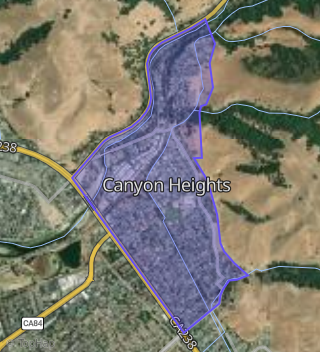
This property is located in Canyon Heights, Fremont, CA 94536.
Seasonal Housing units 94536
15%of housing is for seasonal rent.
Daytime Population for 94536
-18%of people during work hours.
Boundary map of Canyon Heights.
Crime Index for 94536
48
The crime index in 94536 is 48, which is 0.5 times lower than national average.
Market Trends
Historical market data near 223 Barton Dr over selected time period.
Nearby Properties on Barton Dr
- 360 Barton Dr, Fremont, CA 94536 (Canyon Heights) is a 1,945 square foot, 3 bedroom, 1.5 bathroom, 0.18 acre property. It was built in 1954 and has an estimate of $1,298,864 with a price per ft² of $864.
- 241 Barton Dr, Fremont, CA 94536 (Canyon Heights) is a 1,766 square foot, 4 bedroom, 4.25 bathroom, 0.24 acre property. It was built in 1951 and has an estimate of $1,294,141 with a price per ft² of $733.
- 321 Barton Dr, Fremont, CA 94536 (Canyon Heights) is a 1,485 square foot, 3 bedroom, 2.25 bathroom, 0.3 acre property. It was built in 1953 and has an estimate of $1,351,409 with a price per ft² of $910.
- 339 Barton Dr, Fremont, CA 94536 (Canyon Heights) is a 1,170 square foot, 3 bedroom, 2.25 bathroom, 0.28 acre property. It was built in 1953 and has an estimate of $1,208,278 with a price per ft² of $1,033.
- 295 Barton Dr, Fremont, CA 94536 (Canyon Heights) is a 984 square foot, 3 bedroom, 1 bathroom, 0.25 acre property. It was built in 1951 and has an estimate of $1,072,975 with a price per ft² of $1,090.
- 330 Barton Dr, Fremont, CA 94536 (Canyon Heights) is a 1,170 square foot, 2 bedroom, 1 bathroom, 0.12 acre property. It was built in 1954 and has an estimate of $948,555 with a price per ft² of $811.
- 340 Barton Dr, Fremont, CA 94536 (Canyon Heights) is a 1,170 square foot, 3 bedroom, 1.5 bathroom, 0.22 acre property. It was built in 1954 and has an estimate of $1,148,326 with a price per ft² of $981.
- 357 Barton Dr, Fremont, CA 94536 (Canyon Heights) is a 2,276 square foot, 3 bedroom, 3.25 bathroom, 0.3 acre property. It was built in 1953 and has an estimate of $1,681,861 with a price per ft² of $739.
- 303 Barton Dr, Fremont, CA 94536 (Canyon Heights) is a 1,032 square foot, 3 bedroom, 1 bathroom, 0.25 acre property. It was built in 1951 and has an estimate of $1,160,219 with a price per ft² of $1,124.
- 230 Barton Dr, Fremont, CA 94536 (Canyon Heights) is a 2,452 square foot, 4 bedroom, 3 bathroom, 0.12 acre property. It was built in 1952 and has an estimate of $1,830,767 with a price per ft² of $1,724.
- 270 Barton Dr, Fremont, CA 94536 (Canyon Heights) is a 1,056 square foot, 3 bedroom, 1 bathroom, 0.12 acre property. It was built in 1952 and has an estimate of $1,042,388 with a price per ft² of $1,059.
- 223 Barton Dr, Fremont, CA 94536 (Canyon Heights) is a 1,488 square foot, 3 bedroom, 2 bathroom, 0.23 acre property. It was built in 1951 and has an estimate of $1,257,174 with a price per ft² of $845.
- 259 Barton Dr, Fremont, CA 94536 (Canyon Heights) is a 1,425 square foot, 3 bedroom, 1 bathroom, 0.25 acre property. It was built in 1951 and has an estimate of $1,233,435 with a price per ft² of $866.
- 277 Barton Dr, Fremont, CA 94536 (Canyon Heights) is a 984 square foot, 3 bedroom, 1 bathroom, 0.25 acre property. It was built in 1951 and has an estimate of $1,067,826 with a price per ft² of $1,085.
- 205 Barton Dr, Fremont, CA 94536 (Canyon Heights) is a 1,687 square foot, 5 bedroom, 2 bathroom, 0.42 acre property. It was built in 1951 and has an estimate of $1,472,566 with a price per ft² of $873.
- 250 Barton Dr, Fremont, CA 94536 (Canyon Heights) is a 1,008 square foot, 3 bedroom, 2.25 bathroom, 0.12 acre property. It was built in 1952 and has an estimate of $940,160 with a price per ft² of $940.
- 380 Barton Dr, Fremont, CA 94536 (Canyon Heights) is a 1,738 square foot, 4 bedroom, 3.25 bathroom, 0.18 acre property. It was built in 1953 and has an estimate of $1,264,699 with a price per ft² of $728.
- 375 Barton Dr, Fremont, CA 94536 (Canyon Heights) is a 1,396 square foot, 3 bedroom, 1.5 bathroom, 0.24 acre property. It was built in 1954 and has an estimate of $1,198,938 with a price per ft² of $859.
- 393 Barton Dr, Fremont, CA 94536 (Canyon Heights) is a 1,659 square foot, 3 bedroom, 3.25 bathroom, 0.27 acre property. It was built in 1953 and has an estimate of $1,254,965 with a price per ft² of $756.