22353 Arnott Dr
Chowchilla, CA 93610
- -Bed
- -Bath
- 1,231ft²Living Area
- 7,993ft²Lot Size
- -Pool
- 1Car
- 1999Year Built
- -DOM
- -Permit
Property Valuations
Latest estimates for 22353 Arnott Dr based on TopHap automated valuation model (AVM).
TopHap Estimate
$188,700
$153/ft²
Updated 3 months ago
22353 Arnott Dr is valued at $188,700 by TopHap AVM 3 months ago.
Current Ownership
Information about the current owner(s).
Taxes Billed
Taxes billed in 2023$1,231.04From latest Total Assessed Value1.7%Total Assessed Value$72,392=Land+
Assessed Value$21,714Additions
Assessed Value$50,678
In 2023, taxes billed for 22353 Arnott Dr were $1,231.04, which is 1.70% from latest Total Assessed Value of $72,392.
Property History
22353 Arnott Dr has undefined property events records (listings, deeds, permits, tax, foreclosure, loan).
Environment
Environmental factors around 22353 Arnott Dr
Hazard Risks
Earthquake107Nat'l Avg100Particulates100Ozone84Air Pollution84Carb Mono79Lead47Tornado23Weather10Hail4Wind2Hurricane0
11 hazards (Carbon Monoxide, Earthquake Risk, Hail Index, Tornado Index, Air Pollution Index, Ozone Index, Wind Index, Weather Risk, Lead Index, Particulate Matter, National Average) are above the national average around 22353 Arnott Dr.
Walkability Index
6 /20
Most Walkable
20-18
Very Walkable
17-15
Somewhat Walkable
14-10
Car Dependent
9-0
22353 Arnott Dr has a walkability score of 6 out of 20, which means that it is in a car dependent area.
Noise Level
42 dB
Quiet Suburban Residential 0-49
Suburban Residential 50-54
Urban Residential 55-59
Noisy Urban Residential 60-64
Very Noisy Urban Residential 65+
Noise at 22353 Arnott Dr is around 42dBs, which is comparable to a Quiet Suburban Residential area.
Temperature
Seasonal temperature sampled over multiple years
Winter
Average
Low
38°F
High
57°F
Summer
Average
Low
60°F
High
94°F
In the winter at 22353 Arnott Dr, temperatures range from 37.64°F to 57.05°F with an average of 47.35°F. In the summer, the temperature ranges from 59.78°F to 93.51°F with and average of 76.65°F.
School Information
Public/private schools serving 22353 Arnott Dr
Public Schools
Nearby public schools serving 22353 Arnott Dr have ratings undefined, undefined, undefined, undefined, undefined, and undefined.
Neighborhood
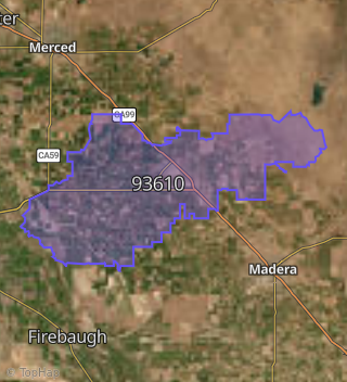
This property is located in Fairmead.
Seasonal Housing units 93610
11%of housing is for seasonal rent.
Daytime Population for 93610
-18%of people during work hours.
Boundary map of Fairmead.
Crime Index for 93610
91
The crime index in 93610 is 91, which is 0.9 times lower than national average.
Market Trends
Historical market data near 22353 Arnott Dr over selected time period.
Nearby Properties on Arnott Dr
- 22372 Arnott Dr, Chowchilla, CA 93610 is a 2,008 square foot, 8 bedroom, 4 bathroom, 0.17 acre property. It was built in 1995 and has an estimate of $239,832 with a price per ft² of $119.
- 22371 Arnott Dr, Chowchilla, CA 93610 is a 1,231 square foot, 4 bedroom, 2 bathroom, 0.16 acre property. It was built in 1994 and has an estimate of $249,142 with a price per ft² of $202.
- 22365 Arnott Dr, Chowchilla, CA 93610 is a 1,244 square foot, 4 bedroom, 2 bathroom, 0.17 acre property. It was built in 1993 and has an estimate of $245,831 with a price per ft² of $198.
- 22359 Arnott Dr, Chowchilla, CA 93610 is a 1,231 square foot and 0.17 acre property. It was built in 1994 and has an estimate of $275,741 with a price per ft² of $224.
- 22353 Arnott Dr, Chowchilla, CA 93610 is a 1,231 square foot and 0.17 acre property. It was built in 1999 and has an estimate of $261,666 with a price per ft² of $213.
- 22347 Arnott Dr, Chowchilla, CA 93610 is a 1,244 square foot, 4 bedroom, 2 bathroom, 0.17 acre property. It was built in 1994 and has an estimate of $249,686 with a price per ft² of $201.
- 22356 Arnott Dr, Chowchilla, CA 93610 is a 1,567 square foot, 3 bedroom, 2 bathroom, 0.17 acre property. It has an estimate of $171,900 with a price per ft² of $110.
- 22343 Arnott Dr, Chowchilla, CA 93610 is a 987 square foot, 3 bedroom, 1 bathroom, 0.17 acre property. It was built in 1993 and has an estimate of $197,111 with a price per ft² of $200.
- 22337 Arnott Dr, Chowchilla, CA 93610 is a 784 square foot, 2 bedroom, 1 bathroom, 0.19 acre property. It was built in 1992 and has an estimate of $189,103 with a price per ft² of $241.
- 22333 Arnott Dr, Chowchilla, CA 93610 is a 1,219 square foot, 4 bedroom, 2 bathroom, 0.18 acre property. It was built in 1993 and has an estimate of $242,191 with a price per ft² of $199.
- 22327 Arnott Dr, Chowchilla, CA 93610 is a 1,234 square foot and 0.18 acre property. It was built in 1992 and has an estimate of $272,472 with a price per ft² of $221.
- 22364 Arnott Dr, Chowchilla, CA 93610 is a 2,008 square foot, 8 bedroom, 4 bathroom, 0.18 acre property. It was built in 1995 and has an estimate of $238,700 with a price per ft² of $119.
- 22368 Arnott Dr, Chowchilla, CA 93610 is a 2,008 square foot, 8 bedroom, 4 bathroom, 0.17 acre property. It was built in 1995 and has an estimate of $238,007 with a price per ft² of $119.
- 22317 Arnott Dr, Chowchilla, CA 93610 is a 2,653 square foot, 4 bedroom, 3.25 bathroom, 0.17 acre property. It was built in 2007 and has an estimate of $381,985 with a price per ft² of $144.
- 22323 Arnott Dr, Chowchilla, CA 93610 is a 1,386 square foot, 3 bedroom, 1 bathroom, 0.17 acre property. It was built in 1993 and has an estimate of $191,770 with a price per ft² of $138.
- 22382 Arnott Dr, Chowchilla, CA 93610 is a 2,008 square foot and 0.17 acre property. It was built in 1995 and has an estimate of $389,728 with a price per ft² of $194.
- 22346 Arnott Dr, Chowchilla, CA 93610 is a 1,428 square foot, 3 bedroom, 2 bathroom, 0.16 acre property. It was built in 2008 and has an estimate of $275,173 with a price per ft² of $193.
- 22314 Arnott Dr, Chowchilla, CA 93610 is a 1,322 square foot, 3 bedroom, 2 bathroom, 0.14 acre property. It was built in 2019 and has an estimate of $316,300 with a price per ft² of $239.