254 Brinsmade Ave
Bronx, NY 10465
- -Bed
- -Bath
- 1,080ft²Living Area
- 2,825ft²Lot Size
- -Pool
- -Car
- 1955Year Built
- -DOM
- -Permit
Property Valuations
Latest estimates for 254 Brinsmade Ave based on TopHap automated valuation model (AVM).
TopHap Estimate
$567,712
$525/ft²
+$145K above Sold Price
Updated 3 months ago
Last Sold Price
$423,000
$392/ft²
6 years ago
254 Brinsmade Ave is valued at $567,712 by TopHap AVM 3 months ago.
254 Brinsmade Ave was last sold in 2018 for $423,000.
Current Ownership
Information about the current owner(s).
Taxes Billed
Taxes billed in 2023$6,180.76From latest Total Assessed Value20.09%Total Assessed Value$30,773=Land+
Assessed Value$8,416Additions
Assessed Value$22,357
In 2023, taxes billed for 254 Brinsmade Ave were $6,180.76, which is 20.09% from latest Total Assessed Value of $30,773.
Property History
254 Brinsmade Ave has undefined property events records (listings, deeds, permits, tax, foreclosure, loan).
Environment
Environmental factors around 254 Brinsmade Ave
Hazard Risks
Wind280Carb Mono145Hurricane120Ozone120Air Pollution115Earthquake112Lead107Nat'l Avg100Weather97Particulates89Hail55Tornado34
12 hazards (Carbon Monoxide, Earthquake Risk, Hail Index, Tornado Index, Hurricane Index, Air Pollution Index, Ozone Index, Wind Index, Weather Risk, Lead Index, Particulate Matter, National Average) are above the national average around 254 Brinsmade Ave.
Walkability Index
14 /20
Most Walkable
20-18
Very Walkable
17-15
Somewhat Walkable
14-10
Car Dependent
9-0
254 Brinsmade Ave has a walkability score of 14 out of 20, which means that it is in a somewhat walkable area.
Temperature
Seasonal temperature sampled over multiple years
Winter
Average
Low
27°F
High
41°F
Summer
Average
Low
65°F
High
82°F
In the winter at 254 Brinsmade Ave, temperatures range from 27.38°F to 40.54°F with an average of 33.96°F. In the summer, the temperature ranges from 65.37°F to 81.93°F with and average of 73.65°F.
School Information
Public/private schools serving 254 Brinsmade Ave
Public Schools
Nearby public schools serving 254 Brinsmade Ave have ratings undefined, undefined, undefined, and undefined.
Neighborhood
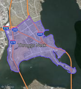
This property is located in Southeast Bronx, Bronx, NY 10465.
Seasonal Housing units 10465
13%of housing is for seasonal rent.
Daytime Population for 10465
-14%of people during work hours.
Boundary map of Southeast Bronx.
Crime Index for 10465
89
The crime index in 10465 is 89, which is 0.9 times lower than national average.
Market Trends
Historical market data near 254 Brinsmade Ave over selected time period.
Nearby Properties on Brinsmade Ave
- 399 Brinsmade Ave, Bronx, NY 10465 (Throggs Neck) is a 1,508 square foot and 0.07 acre property. It was built in 1983 and has an estimate of $700,600 with a price per ft² of $465.
- 1048 Brinsmade Ave, Bronx, NY 10465 (Throggs Neck) is a 1,908 square foot and 0.1 acre property. It was built in 1950 and has an estimate of $671,497 with a price per ft² of $352.
- 903 Brinsmade Ave, Bronx, NY 10465 (Throggs Neck) is a 1,638 square foot and 0.04 acre property. It was built in 1950 and has an estimate of $603,431 with a price per ft² of $368.
- 248 Brinsmade Ave, Bronx, NY 10465 (Throggs Neck) is a 1,350 square foot and 0.04 acre property. It was built in 1955 and has an estimate of $563,157 with a price per ft² of $417.
- 199 Brinsmade Ave, Bronx, NY 10465 (Throggs Neck) is a 1,224 square foot and 0.05 acre property. It was built in 1955 and has an estimate of $504,670 with a price per ft² of $412.
- 228 Brinsmade Ave, Bronx, NY 10465 (Throggs Neck) is a 1,804 square foot and 0.06 acre property. It was built in 1950 and has an estimate of $666,400 with a price per ft² of $369.
- 261 Brinsmade Ave, Bronx, NY 10465 (Throggs Neck) is a 2,358 square foot and 0.07 acre property. It was built in 1965 and has an estimate of $774,409 with a price per ft² of $328.
- 283 Brinsmade Ave, Bronx, NY 10465 (Throggs Neck) is a 1,792 square foot and 0.04 acre property. It was built in 1960 and has an estimate of $577,498 with a price per ft² of $322.
- 319 Brinsmade Ave, Bronx, NY 10465 (Throggs Neck) is a 1,995 square foot and 0.06 acre property. It was built in 1950 and has an estimate of $690,809 with a price per ft² of $346.
- 254 Brinsmade Ave, Bronx, NY 10465 (Throggs Neck) is a 1,080 square foot and 0.06 acre property. It was built in 1955 and has an estimate of $594,401 with a price per ft² of $550.
- 234 Brinsmade Ave, Bronx, NY 10465 (Throggs Neck) is a 1,224 square foot and 0.06 acre property. It was built in 1955 and has an estimate of $556,218 with a price per ft² of $454.
- 391 Brinsmade Ave, Bronx, NY 10465 (Throggs Neck) is a 1,450 square foot and 0.06 acre property. It was built in 1983 and has an estimate of $668,500 with a price per ft² of $461.
- 312 Brinsmade Ave, Bronx, NY 10465 (Throggs Neck) is a 2,112 square foot and 0.1 acre property. It was built in 1925 and has an estimate of $690,765 with a price per ft² of $327.
- 238 Brinsmade Ave, Bronx, NY 10465 (Throggs Neck) is a 1,620 square foot and 0.04 acre property. It was built in 1955 and has an estimate of $603,961 with a price per ft² of $373.
- 1056 Brinsmade Ave, Bronx, NY 10465 (Throggs Neck) is a 1,836 square foot and 0.06 acre property. It was built in 1955 and has an estimate of $649,188 with a price per ft² of $354.
- 1020 Brinsmade Ave, Bronx, NY 10465 (Throggs Neck) is a 1,908 square foot and 0.07 acre property. It was built in 1950 and has an estimate of $677,515 with a price per ft² of $355.
- 1049 Brinsmade Ave, Bronx, NY 10465 (Throggs Neck) is a 1,944 square foot and 0.06 acre property. It was built in 1955 and has an estimate of $683,084 with a price per ft² of $351.
- 1057 Brinsmade Ave, Bronx, NY 10465 (Throggs Neck) is a 1,944 square foot and 0.06 acre property. It was built in 1955 and has an estimate of $683,084 with a price per ft² of $351.
- 226 Brinsmade Ave, Bronx, NY 10465 (Throggs Neck) is a 1,804 square foot and 0.06 acre property. It was built in 1950 and has an estimate of $665,200 with a price per ft² of $369.
- 350 Brinsmade Ave, Bronx, NY 10465 (Throggs Neck) is a 1,500 square foot and 0.06 acre property. It was built in 1960 and has an estimate of $642,661 with a price per ft² of $428.
- 348 Brinsmade Ave, Bronx, NY 10465 (Throggs Neck) is a 1,500 square foot and 0.05 acre property. It was built in 1960 and has an estimate of $576,833 with a price per ft² of $385.
- 346 Brinsmade Ave, Bronx, NY 10465 (Throggs Neck) is a 1,500 square foot and 0.05 acre property. It was built in 1960 and has an estimate of $622,578 with a price per ft² of $415.
- 344 Brinsmade Ave, Bronx, NY 10465 (Throggs Neck) is a 1,500 square foot and 0.05 acre property. It was built in 1960 and has an estimate of $576,833 with a price per ft² of $385.
- 342 Brinsmade Ave, Bronx, NY 10465 (Throggs Neck) is a 1,500 square foot and 0.05 acre property. It was built in 1960 and has an estimate of $622,578 with a price per ft² of $415.
- 340 Brinsmade Ave, Bronx, NY 10465 (Throggs Neck) is a 1,500 square foot and 0.06 acre property. It was built in 1960 and has an estimate of $567,907 with a price per ft² of $379.
- View more properties on Brinsmade Ave