2622 Aerial Dr
Peoria, IL 61607
- 4Beds
- 4Baths
- 2,344ft²Living Area
- -Lot Size
- -Pool
- -Car
- 1972Year Built
- -DOM
- -Permit
Property Valuations
Latest estimates for 2622 Aerial Dr based on TopHap automated valuation model (AVM).
TopHap Estimate
$162,168
$69/ft²
+$112K above Sold Price
Updated 3 months ago
Last Sold Price
$50,000
$21/ft²
25 years ago
2622 Aerial Dr is valued at $162,168 by TopHap AVM 3 months ago.
2622 Aerial Dr was last sold in 1998 for $50,000.
Current Ownership
Information about the current owner(s).
Taxes Billed
Taxes billed in 2022$3,195.94From latest Total Assessed Value6.86%Total Assessed Value$46,560=Land+
Assessed Value$4,840Additions
Assessed Value$41,720
In 2022, taxes billed for 2622 Aerial Dr were $3,195.94, which is 6.86% from latest Total Assessed Value of $46,560.
Property History
2622 Aerial Dr has undefined property events records (listings, deeds, permits, tax, foreclosure, loan).
Environment
Environmental factors around 2622 Aerial Dr
Hazard Risks
Carb Mono133Tornado105Nat'l Avg100Ozone88Air Pollution85Particulates81Wind54Hail53Weather52Lead44Earthquake37Hurricane13
12 hazards (Carbon Monoxide, Earthquake Risk, Hail Index, Tornado Index, Hurricane Index, Air Pollution Index, Ozone Index, Wind Index, Weather Risk, Lead Index, Particulate Matter, National Average) are above the national average around 2622 Aerial Dr.
Walkability Index
7 /20
Most Walkable
20-18
Very Walkable
17-15
Somewhat Walkable
14-10
Car Dependent
9-0
2622 Aerial Dr has a walkability score of 7 out of 20, which means that it is in a car dependent area.
Temperature
Seasonal temperature sampled over multiple years
Winter
Average
Low
19°F
High
36°F
Summer
Average
Low
62°F
High
85°F
In the winter at 2622 Aerial Dr, temperatures range from 18.71°F to 35.64°F with an average of 27.18°F. In the summer, the temperature ranges from 62.22°F to 85.18°F with and average of 73.7°F.
School Information
Public/private schools serving 2622 Aerial Dr
Public Schools
Nearby public schools serving 2622 Aerial Dr have ratings undefined, and undefined.
Neighborhood
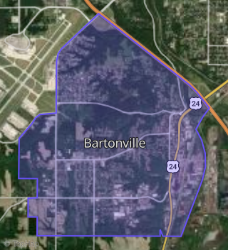
This property is located in Bartonville, Peoria, IL 61607.
Seasonal Housing units 61607
2%of housing is for seasonal rent.
Daytime Population for 61607
-1%of people during work hours.
Boundary map of Bartonville.
Crime Index for 61607
83
The crime index in 61607 is 83, which is 0.8 times lower than national average.
Market Trends
Historical market data near 2622 Aerial Dr over selected time period.
Nearby Properties on Aerial Dr
- 2714 S Aerial Dr, Peoria, IL 61607 (Bartonville) is a 1,500 square foot, 2 bedroom, 1 bathroom, 0.11 acre property. It was built in 1972 and has an estimate of $91,830 with a price per ft² of $61.
- 2720 S Aerial Dr, Peoria, IL 61607 (Bartonville) is a 1,160 square foot, 3 bedroom, 2.25 bathroom, 0.11 acre property. It was built in 1972 and has an estimate of $98,070 with a price per ft² of $85.
- 2708 S Aerial Dr, Peoria, IL 61607 (Bartonville) is a 1,500 square foot, 2 bedroom, 2.25 bathroom, 0.11 acre property. It was built in 1972 and has an estimate of $93,660 with a price per ft² of $62.
- 2721 S Aerial Dr, Peoria, IL 61607 (Bartonville) is a 992 square foot, 2 bedroom, 1 bathroom, 0.23 acre property. It was built in 1950 and has an estimate of $85,000 with a price per ft² of $86.
- 2724 S Aerial Dr, Peoria, IL 61607 (Bartonville) is a 4,320 square foot, 6 bedroom, 4 bathroom, 0.46 acre property.
- 2716 S Aerial Dr, Peoria, IL 61607 (Bartonville) is a 1,500 square foot, 2 bedroom, 1 bathroom, 0.11 acre property. It was built in 1972 and has an estimate of $89,730 with a price per ft² of $60.
- 2710 S Aerial Dr, Peoria, IL 61607 (Bartonville) is a 1,152 square foot, 2 bedroom, 2.25 bathroom, 0.11 acre property. It was built in 1972 and has an estimate of $89,740 with a price per ft² of $78.
- 2712 S Aerial Dr, Peoria, IL 61607 (Bartonville) is a 1,152 square foot, 2 bedroom, 2.25 bathroom, 0.11 acre property. It was built in 1972 and has an estimate of $88,770 with a price per ft² of $77.
- 2722 S Aerial Dr, Peoria, IL 61607 (Bartonville) is a 1,184 square foot, 3 bedroom, 2.25 bathroom, 0.11 acre property. It was built in 1972 and has an estimate of $76,760 with a price per ft² of $65.
- 2628 S Aerial Dr, Peoria, IL 61607 (Bartonville) is a 1,500 square foot, 4 bedroom, 2 bathroom, 0.21 acre property. It was built in 1972 and has an estimate of $147,500 with a price per ft² of $98.
- 2701 S Aerial Dr, Peoria, IL 61607 (Bartonville) is a 896 square foot, 2 bedroom, 1 bathroom, 0.23 acre property. It was built in 1953 and has an estimate of $120,004 with a price per ft² of $134.
- 2707 S Aerial Dr, Peoria, IL 61607 (Bartonville) is a 1,008 square foot, 2 bedroom, 1 bathroom, 0.23 acre property. It was built in 1960 and has an estimate of $71,479 with a price per ft² of $71.
- 2711 S Aerial Dr, Peoria, IL 61607 (Bartonville) is a 1,108 square foot, 2 bedroom, 1 bathroom, 0.23 acre property. It was built in 1960 and has an estimate of $60,185 with a price per ft² of $54.
- 2715 S Aerial Dr, Peoria, IL 61607 (Bartonville) is a 2 bedroom and 0.23 acre property. It has an estimate of $13,229.
- 2622 S Aerial Dr, Peoria, IL 61607 (Bartonville) is a 2,344 square foot, 4 bedroom, 4.5 bathroom, 0.22 acre property. It was built in 1972 and has an estimate of $161,300 with a price per ft² of $69.
- 2702 S Aerial Dr, Peoria, IL 61607 (Bartonville) is a 2,304 square foot, 4 bedroom, 4.5 bathroom, 0.21 acre property. It was built in 1972 and has an estimate of $146,500 with a price per ft² of $64.
- 2706 S Aerial Dr, Peoria, IL 61607 (Bartonville) is a 1,500 square foot, 2 bedroom, 2.25 bathroom, 0.11 acre property. It was built in 1972 and has an estimate of $93,720 with a price per ft² of $62.