264 Baypoint Dr
San Rafael, CA 94901
- 4Beds
- 3Baths
- 2,385ft²Living Area
- 4,190ft²Lot Size
- -Pool
- 2Car
- 2000Year Built
- -DOM
- 3Permits
Property Valuations
Latest estimates for 264 Baypoint Dr based on TopHap automated valuation model (AVM).
TopHap Estimate
$1,649,750
$691/ft²
Updated 3 months ago
264 Baypoint Dr is valued at $1,649,750 by TopHap AVM 3 months ago.
Permits
264 Baypoint Dr has 3 permit records.
Current Ownership
Information about the current owner(s).
Taxes Billed
Taxes billed in 2023$19,087.36From latest Total Assessed Value1.37%Total Assessed Value$1,390,000=Land+
Assessed Value$618,000Additions
Assessed Value$772,000
In 2023, taxes billed for 264 Baypoint Dr were $19,087.36, which is 1.37% from latest Total Assessed Value of $1,390,000.
Property History
264 Baypoint Dr has undefined property events records (listings, deeds, permits, tax, foreclosure, loan).
Environment
Environmental factors around 264 Baypoint Dr
Hazard Risks
Earthquake371Particulates101Nat'l Avg100Carb Mono88Air Pollution85Ozone84Lead40Hail0Hurricane0Tornado0Weather0Wind0
7 hazards (Carbon Monoxide, Earthquake Risk, Air Pollution Index, Ozone Index, Lead Index, Particulate Matter, National Average) are above the national average around 264 Baypoint Dr.
Walkability Index
13 /20
Most Walkable
20-18
Very Walkable
17-15
Somewhat Walkable
14-10
Car Dependent
9-0
264 Baypoint Dr has a walkability score of 13 out of 20, which means that it is in a somewhat walkable area.
Temperature
Seasonal temperature sampled over multiple years
Winter
Average
Low
42°F
High
58°F
Summer
Average
Low
53°F
High
76°F
In the winter at 264 Baypoint Dr, temperatures range from 41.84°F to 57.52°F with an average of 49.68°F. In the summer, the temperature ranges from 52.91°F to 75.64°F with and average of 64.28°F.
School Information
Public/private schools serving 264 Baypoint Dr
Public Schools
Nearby public schools serving 264 Baypoint Dr have ratings undefined, undefined, undefined, and undefined.
Neighborhood
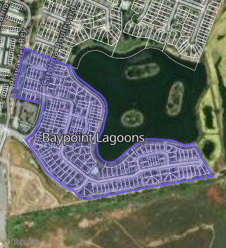
This property is located in San Rafael, San Rafael, CA 94901.
Seasonal Housing units 94901
18%of housing is for seasonal rent.
Daytime Population for 94901
+29%of people during work hours.
Boundary map of San Rafael.
Crime Index for 94901
111
The crime index in 94901 is 111, which is 1.1 times higher than national average.
Market Trends
Historical market data near 264 Baypoint Dr over selected time period.
Nearby Properties on Baypoint Dr
- 152 Baypoint Dr, San Rafael, CA 94901 (Baypoint Lagoons) is a 2,385 square foot, 4 bedroom, 3 bathroom, 0.1 acre property. It was built in 1998 and has an estimate of $1,046,789 with a price per ft² of $439.
- 212 Baypoint Dr, San Rafael, CA 94901 (Baypoint Lagoons) is a 2,210 square foot, 3 bedroom, 2 bathroom, 0.06 acre property. It was built in 1999 and has an estimate of $1,162,101 with a price per ft² of $526.
- 160 Baypoint Dr, San Rafael, CA 94901 (Baypoint Lagoons) is a 1,980 square foot, 3 bedroom, 3 bathroom, 0.07 acre property. It was built in 1998 and has an estimate of $926,524 with a price per ft² of $468.
- 113 Baypoint Dr, San Rafael, CA 94901 (Baypoint Lagoons) is a 2,078 square foot, 3 bedroom, 2 bathroom, 0.09 acre property. It was built in 1996 and has an estimate of $1,060,764 with a price per ft² of $510.
- 259 Baypoint Dr, San Rafael, CA 94901 (Baypoint Lagoons) is a 2,385 square foot, 4 bedroom, 3 bathroom, 0.07 acre property. It was built in 2000 and has an estimate of $1,324,288 with a price per ft² of $555.
- 204 Baypoint Dr, San Rafael, CA 94901 (Baypoint Lagoons) is a 2,210 square foot, 3 bedroom, 2 bathroom, 0.09 acre property. It was built in 1999 and has an estimate of $1,196,671 with a price per ft² of $541.
- 264 Baypoint Dr, San Rafael, CA 94901 (Baypoint Lagoons) is a 2,385 square foot, 4 bedroom, 3 bathroom, 0.08 acre property. It was built in 2000 and has an estimate of $1,226,245 with a price per ft² of $514.
- 110 Baypoint Dr, San Rafael, CA 94901 (Baypoint Lagoons) is a 2,365 square foot, 4 bedroom, 3 bathroom, 0.11 acre property. It was built in 1996 and has an estimate of $1,016,795 with a price per ft² of $430.
- 128 Baypoint Dr, San Rafael, CA 94901 (Baypoint Lagoons) is a 2,078 square foot, 3 bedroom, 2 bathroom, 0.07 acre property. It was built in 1996 and has an estimate of $1,038,965 with a price per ft² of $500.
- 263 Baypoint Dr, San Rafael, CA 94901 (Baypoint Lagoons) is a 2,385 square foot, 4 bedroom, 3 bathroom, 0.09 acre property. It was built in 2000 and has an estimate of $1,289,286 with a price per ft² of $541.
- 116 Baypoint Dr, San Rafael, CA 94901 (Baypoint Lagoons) is a 2,078 square foot, 3 bedroom, 2 bathroom, 0.07 acre property. It was built in 1996 and has an estimate of $901,629 with a price per ft² of $434.
- 205 Baypoint Dr, San Rafael, CA 94901 (Baypoint Lagoons) is a 1,095 square foot, 2 bedroom, 2 bathroom, 0.04 acre property. It was built in 2000 and has an estimate of $466,690 with a price per ft² of $426.
- 64 Baypoint Dr, San Rafael, CA 94901 (Baypoint Lagoons) is a 1,876 square foot, 3 bedroom, 2 bathroom, 0.06 acre property. It was built in 1994 and has an estimate of $1,002,473 with a price per ft² of $534.
- 105 Baypoint Dr, San Rafael, CA 94901 (Baypoint Lagoons) is a 2,371 square foot, 4 bedroom, 3 bathroom, 0.08 acre property. It was built in 1996 and has an estimate of $1,243,708 with a price per ft² of $525.
- 80 Baypoint Dr, San Rafael, CA 94901 (Baypoint Lagoons) is a 2,102 square foot, 3 bedroom, 2 bathroom, 0.08 acre property. It was built in 1991 and has an estimate of $1,197,126 with a price per ft² of $570.
- 27 Baypoint Dr, San Rafael, CA 94901 (Baypoint Lagoons) is a 1,920 square foot, 3 bedroom, 2 bathroom, 0.07 acre property. It was built in 1991 and has an estimate of $984,838 with a price per ft² of $513.
- 168 Baypoint Dr, San Rafael, CA 94901 (Baypoint Lagoons) is a 2,016 square foot, 3 bedroom, 2 bathroom, 0.08 acre property. It was built in 1998 and has an estimate of $1,111,548 with a price per ft² of $551.
- 19 Baypoint Dr, San Rafael, CA 94901 (Baypoint Lagoons) is a 1,929 square foot, 3 bedroom, 2 bathroom, 0.07 acre property. It was built in 1991 and has an estimate of $1,015,473 with a price per ft² of $526.
- 224 Baypoint Dr, San Rafael, CA 94901 (Baypoint Lagoons) is a 2,254 square foot, 3 bedroom, 2 bathroom, 0.1 acre property. It was built in 1999 and has an estimate of $1,069,145 with a price per ft² of $474.
- 228 Baypoint Dr, San Rafael, CA 94901 (Baypoint Lagoons) is a 2,210 square foot, 3 bedroom, 2.5 bathroom, 0.09 acre property. It was built in 2000 and has an estimate of $999,454 with a price per ft² of $452.
- 220 Baypoint Dr, San Rafael, CA 94901 (Baypoint Lagoons) is a 2,254 square foot, 3 bedroom, 2.5 bathroom, 0.1 acre property. It was built in 1999 and has an estimate of $922,240 with a price per ft² of $409.
- 232 Baypoint Dr, San Rafael, CA 94901 (Baypoint Lagoons) is a 2,210 square foot, 3 bedroom, 2.5 bathroom, 0.06 acre property. It was built in 2000 and has an estimate of $994,834 with a price per ft² of $450.
- 216 Baypoint Dr, San Rafael, CA 94901 (Baypoint Lagoons) is a 2,210 square foot, 3 bedroom, 2 bathroom, 0.09 acre property. It was built in 1999 and has an estimate of $1,080,993 with a price per ft² of $489.
- 240 Baypoint Dr, San Rafael, CA 94901 (Baypoint Lagoons) is a 2,210 square foot, 3 bedroom, 2.5 bathroom, 0.09 acre property. It was built in 2000 and has an estimate of $1,048,157 with a price per ft² of $474.
- 4 Baypoint Dr, San Rafael, CA 94901 (Baypoint Lagoons) is a 1,929 square foot, 3 bedroom, 2 bathroom, 0.08 acre property. It was built in 1993 and has an estimate of $1,000,340 with a price per ft² of $519.
- View more properties on Baypoint Dr