266 Brookside Dr
Angwin, CA 94508
- 4Beds
- 2Baths
- 1,428ft²Living Area
- 0.5acLot Size
- -Pool
- 2Car
- 1940Year Built
- -DOM
- 4Permits
Property Valuations
Latest estimates for 266 Brookside Dr based on TopHap automated valuation model (AVM).
TopHap Estimate
$618,300
$432/ft²
+$384K above Sold Price
Updated 3 months ago
Last Sold Price
$234,000
$164/ft²
25 years ago
266 Brookside Dr is valued at $618,300 by TopHap AVM 3 months ago.
266 Brookside Dr was last sold in 1999 for $234,000.
Permits
266 Brookside Dr has 4 permit records of total value of $26,515.
Current Ownership
Information about the current owner(s).
Taxes Billed
Taxes billed in 2023$3,650.32From latest Total Assessed Value1.04%Total Assessed Value$352,583=Land+
Assessed Value$150,676Additions
Assessed Value$201,907
In 2023, taxes billed for 266 Brookside Dr were $3,650.32, which is 1.04% from latest Total Assessed Value of $352,583.
Property History
266 Brookside Dr has undefined property events records (listings, deeds, permits, tax, foreclosure, loan).
Environment
Environmental factors around 266 Brookside Dr
Hazard Risks
Earthquake285Nat'l Avg100Particulates95Carb Mono88Air Pollution87Ozone83Lead46Tornado3Hail0Hurricane0Weather0Wind0
8 hazards (Carbon Monoxide, Earthquake Risk, Tornado Index, Air Pollution Index, Ozone Index, Lead Index, Particulate Matter, National Average) are above the national average around 266 Brookside Dr.
Walkability Index
8 /20
Most Walkable
20-18
Very Walkable
17-15
Somewhat Walkable
14-10
Car Dependent
9-0
266 Brookside Dr has a walkability score of 8 out of 20, which means that it is in a car dependent area.
Temperature
Seasonal temperature sampled over multiple years
Winter
Average
Low
39°F
High
54°F
Summer
Average
Low
54°F
High
84°F
In the winter at 266 Brookside Dr, temperatures range from 39.13°F to 53.95°F with an average of 46.54°F. In the summer, the temperature ranges from 54.37°F to 84.43°F with and average of 69.4°F.
School Information
Public/private schools serving 266 Brookside Dr
Public Schools
Nearby public schools serving 266 Brookside Dr have ratings undefined, undefined, undefined, undefined, undefined, and undefined.
Neighborhood
This property is located in Angwin.
Seasonal Housing units 94508
53%of housing is for seasonal rent.
Daytime Population for 94508
+11%of people during work hours.
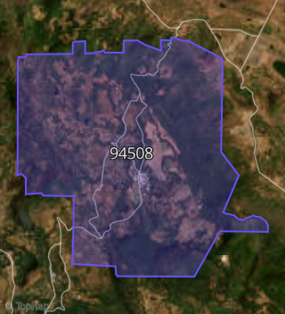
Boundary map of Angwin.
Crime Index for 94508
116
The crime index in 94508 is 116, which is 1.2 times higher than national average.
Market Trends
Historical market data near 266 Brookside Dr over selected time period.
Nearby Properties on Brookside Dr
- 280 Brookside Dr, Angwin, CA 94508 is a 2,534 square foot, 5 bedroom, 3 bathroom, 1.65 acre property. It was built in 1974 and has an estimate of $733,350 with a price per ft² of $289.
- 360 Brookside Dr, Angwin, CA 94508 is a 3,194 square foot, 4 bedroom, 3.25 bathroom, 4.08 acre property. It was built in 1991 and has an estimate of $1,764,242 with a price per ft² of $552.
- 132 Brookside Dr, Angwin, CA 94508 is a 1,593 square foot, 4 bedroom, 3.25 bathroom, 0.47 acre property. It was built in 1938 and has an estimate of $487,630 with a price per ft² of $306.
- 265 Brookside Dr, Angwin, CA 94508 is a 1,462 square foot, 3 bedroom, 2 bathroom, 0.92 acre property. It was built in 1940 and has an estimate of $637,029 with a price per ft² of $436.
- 110 Brookside Dr, Angwin, CA 94508 is a 2,516 square foot, 8 bedroom, 2 bathroom, 0.97 acre property. It was built in 1910 and has an estimate of $656,821 with a price per ft² of $261.
- 225 Brookside Dr, Angwin, CA 94508 is a 1,118 square foot, 2 bedroom, 2 bathroom, 0.39 acre property. It was built in 1946 and has an estimate of $561,000 with a price per ft² of $502.
- 108 Brookside Dr, Angwin, CA 94508 is a 1,296 square foot, 3 bedroom, 2.25 bathroom, 1.55 acre property. It was built in 1980 and has an estimate of $501,497 with a price per ft² of $387.
- 140 Brookside Dr, Angwin, CA 94508 is a 985 square foot, 3 bedroom, 2 bathroom, 0.5 acre property. It was built in 1924 and has an estimate of $659,121 with a price per ft² of $669.
- 266 Brookside Dr, Angwin, CA 94508 is a 1,428 square foot, 4 bedroom, 2 bathroom, 0.57 acre property. It was built in 1940 and has an estimate of $952,922 with a price per ft² of $667.
- 272 Brookside Dr, Angwin, CA 94508 is a 1,162 square foot, 4 bedroom, 2 bathroom, 0.19 acre property. It was built in 1935 and has an estimate of $663,179 with a price per ft² of $571.
- 250 Brookside Dr, Angwin, CA 94508 is a 1,722 square foot, 4 bedroom, 2 bathroom, 0.45 acre property. It was built in 1936 and has an estimate of $542,377 with a price per ft² of $315.
- 260 Brookside Dr, Angwin, CA 94508 is a 2,344 square foot, 4 bedroom, 3 bathroom, 0.32 acre property. It was built in 1975 and has an estimate of $833,690 with a price per ft² of $356.
- 251 Brookside Dr, Angwin, CA 94508 is a 1,699 square foot, 5 bedroom, 3 bathroom, 0.93 acre property. It was built in 1947 and has an estimate of $675,344 with a price per ft² of $397.
- 235 Brookside Dr, Angwin, CA 94508 is a 1,722 square foot, 3 bedroom, 3.25 bathroom, 0.64 acre property. It was built in 1950 and has an estimate of $456,501 with a price per ft² of $265.
- 276 Brookside Dr, Angwin, CA 94508 is a 1,568 square foot, 3 bedroom, 2 bathroom, 0.31 acre property. It was built in 1990 and has an estimate of $638,370 with a price per ft² of $407.
- 320 Brookside Dr, Angwin, CA 94508 is a 2,100 square foot, 4 bedroom, 3 bathroom, 1.17 acre property. It was built in 1969 and has an estimate of $701,226 with a price per ft² of $334.
- 340 Brookside Dr, Angwin, CA 94508 is a 3,401 square foot, 4 bedroom, 3 bathroom, 6.77 acre property. It was built in 1989 and has an estimate of $1,624,757 with a price per ft² of $478.
- 350 Brookside Dr, Angwin, CA 94508 is a 3,311 square foot, 4 bedroom, 4.25 bathroom, 1.91 acre property. It was built in 1993 and has an estimate of $1,279,410 with a price per ft² of $386.
- 317 Brookside Dr, Angwin, CA 94508 is a 1,568 square foot, 1 bedroom, 1 bathroom, 1.04 acre property. It was built in 1932 and has an estimate of $580,388 with a price per ft² of $370.
- 315 Brookside Dr, Angwin, CA 94508 is a 418 square foot, 4 bedroom, 4 bathroom, 1.13 acre property. It was built in 2008 and has an estimate of $524,107 with a price per ft² of $1,254.
- 305 Brookside Dr, Angwin, CA 94508 is a 1,872 square foot, 3 bedroom, 2 bathroom, 2 acre property. It was built in 1981 and has an estimate of $859,865 with a price per ft² of $459.
- 303 Brookside Dr, Angwin, CA 94508 is a 2,654 square foot, 3 bedroom, 3 bathroom, 1 acre property. It was built in 1994 and has an estimate of $902,735 with a price per ft² of $340.
- 335 Brookside Dr, Angwin, CA 94508 is a 1,992 square foot, 3 bedroom, 3.25 bathroom, 5.4 acre property. It was built in 1992 and has an estimate of $1,191,037 with a price per ft² of $598.
- 166 Brookside Dr, Angwin, CA 94508 is a 3,285 square foot, 7 bedroom, 7 bathroom, 1.04 acre property. It was built in 1938 and has an estimate of $1,195,679 with a price per ft² of $364.
- 170 Brookside Dr, Angwin, CA 94508 is a 1,572 square foot, 3 bedroom, 2 bathroom, 0.72 acre property. It was built in 1964 and has an estimate of $647,064 with a price per ft² of $412.
- View more properties on Brookside Dr