290 Gail Dr
Lathrop, CA 95330
- 3Beds
- 2Baths
- 1,401ft²Living Area
- 6,150ft²Lot Size
- -Pool
- 2Car
- 1989Year Built
- -DOM
- -Permit
Property Valuations
Latest estimates for 290 Gail Dr based on TopHap automated valuation model (AVM).
TopHap Estimate
$538,000
$384/ft²
Updated 3 months ago
290 Gail Dr is valued at $538,000 by TopHap AVM 3 months ago.
Current Ownership
Information about the current owner(s).
Taxes Billed
Taxes billed in 2023$2,460.40From latest Total Assessed Value1.25%Total Assessed Value$196,352=Land+
Assessed Value$72,121Additions
Assessed Value$124,231
In 2023, taxes billed for 290 Gail Dr were $2,460.4, which is 1.25% from latest Total Assessed Value of $196,352.
Property History
290 Gail Dr has undefined property events records (listings, deeds, permits, tax, foreclosure, loan).
Environment
Environmental factors around 290 Gail Dr
Hazard Risks
Earthquake179Nat'l Avg100Particulates97Air Pollution85Ozone82Carb Mono80Lead37Tornado22Weather8Wind2Hail0Hurricane0
10 hazards (Carbon Monoxide, Earthquake Risk, Tornado Index, Air Pollution Index, Ozone Index, Wind Index, Weather Risk, Lead Index, Particulate Matter, National Average) are above the national average around 290 Gail Dr.
Walkability Index
15 /20
Most Walkable
20-18
Very Walkable
17-15
Somewhat Walkable
14-10
Car Dependent
9-0
290 Gail Dr has a walkability score of 15 out of 20, which means that it is in a very walkable area.
Noise Level
42 dB
Quiet Suburban Residential 0-49
Suburban Residential 50-54
Urban Residential 55-59
Noisy Urban Residential 60-64
Very Noisy Urban Residential 65+
Noise at 290 Gail Dr is around 42dBs, which is comparable to a Quiet Suburban Residential area.
Temperature
Seasonal temperature sampled over multiple years
Winter
Average
Low
38°F
High
56°F
Summer
Average
Low
57°F
High
91°F
In the winter at 290 Gail Dr, temperatures range from 38.21°F to 56.42°F with an average of 47.32°F. In the summer, the temperature ranges from 57.07°F to 90.9°F with and average of 73.99°F.
School Information
Public/private schools serving 290 Gail Dr
Public Schools
Nearby public schools serving 290 Gail Dr have ratings undefined, and undefined.
Neighborhood
This property is located in Rosegate Terrace, Lathrop, CA 95330.
Seasonal Housing units 95330
13%of housing is for seasonal rent.
Daytime Population for 95330
-11%of people during work hours.
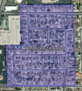
Boundary map of Rosegate Terrace.
Crime Index for 95330
75
The crime index in 95330 is 75, which is 0.8 times lower than national average.
Market Trends
Historical market data near 290 Gail Dr over selected time period.
Nearby Properties on Gail Dr
- 276 Gail Dr, Lathrop, CA 95330 (Rosegate Terrace) is a 1,148 square foot, 3 bedroom, 2 bathroom, 0.14 acre property. It was built in 1989 and has an estimate of $488,799 with a price per ft² of $426.
- 299 Gail Dr, Lathrop, CA 95330 (Rosegate Terrace) is a 1,827 square foot, 4 bedroom, 2 bathroom, 0.14 acre property. It was built in 1990 and has an estimate of $527,745 with a price per ft² of $289.
- 192 Gail Dr, Lathrop, CA 95330 (Rosegate Terrace) is a 1,431 square foot, 3 bedroom, 1 bathroom, 0.14 acre property. It was built in 1989 and has an estimate of $465,835 with a price per ft² of $326.
- 171 Gail Dr, Lathrop, CA 95330 (Rosegate Terrace) is a 1,401 square foot, 3 bedroom, 2 bathroom, 0.14 acre property. It was built in 1990 and has an estimate of $489,960 with a price per ft² of $350.
- 281 Gail Dr, Lathrop, CA 95330 (Rosegate Terrace) is a 1,473 square foot, 4 bedroom, 2 bathroom, 0.14 acre property. It was built in 1990 and has an estimate of $503,291 with a price per ft² of $342.
- 290 Gail Dr, Lathrop, CA 95330 (Rosegate Terrace) is a 1,401 square foot, 3 bedroom, 2 bathroom, 0.14 acre property. It was built in 1989 and has an estimate of $521,075 with a price per ft² of $372.
- 258 Gail Dr, Lathrop, CA 95330 (Rosegate Terrace) is a 1,568 square foot, 3 bedroom, 2 bathroom, 0.14 acre property. It was built in 1989 and has an estimate of $503,290 with a price per ft² of $321.
- 244 Gail Dr, Lathrop, CA 95330 (Rosegate Terrace) is a 1,827 square foot, 4 bedroom, 2 bathroom, 0.14 acre property. It was built in 1989 and has an estimate of $566,993 with a price per ft² of $310.
- 310 Gail Dr, Lathrop, CA 95330 (Rosegate Terrace) is a 1,473 square foot, 4 bedroom, 2 bathroom, 0.14 acre property. It was built in 1989 and has an estimate of $546,349 with a price per ft² of $371.
- 265 Gail Dr, Lathrop, CA 95330 (Rosegate Terrace) is a 1,431 square foot, 3 bedroom, 2 bathroom, 0.14 acre property. It was built in 1990 and has an estimate of $496,118 with a price per ft² of $347.
- 249 Gail Dr, Lathrop, CA 95330 (Rosegate Terrace) is a 1,473 square foot, 4 bedroom, 2 bathroom, 0.14 acre property. It was built in 1990 and has an estimate of $501,433 with a price per ft² of $340.
- 232 Gail Dr, Lathrop, CA 95330 (Rosegate Terrace) is a 1,152 square foot, 3 bedroom, 2 bathroom, 0.14 acre property. It was built in 1989 and has an estimate of $498,734 with a price per ft² of $433.
- 235 Gail Dr, Lathrop, CA 95330 (Rosegate Terrace) is a 1,827 square foot, 4 bedroom, 2 bathroom, 0.14 acre property. It was built in 1990 and has an estimate of $528,371 with a price per ft² of $289.
- 321 Gail Dr, Lathrop, CA 95330 (Rosegate Terrace) is a 1,568 square foot, 3 bedroom, 2 bathroom, 0.14 acre property. It was built in 1990 and has an estimate of $479,929 with a price per ft² of $306.
- 178 Gail Dr, Lathrop, CA 95330 (Rosegate Terrace) is a 1,568 square foot, 3 bedroom, 2 bathroom, 0.14 acre property. It was built in 1989 and has an estimate of $510,902 with a price per ft² of $326.
- 200 Gail Dr, Lathrop, CA 95330 (Rosegate Terrace) is a 1,827 square foot, 4 bedroom, 2 bathroom, 0.14 acre property. It was built in 1989 and has an estimate of $559,228 with a price per ft² of $306.
- 218 Gail Dr, Lathrop, CA 95330 (Rosegate Terrace) is a 1,473 square foot, 4 bedroom, 2 bathroom, 0.14 acre property. It was built in 1989 and has an estimate of $525,059 with a price per ft² of $356.
- 197 Gail Dr, Lathrop, CA 95330 (Rosegate Terrace) is a 1,473 square foot, 4 bedroom, 2 bathroom, 0.14 acre property. It was built in 1990 and has an estimate of $497,009 with a price per ft² of $337.
- 211 Gail Dr, Lathrop, CA 95330 (Rosegate Terrace) is a 1,827 square foot, 4 bedroom, 2 bathroom, 0.14 acre property. It was built in 1990 and has an estimate of $551,604 with a price per ft² of $302.
- 183 Gail Dr, Lathrop, CA 95330 (Rosegate Terrace) is a 1,827 square foot, 4 bedroom, 2 bathroom, 0.14 acre property. It was built in 1990 and has an estimate of $528,089 with a price per ft² of $289.
- 221 Gail Dr, Lathrop, CA 95330 (Rosegate Terrace) is a 1,568 square foot, 3 bedroom, 2 bathroom, 0.14 acre property. It was built in 1990 and has an estimate of $469,811 with a price per ft² of $300.
- 160 Gail Dr, Lathrop, CA 95330 (Rosegate Terrace) is a 1,316 square foot, 3 bedroom, 2 bathroom, 0.17 acre property. It was built in 1989 and has an estimate of $512,968 with a price per ft² of $390.
- 153 Gail Dr, Lathrop, CA 95330 (Rosegate Terrace) is a 1,316 square foot, 3 bedroom, 2 bathroom, 0.15 acre property. It was built in 1990 and has an estimate of $490,477 with a price per ft² of $373.