2926 La Combadura Rd
Santa Barbara, CA 93105
- 1Bed
- 1Bath
- 367ft²Living Area
- 6,969ft²Lot Size
- -Pool
- -Car
- 1951Year Built
- -DOM
- 2Permits
Property Valuations
Latest estimates for 2926 La Combadura Rd based on TopHap automated valuation model (AVM).
TopHap Estimate
$1,173,000
$3,196/ft²
+$908K above Sold Price
Updated 3 months ago
Last Sold Price
$265,000
$722/ft²
28 years ago
2926 La Combadura Rd is valued at $1,173,000 by TopHap AVM 3 months ago.
2926 La Combadura Rd was last sold in 1996 for $265,000.
Permits
2926 La Combadura Rd has 2 permit records of total value of $12,000.
Current Ownership
Information about the current owner(s).
Taxes Billed
Taxes billed in 2023$5,161.32From latest Total Assessed Value1.2%Total Assessed Value$430,503=Land+
Assessed Value$287,405Additions
Assessed Value$143,098
In 2023, taxes billed for 2926 La Combadura Rd were $5,161.32, which is 1.20% from latest Total Assessed Value of $430,503.
Property History
2926 La Combadura Rd has undefined property events records (listings, deeds, permits, tax, foreclosure, loan).
Environment
Environmental factors around 2926 La Combadura Rd
Hazard Risks
Earthquake477Nat'l Avg100Lead100Particulates100Air Pollution100Carb Mono95Ozone95Tornado10Weather6Hurricane1Wind1Hail0
11 hazards (Carbon Monoxide, Earthquake Risk, Tornado Index, Hurricane Index, Air Pollution Index, Ozone Index, Wind Index, Weather Risk, Lead Index, Particulate Matter, National Average) are above the national average around 2926 La Combadura Rd.
Walkability Index
7 /20
Most Walkable
20-18
Very Walkable
17-15
Somewhat Walkable
14-10
Car Dependent
9-0
2926 La Combadura Rd has a walkability score of 7 out of 20, which means that it is in a car dependent area.
Temperature
Seasonal temperature sampled over multiple years
Winter
Average
Low
34°F
High
52°F
Summer
Average
Low
55°F
High
88°F
In the winter at 2926 La Combadura Rd, temperatures range from 34.45°F to 52.25°F with an average of 43.35°F. In the summer, the temperature ranges from 54.95°F to 87.52°F with and average of 71.24°F.
School Information
Public/private schools serving 2926 La Combadura Rd
Public Schools
Nearby public schools serving 2926 La Combadura Rd have ratings undefined, undefined, and undefined.
Neighborhood
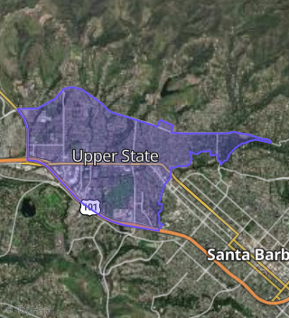
This property is located in Upper State, Santa Barbara, CA 93105.
Seasonal Housing units 93105
39%of housing is for seasonal rent.
Daytime Population for 93105
+20%of people during work hours.
Boundary map of Upper State.
Crime Index for 93105
99
The crime index in 93105 is 99, which is 1.0 times lower than national average.
Market Trends
Historical market data near 2926 La Combadura Rd over selected time period.
Nearby Properties on La Combadura Rd
- 2977 La Combadura Rd, Santa Barbara, CA 93105 (East San Roque) is a 1,746 square foot, 2 bedroom, 1 bathroom, 0.13 acre property. It was built in 1925 and has an estimate of $1,727,125 with a price per ft² of $989.
- 2972 La Combadura Rd, Santa Barbara, CA 93105 (Upper State) is a 1,524 square foot, 3 bedroom, 3.25 bathroom, 0.1 acre property. It was built in 1999 and has an estimate of $1,624,210 with a price per ft² of $1,066.
- 2946 La Combadura Rd, Santa Barbara, CA 93105 (Upper State) is a 1,073 square foot, 3 bedroom, 2 bathroom, 0.11 acre property. It was built in 1959 and has an estimate of $1,495,714 with a price per ft² of $1,394.
- 2948 La Combadura Rd, Santa Barbara, CA 93105 (Upper State) is a 1,460 square foot, 3 bedroom, 3.25 bathroom, 0.11 acre property. It was built in 1949 and has an estimate of $1,943,831 with a price per ft² of $1,331.
- 2923 La Combadura Rd, Santa Barbara, CA 93105 (East San Roque) is a 886 square foot, 2 bedroom, 1 bathroom, 0.13 acre property. It was built in 1952 and has an estimate of $1,611,730 with a price per ft² of $1,819.
- 2975 La Combadura Rd, Santa Barbara, CA 93105 (East San Roque) is a 840 square foot, 2 bedroom, 1 bathroom, 0.12 acre property. It was built in 1953 and has an estimate of $1,201,225 with a price per ft² of $1,430.
- 2979 La Combadura Rd, Santa Barbara, CA 93105 (East San Roque) is a 2,205 square foot, 3 bedroom, 3 bathroom, 0.14 acre property. It was built in 1996 and has an estimate of $1,911,488 with a price per ft² of $867.
- 2928 La Combadura Rd, Santa Barbara, CA 93105 (Upper State) is a 985 square foot, 2 bedroom, 1 bathroom, 0.17 acre property. It was built in 1947 and has an estimate of $1,373,575 with a price per ft² of $1,394.
- 2944 La Combadura Rd, Santa Barbara, CA 93105 (Upper State) is a 2,456 square foot, 3 bedroom, 3 bathroom, 0.22 acre property. It was built in 1958 and has an estimate of $2,331,477 with a price per ft² of $949.
- 2908 La Combadura Rd, Santa Barbara, CA 93105 (Upper State) is a 1,303 square foot, 3 bedroom, 3.25 bathroom, 0.18 acre property. It was built in 1960 and has an estimate of $1,801,019 with a price per ft² of $1,382.
- 2917 La Combadura Rd, Santa Barbara, CA 93105 (Upper State) is a 1,131 square foot, 3 bedroom, 3.25 bathroom, 0.28 acre property. It was built in 1960 and has an estimate of $1,810,533 with a price per ft² of $1,601.
- 2906 La Combadura Rd, Santa Barbara, CA 93105 (Upper State) is a 2,010 square foot, 3 bedroom, 4.25 bathroom, 0.24 acre property. It was built in 1960 and has an estimate of $2,400,142 with a price per ft² of $1,194.
- 2924 La Combadura Rd, Santa Barbara, CA 93105 (Upper State) is a 908 square foot, 1 bedroom, 1 bathroom, 0.12 acre property. It was built in 1946 and has an estimate of $1,242,928 with a price per ft² of $1,369.
- 2926 La Combadura Rd, Santa Barbara, CA 93105 (Upper State) is a 367 square foot, 1 bedroom, 1 bathroom, 0.16 acre property. It was built in 1951 and has an estimate of $955,170 with a price per ft² of $2,603.
- 2932 La Combadura Rd, Santa Barbara, CA 93105 (Upper State) is a 816 square foot, 4 bedroom, 1 bathroom, 0.11 acre property. It was built in 1950 and has an estimate of $1,232,611 with a price per ft² of $1,511.
- 2956 La Combadura Rd, Santa Barbara, CA 93105 (Upper State) is a 1,548 square foot, 3 bedroom, 4.25 bathroom, 0.11 acre property. It was built in 1946 and has an estimate of $2,019,489 with a price per ft² of $1,305.
- 2964 La Combadura Rd, Santa Barbara, CA 93105 (Upper State) is a 1,223 square foot, 2 bedroom, 2 bathroom, 0.1 acre property. It was built in 1947 and has an estimate of $1,418,407 with a price per ft² of $1,160.
- 2918 La Combadura Rd, Santa Barbara, CA 93105 (Upper State) is a 950 square foot, 2 bedroom, 1 bathroom, 0.16 acre property. It was built in 1964 and has an estimate of $1,259,757 with a price per ft² of $1,326.
- 2916 La Combadura Rd, Santa Barbara, CA 93105 (Upper State) is a 1,032 square foot, 2 bedroom, 1 bathroom, 0.18 acre property. It was built in 1964 and has an estimate of $1,476,576 with a price per ft² of $1,431.
- 2920 La Combadura Rd, Santa Barbara, CA 93105 (Upper State) is a 720 square foot, 1 bedroom, 1 bathroom, 0.11 acre property. It was built in 1947 and has an estimate of $1,191,886 with a price per ft² of $1,655.
- 2908 La Combadura Rd, Santa Barbara, CA 93105 (Upper State) is a 0.02 acre property.
- 2943 La Combadura Rd, Santa Barbara, CA 93105 (East San Roque) is a 1,467 square foot, 3 bedroom, 3.25 bathroom, 0.19 acre property. It was built in 1949 and has an estimate of $1,889,544 with a price per ft² of $1,288.
- 2933 La Combadura Rd, Santa Barbara, CA 93105 (East San Roque) is a 1,385 square foot, 2 bedroom, 2 bathroom, 0.23 acre property. It was built in 1948 and has an estimate of $1,807,098 with a price per ft² of $1,305.
- 2919 La Combadura Rd, Santa Barbara, CA 93105 (East San Roque) is a 1,000 square foot, 2 bedroom, 2 bathroom, 0.11 acre property. It was built in 1950 and has an estimate of $1,444,193 with a price per ft² of $1,444.
- 2915 La Combadura Rd, Santa Barbara, CA 93105 (East San Roque) is a 1,888 square foot, 2 bedroom, 1 bathroom, 0.11 acre property. It was built in 1975 and has an estimate of $1,780,844 with a price per ft² of $943.
- View more properties on La Combadura-Rd