345 Dale Ct
Benicia, CA 94510
- 3Beds
- 3Baths
- 1,760ft²Living Area
- 0.5acLot Size
- -Pool
- 2Car
- 1981Year Built
- -DOM
- -Permit
Property Valuations
Latest estimates for 345 Dale Ct based on TopHap automated valuation model (AVM).
TopHap Estimate
$825,250
$468/ft²
+$408K above Sold Price
Updated 3 months ago
Last Sold Price
$417,500
$237/ft²
21 years ago
345 Dale Ct is valued at $825,250 by TopHap AVM 3 months ago.
345 Dale Ct was last sold in 2002 for $417,500.
Current Ownership
Information about the current owner(s).
Taxes Billed
Taxes billed in 2022$6,789.58From latest Total Assessed Value1.17%Total Assessed Value$581,191=Land+
Assessed Value$139,202Additions
Assessed Value$441,989
In 2022, taxes billed for 345 Dale Ct were $6,789.58, which is 1.17% from latest Total Assessed Value of $581,191.
Property History
345 Dale Ct has undefined property events records (listings, deeds, permits, tax, foreclosure, loan).
Environment
Environmental factors around 345 Dale Ct
Hazard Risks
Earthquake475Nat'l Avg100Particulates92Carb Mono90Air Pollution85Ozone84Lead42Tornado6Hail2Weather1Hurricane0Wind0
10 hazards (Carbon Monoxide, Earthquake Risk, Hail Index, Tornado Index, Air Pollution Index, Ozone Index, Weather Risk, Lead Index, Particulate Matter, National Average) are above the national average around 345 Dale Ct.
Walkability Index
12 /20
Most Walkable
20-18
Very Walkable
17-15
Somewhat Walkable
14-10
Car Dependent
9-0
345 Dale Ct has a walkability score of 12 out of 20, which means that it is in a somewhat walkable area.
Noise Level
39 dB
Quiet Suburban Residential 0-49
Suburban Residential 50-54
Urban Residential 55-59
Noisy Urban Residential 60-64
Very Noisy Urban Residential 65+
Noise at 345 Dale Ct is around 39dBs, which is comparable to a Quiet Suburban Residential area.
Temperature
Seasonal temperature sampled over multiple years
Winter
Average
Low
39°F
High
57°F
Summer
Average
Low
54°F
High
83°F
In the winter at 345 Dale Ct, temperatures range from 39.4°F to 56.97°F with an average of 48.19°F. In the summer, the temperature ranges from 54.32°F to 83.43°F with and average of 68.88°F.
School Information
Public/private schools serving 345 Dale Ct
Public Schools
Nearby public schools serving 345 Dale Ct have ratings undefined, undefined, and undefined.
Neighborhood
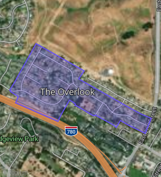
This property is located in The Overlook, Benicia, CA 94510.
Seasonal Housing units 94510
14%of housing is for seasonal rent.
Daytime Population for 94510
+3%of people during work hours.
Boundary map of The Overlook.
Crime Index for 94510
74
The crime index in 94510 is 74, which is 0.7 times lower than national average.
Market Trends
Historical market data near 345 Dale Ct over selected time period.
Nearby Properties on Dale Ct
- 340 Dale Ct, Benicia, CA 94510 (The Overlook) is a 1,760 square foot, 3 bedroom, 3.25 bathroom, 0.19 acre property. It was built in 1982 and has an estimate of $992,111 with a price per ft² of $564.
- 345 Dale Ct, Benicia, CA 94510 (The Overlook) is a 1,760 square foot, 3 bedroom, 2.5 bathroom, 0.46 acre property. It was built in 1981 and has an estimate of $1,126,767 with a price per ft² of $640.
- 311 Dale Ct, Benicia, CA 94510 (The Overlook) is a 2,112 square foot, 4 bedroom, 3 bathroom, 0.3 acre property. It was built in 1981 and has an estimate of $1,216,742 with a price per ft² of $576.
- 330 Dale Ct, Benicia, CA 94510 (The Overlook) is a 2,048 square foot, 4 bedroom, 3.25 bathroom, 0.17 acre property. It was built in 1980 and has an estimate of $1,093,916 with a price per ft² of $534.
- 335 Dale Ct, Benicia, CA 94510 (The Overlook) is a 1,536 square foot, 4 bedroom, 2 bathroom, 0.24 acre property. It was built in 1980 and has an estimate of $999,313 with a price per ft² of $651.
- 344 Dale Ct, Benicia, CA 94510 (The Overlook) is a 1,776 square foot, 3 bedroom, 2 bathroom, 0.39 acre property. It was built in 1980 and has an estimate of $1,036,514 with a price per ft² of $584.
- 318 Dale Ct, Benicia, CA 94510 (The Overlook) is a 1,561 square foot, 4 bedroom, 3.25 bathroom, 0.17 acre property. It was built in 1981 and has an estimate of $915,664 with a price per ft² of $587.
- 308 Dale Ct, Benicia, CA 94510 (The Overlook) is a 1,776 square foot, 3 bedroom, 2 bathroom, 0.21 acre property. It was built in 1979 and has an estimate of $1,045,546 with a price per ft² of $589.
- 327 Dale Ct, Benicia, CA 94510 (The Overlook) is a 1,760 square foot, 3 bedroom, 3.25 bathroom, 0.26 acre property. It was built in 1980 and has an estimate of $1,045,777 with a price per ft² of $594.
- 343 Dale Ct, Benicia, CA 94510 (The Overlook) is a 2,048 square foot, 4 bedroom, 2.5 bathroom, 0.32 acre property. It was built in 1985 and has an estimate of $1,177,969 with a price per ft² of $575.