347 G St
Fremont, CA 94536
- 4Beds
- 3Baths
- 2,202ft²Living Area
- 2,500ft²Lot Size
- -Pool
- 1Car
- 1917Year Built
- -DOM
- 18Permits
Property Valuations
Latest estimates for 347 G St based on TopHap automated valuation model (AVM).
TopHap Estimate
$1,714,000
$778/ft²
+$1M above Sold Price
Updated 3 months ago
Last Sold Price
$410,000
$186/ft²
26 years ago
347 G St is valued at $1,714,000 by TopHap AVM 3 months ago.
347 G St was last sold in 1998 for $410,000.
Permits
347 G St has 18 permit records of total value of $46,000.
Current Ownership
Information about the current owner(s).
Taxes Billed
Taxes billed in 2023$7,870.40From latest Total Assessed Value1.25%Total Assessed Value$629,218=Land+
Assessed Value$188,765Additions
Assessed Value$440,453
In 2023, taxes billed for 347 G St were $7,870.4, which is 1.25% from latest Total Assessed Value of $629,218.
Property History
347 G St has undefined property events records (listings, deeds, permits, tax, foreclosure, loan).
Environment
Environmental factors around 347 G St
Hazard Risks
Earthquake557Particulates103Nat'l Avg100Carb Mono100Air Pollution92Ozone86Lead39Tornado12Weather3Wind1Hail0Hurricane0
10 hazards (Carbon Monoxide, Earthquake Risk, Tornado Index, Air Pollution Index, Ozone Index, Wind Index, Weather Risk, Lead Index, Particulate Matter, National Average) are above the national average around 347 G St.
Walkability Index
15 /20
Most Walkable
20-18
Very Walkable
17-15
Somewhat Walkable
14-10
Car Dependent
9-0
347 G St has a walkability score of 15 out of 20, which means that it is in a very walkable area.
Temperature
Seasonal temperature sampled over multiple years
Winter
Average
Low
42°F
High
59°F
Summer
Average
Low
55°F
High
78°F
In the winter at 347 G St, temperatures range from 41.54°F to 58.66°F with an average of 50.1°F. In the summer, the temperature ranges from 54.96°F to 78.03°F with and average of 66.5°F.
School Information
Public/private schools serving 347 G St
Public Schools
Nearby public schools serving 347 G St have ratings undefined, undefined, and undefined.
Neighborhood
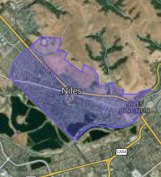
This property is located in Niles, Fremont, CA 94536.
Seasonal Housing units 94536
15%of housing is for seasonal rent.
Daytime Population for 94536
-18%of people during work hours.
Boundary map of Niles.
Crime Index for 94536
48
The crime index in 94536 is 48, which is 0.5 times lower than national average.
Market Trends
Historical market data near 347 G St over selected time period.
Nearby Properties on G St
- 153 G St, Fremont, CA 94536 (Niles) is a 1,605 square foot, 4 bedroom, 2 bathroom, 0.11 acre property. It was built in 1915 and has an estimate of $1,255,718 with a price per ft² of $782.
- 152 G St, Fremont, CA 94536 (Niles) is a 1,224 square foot, 2 bedroom, 2.25 bathroom, 0.13 acre property. It was built in 1930 and has an estimate of $1,162,465 with a price per ft² of $950.
- 310 G St, Fremont, CA 94536 (Niles) is a 1,130 square foot, 3 bedroom, 1.5 bathroom, 0.12 acre property. It was built in 1937 and has an estimate of $1,140,286 with a price per ft² of $1,009.
- 312 G St, Fremont, CA 94536 (Niles) is a 966 square foot, 2 bedroom, 1 bathroom, 0.12 acre property. It was built in 1939 and has an estimate of $1,015,669 with a price per ft² of $1,051.
- 306 G St, Fremont, CA 94536 (Niles) is a 1,227 square foot, 2 bedroom, 1 bathroom, 0.12 acre property. It was built in 1937 and has an estimate of $1,082,940 with a price per ft² of $883.
- 281 G St, Fremont, CA 94536 (Niles) is a 1,304 square foot, 3 bedroom, 3 bathroom, 0.19 acre property. It was built in 1900 and has an estimate of $1,294,353 with a price per ft² of $993.
- 347 G St, Fremont, CA 94536 (Niles) is a 2,202 square foot, 2 bedroom, 1 bathroom, 0.19 acre property. It was built in 1917 and has an estimate of $1,599,987 with a price per ft² of $727.