352 L St
Fremont, CA 94536
- 4Beds
- 3Baths
- 1,801ft²Living Area
- 7,500ft²Lot Size
- -Pool
- -Car
- 1910Year Built
- -DOM
- 7Permits
Permits
352 L St has 7 permit records of total value of $1,000.
Current Ownership
Information about the current owner(s).
Taxes Billed
Taxes billed in 2023$3,120.92From latest Total Assessed Value3.02%Total Assessed Value$103,412=Land+
Assessed Value$50,944Additions
Assessed Value$52,468
In 2023, taxes billed for 352 L St were $3,120.92, which is 3.02% from latest Total Assessed Value of $103,412.
Property History
352 L St has undefined property events records (listings, deeds, permits, tax, foreclosure, loan).
Environment
Environmental factors around 352 L St
Hazard Risks
Earthquake557Particulates103Nat'l Avg100Carb Mono100Air Pollution92Ozone86Lead39Tornado12Weather3Wind1Hail0Hurricane0
10 hazards (Carbon Monoxide, Earthquake Risk, Tornado Index, Air Pollution Index, Ozone Index, Wind Index, Weather Risk, Lead Index, Particulate Matter, National Average) are above the national average around 352 L St.
Walkability Index
15 /20
Most Walkable
20-18
Very Walkable
17-15
Somewhat Walkable
14-10
Car Dependent
9-0
352 L St has a walkability score of 15 out of 20, which means that it is in a very walkable area.
Temperature
Seasonal temperature sampled over multiple years
Winter
Average
Low
42°F
High
59°F
Summer
Average
Low
55°F
High
78°F
In the winter at 352 L St, temperatures range from 41.54°F to 58.66°F with an average of 50.1°F. In the summer, the temperature ranges from 54.96°F to 78.03°F with and average of 66.5°F.
School Information
Public/private schools serving 352 L St
Public Schools
Nearby public schools serving 352 L St have ratings undefined, undefined, and undefined.
Neighborhood
This property is located in Niles, Fremont, CA 94536.
Seasonal Housing units 94536
15%of housing is for seasonal rent.
Daytime Population for 94536
-18%of people during work hours.
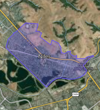
Boundary map of Niles.
Crime Index for 94536
48
The crime index in 94536 is 48, which is 0.5 times lower than national average.
Market Trends
Historical market data near 352 L St over selected time period.
Nearby Properties on L St
- 385 L St, Fremont, CA 94536 (Niles) is a 966 square foot, 3 bedroom, 1 bathroom, 0.17 acre property. It was built in 1955 and has an estimate of $1,108,454 with a price per ft² of $1,108.
- 390 L St, Fremont, CA 94536 (Niles) is a 3,128 square foot, 6 bedroom, 4 bathroom, 0.18 acre property. It was built in 1985 and has an estimate of $1,776,189 with a price per ft² of $568.
- 381 L St, Fremont, CA 94536 (Niles) is a 1,853 square foot, 5 bedroom, 2 bathroom, 0.17 acre property. It was built in 1906 and has an estimate of $1,330,880 with a price per ft² of $718.
- 393 L St, Fremont, CA 94536 (Niles) is a 1,458 square foot, 4 bedroom, 2 bathroom, 0.17 acre property. It was built in 1960 and has an estimate of $1,351,498 with a price per ft² of $927.
- 367 L St, Fremont, CA 94536 (Niles) is a 1,556 square foot, 4 bedroom, 2.5 bathroom, 0.17 acre property. It was built in 1915 and has an estimate of $1,325,851 with a price per ft² of $852.
- 399 L St, Fremont, CA 94536 (Niles) is a 2,584 square foot, 6 bedroom, 4 bathroom, 0.19 acre property. It was built in 1982 and has an estimate of $1,645,445 with a price per ft² of $637.
- 403 L St, Fremont, CA 94536 (Niles) is a 2,584 square foot, 6 bedroom, 4 bathroom, 0.2 acre property. It was built in 1981 and has an estimate of $1,722,103 with a price per ft² of $666.
- 407 L St, Fremont, CA 94536 (Niles) is a 2,584 square foot, 6 bedroom, 4 bathroom, 0.18 acre property. It was built in 1981 and has an estimate of $1,678,673 with a price per ft² of $650.
- 353 L St, Fremont, CA 94536 (Niles) is a 1,264 square foot, 3 bedroom, 2 bathroom, 0.17 acre property. It was built in 1923 and has an estimate of $1,236,070 with a price per ft² of $997.
- 380 L St, Fremont, CA 94536 (Niles) is a 3,456 square foot, 6 bathroom, 0.4 acre property. It was built in 1950 and has an estimate of $1,990,884 with a price per ft² of $576.
- 394 L St, Fremont, CA 94536 (Niles) is a 3,128 square foot, 6 bedroom, 4 bathroom, 0.18 acre property. It was built in 1985 and has an estimate of $1,776,189 with a price per ft² of $568.
- 302 L St, Fremont, CA 94536 (Niles) is a 2,880 square foot, 4 bedroom, 4 bathroom, 0.17 acre property. It was built in 1951 and has an estimate of $1,675,991 with a price per ft² of $582.
- 352 L St, Fremont, CA 94536 (Niles) is a 1,801 square foot, 4 bedroom, 3 bathroom, 0.17 acre property. It was built in 1910 and has an estimate of $1,440,354 with a price per ft² of $800.
- 398 L St, Fremont, CA 94536 (Niles) is a 3,128 square foot, 6 bedroom, 4 bathroom, 0.18 acre property. It was built in 1985 and has an estimate of $1,859,818 with a price per ft² of $595.