380 Mccall Dr
Benicia, CA 94510
- 4Beds
- 3Baths
- 3,162ft²Living Area
- 7,215ft²Lot Size
- -Pool
- 3Car
- 2004Year Built
- -DOM
- -Permit
Property Valuations
Latest estimates for 380 Mccall Dr based on TopHap automated valuation model (AVM).
TopHap Estimate
$1,158,750
$366/ft²
Updated 3 months ago
380 Mccall Dr is valued at $1,158,750 by TopHap AVM 3 months ago.
Current Ownership
Information about the current owner(s).
Taxes Billed
Taxes billed in 2022$9,134.58From latest Total Assessed Value1.17%Total Assessed Value$777,702=Land+
Assessed Value$252,498Additions
Assessed Value$525,204
In 2022, taxes billed for 380 Mccall Dr were $9,134.58, which is 1.17% from latest Total Assessed Value of $777,702.
Property History
380 Mccall Dr has undefined property events records (listings, deeds, permits, tax, foreclosure, loan).
Environment
Environmental factors around 380 Mccall Dr
Hazard Risks
Earthquake475Nat'l Avg100Particulates92Carb Mono90Air Pollution85Ozone84Lead42Tornado6Hail2Weather1Hurricane0Wind0
10 hazards (Carbon Monoxide, Earthquake Risk, Hail Index, Tornado Index, Air Pollution Index, Ozone Index, Weather Risk, Lead Index, Particulate Matter, National Average) are above the national average around 380 Mccall Dr.
Walkability Index
8 /20
Most Walkable
20-18
Very Walkable
17-15
Somewhat Walkable
14-10
Car Dependent
9-0
380 Mccall Dr has a walkability score of 8 out of 20, which means that it is in a car dependent area.
Noise Level
47 dB
Quiet Suburban Residential 0-49
Suburban Residential 50-54
Urban Residential 55-59
Noisy Urban Residential 60-64
Very Noisy Urban Residential 65+
Noise at 380 Mccall Dr is around 47dBs, which is comparable to a Quiet Suburban Residential area.
Temperature
Seasonal temperature sampled over multiple years
Winter
Average
Low
39°F
High
57°F
Summer
Average
Low
54°F
High
83°F
In the winter at 380 Mccall Dr, temperatures range from 39.4°F to 56.97°F with an average of 48.19°F. In the summer, the temperature ranges from 54.32°F to 83.43°F with and average of 68.88°F.
School Information
Public/private schools serving 380 Mccall Dr
Public Schools
Nearby public schools serving 380 Mccall Dr have ratings undefined, undefined, and undefined.
Neighborhood
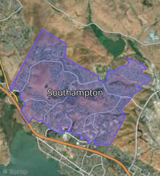
This property is located in Southampton, Benicia, CA 94510.
Seasonal Housing units 94510
14%of housing is for seasonal rent.
Daytime Population for 94510
+3%of people during work hours.
Boundary map of Southampton.
Crime Index for 94510
74
The crime index in 94510 is 74, which is 0.7 times lower than national average.
Market Trends
Historical market data near 380 Mccall Dr over selected time period.
Nearby Properties on Mccall Dr
- 530 Mccall Dr, Benicia, CA 94510 (Southampton) is a 2,153 square foot, 3 bedroom, 2 bathroom, 0.25 acre property. It was built in 1997 and has an estimate of $1,101,745 with a price per ft² of $512.
- 478 Mccall Dr, Benicia, CA 94510 (Southampton) is a 2,794 square foot, 4 bedroom, 3 bathroom, 0.23 acre property. It was built in 1997 and has an estimate of $1,198,216 with a price per ft² of $429.
- 486 Mccall Dr, Benicia, CA 94510 (Southampton) is a 2,794 square foot, 4 bedroom, 3 bathroom, 0.26 acre property. It was built in 1997 and has an estimate of $1,263,943 with a price per ft² of $452.
- 360 Mccall Dr, Benicia, CA 94510 (Southampton) is a 3,509 square foot, 4 bedroom, 3.5 bathroom, 0.21 acre property. It was built in 2004 and has an estimate of $1,258,073 with a price per ft² of $359.
- 361 Mccall Dr, Benicia, CA 94510 (Southampton) is a 3,485 square foot, 4 bedroom, 3 bathroom, 0.21 acre property. It was built in 2004 and has an estimate of $1,274,271 with a price per ft² of $366.
- 464 Mccall Dr, Benicia, CA 94510 (Southampton) is a 2,488 square foot, 4 bedroom, 3 bathroom, 0.2 acre property. It was built in 1998 and has an estimate of $1,168,239 with a price per ft² of $470.
- 358 Mccall Dr, Benicia, CA 94510 (Southampton) is a 3,485 square foot, 3 bedroom, 3 bathroom, 0.22 acre property. It was built in 2004 and has an estimate of $1,280,323 with a price per ft² of $367.
- 476 Mccall Dr, Benicia, CA 94510 (Southampton) is a 2,763 square foot, 5 bedroom, 3 bathroom, 0.23 acre property. It was built in 1997 and has an estimate of $1,219,751 with a price per ft² of $441.
- 472 Mccall Dr, Benicia, CA 94510 (Southampton) is a 2,488 square foot, 4 bedroom, 3 bathroom, 0.21 acre property. It was built in 1997 and has an estimate of $1,175,749 with a price per ft² of $473.
- 484 Mccall Dr, Benicia, CA 94510 (Southampton) is a 2,153 square foot, 3 bedroom, 2 bathroom, 0.24 acre property. It was built in 1997 and has an estimate of $1,134,246 with a price per ft² of $527.
- 380 Mccall Dr, Benicia, CA 94510 (Southampton) is a 3,162 square foot, 4 bedroom, 3.25 bathroom, 0.17 acre property. It was built in 2004 and has an estimate of $1,298,306 with a price per ft² of $411.
- 378 Mccall Dr, Benicia, CA 94510 (Southampton) is a 3,485 square foot, 4 bedroom, 3 bathroom, 0.17 acre property. It was built in 2004 and has an estimate of $1,312,423 with a price per ft² of $377.
- 376 Mccall Dr, Benicia, CA 94510 (Southampton) is a 3,162 square foot, 4 bedroom, 3.25 bathroom, 0.17 acre property. It was built in 2004 and has an estimate of $1,292,407 with a price per ft² of $409.
- 390 Mccall Dr, Benicia, CA 94510 (Southampton) is a 3,509 square foot, 4 bedroom, 3.5 bathroom, 0.18 acre property. It was built in 2004 and has an estimate of $1,286,219 with a price per ft² of $367.
- 392 Mccall Dr, Benicia, CA 94510 (Southampton) is a 3,280 square foot, 5 bedroom, 4.25 bathroom, 0.19 acre property. It was built in 2004 and has an estimate of $1,332,874 with a price per ft² of $406.
- 394 Mccall Dr, Benicia, CA 94510 (Southampton) is a 3,508 square foot, 4 bedroom, 4.25 bathroom, 0.2 acre property. It was built in 2004 and has an estimate of $1,287,684 with a price per ft² of $367.
- 364 Mccall Dr, Benicia, CA 94510 (Southampton) is a 3,508 square foot, 4 bedroom, 4.25 bathroom, 0.18 acre property. It was built in 2004 and has an estimate of $1,359,727 with a price per ft² of $388.
- 396 Mccall Dr, Benicia, CA 94510 (Southampton) is a 2,758 square foot, 4 bedroom, 3 bathroom, 0.2 acre property. It was built in 2004 and has an estimate of $1,237,996 with a price per ft² of $449.
- 362 Mccall Dr, Benicia, CA 94510 (Southampton) is a 3,162 square foot, 4 bedroom, 3.25 bathroom, 0.21 acre property. It was built in 2004 and has an estimate of $1,245,425 with a price per ft² of $394.
- 398 Mccall Dr, Benicia, CA 94510 (Southampton) is a 3,485 square foot, 5 bedroom, 3 bathroom, 0.21 acre property. It was built in 2004 and has an estimate of $1,263,969 with a price per ft² of $363.
- 374 Mccall Dr, Benicia, CA 94510 (Southampton) is a 3,280 square foot, 5 bedroom, 4.25 bathroom, 0.17 acre property. It was built in 2004 and has an estimate of $1,305,496 with a price per ft² of $398.
- 522 Mccall Dr, Benicia, CA 94510 (Southampton) is a 2,153 square foot, 3 bedroom, 2 bathroom, 0.28 acre property. It was built in 1997 and has an estimate of $1,132,385 with a price per ft² of $526.
- 466 Mccall Dr, Benicia, CA 94510 (Southampton) is a 2,763 square foot, 5 bedroom, 3 bathroom, 0.2 acre property. It was built in 1998 and has an estimate of $1,227,086 with a price per ft² of $444.
- 363 Mccall Dr, Benicia, CA 94510 (Southampton) is a 2,758 square foot, 4 bedroom, 3 bathroom, 0.26 acre property. It was built in 2004 and has an estimate of $1,253,701 with a price per ft² of $455.
- 521 Mccall Dr, Benicia, CA 94510 (Southampton) is a 3,121 square foot, 4 bedroom, 4.25 bathroom, 0.38 acre property. It was built in 1992 and has an estimate of $1,422,571 with a price per ft² of $456.
- View more properties on Mccall Dr