3933 Stacy Ln
Santa Barbara, CA 93110
- 4Beds
- 4Baths
- 2,367ft²Living Area
- 9,147ft²Lot Size
- -Pool
- -Car
- 2000Year Built
- -DOM
- 2Permits
Property Valuations
Latest estimates for 3933 Stacy Ln based on TopHap automated valuation model (AVM).
TopHap Estimate
$2,365,250
$999/ft²
+$940K above Sold Price
Updated 3 months ago
Last Sold Price
$1,425,000
$602/ft²
16 years ago
3933 Stacy Ln is valued at $2,365,250 by TopHap AVM 3 months ago.
3933 Stacy Ln was last sold in 2007 for $1,425,000.
Permits
3933 Stacy Ln has 2 permit records.
Current Ownership
Information about the current owner(s).
Taxes Billed
Taxes billed in 2023$19,295.20From latest Total Assessed Value1.07%Total Assessed Value$1,799,070=Land+
Assessed Value$1,104,693Additions
Assessed Value$694,377
In 2023, taxes billed for 3933 Stacy Ln were $19,295.2, which is 1.07% from latest Total Assessed Value of $1,799,070.
Property History
3933 Stacy Ln has undefined property events records (listings, deeds, permits, tax, foreclosure, loan).
Environment
Environmental factors around 3933 Stacy Ln
Hazard Risks
Earthquake450Lead101Particulates101Nat'l Avg100Ozone98Air Pollution96Carb Mono85Tornado5Weather3Hurricane2Wind1Hail0
11 hazards (Carbon Monoxide, Earthquake Risk, Tornado Index, Hurricane Index, Air Pollution Index, Ozone Index, Wind Index, Weather Risk, Lead Index, Particulate Matter, National Average) are above the national average around 3933 Stacy Ln.
Walkability Index
8 /20
Most Walkable
20-18
Very Walkable
17-15
Somewhat Walkable
14-10
Car Dependent
9-0
3933 Stacy Ln has a walkability score of 8 out of 20, which means that it is in a car dependent area.
Temperature
Seasonal temperature sampled over multiple years
Winter
Average
Low
39°F
High
58°F
Summer
Average
Low
55°F
High
81°F
In the winter at 3933 Stacy Ln, temperatures range from 39.08°F to 58.42°F with an average of 48.75°F. In the summer, the temperature ranges from 54.73°F to 80.82°F with and average of 67.78°F.
School Information
Public/private schools serving 3933 Stacy Ln
Public Schools
Nearby public schools serving 3933 Stacy Ln have ratings undefined, undefined, and undefined.
Neighborhood
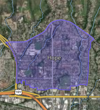
This property is located in Upper State, Santa Barbara, CA 93110.
Seasonal Housing units 93110
32%of housing is for seasonal rent.
Daytime Population for 93110
+1%of people during work hours.
Boundary map of Upper State.
Crime Index for 93110
104
The crime index in 93110 is 104, which is 1.0 times higher than national average.
Market Trends
Historical market data near 3933 Stacy Ln over selected time period.
Nearby Properties on Stacy Ln
- 3946 Stacy Ln, Santa Barbara, CA 93110 (Hope) is a 2,359 square foot, 4 bedroom, 3.25 bathroom, 0.19 acre property. It was built in 2000 and has an estimate of $2,190,299 with a price per ft² of $928.
- 3933 Stacy Ln, Santa Barbara, CA 93110 (Hope) is a 2,367 square foot, 4 bedroom, 4.25 bathroom, 0.21 acre property. It was built in 2000 and has an estimate of $2,166,496 with a price per ft² of $915.
- 3951 Stacy Ln, Santa Barbara, CA 93110 (Hope) is a 2,166 square foot, 2 bedroom, 3.25 bathroom, 0.25 acre property. It was built in 2000 and has an estimate of $2,035,590 with a price per ft² of $940.
- 3918 Stacy Ln, Santa Barbara, CA 93110 (Hope) is a 1,352 square foot, 3 bedroom, 2 bathroom, 0.17 acre property. It was built in 1960 and has an estimate of $1,411,726 with a price per ft² of $1,044.
- 3934 Stacy Ln, Santa Barbara, CA 93110 (Hope) is a 2,359 square foot, 4 bedroom, 2.5 bathroom, 0.19 acre property. It was built in 2001 and has an estimate of $2,248,016 with a price per ft² of $953.
- 3940 Stacy Ln, Santa Barbara, CA 93110 (Hope) is a 2,367 square foot, 4 bedroom, 3.25 bathroom, 0.21 acre property. It was built in 2000 and has an estimate of $2,277,332 with a price per ft² of $962.
- 3939 Stacy Ln, Santa Barbara, CA 93110 (Hope) is a 2,359 square foot, 4 bedroom, 3.25 bathroom, 0.23 acre property. It was built in 2000 and has an estimate of $2,197,121 with a price per ft² of $931.
- 3945 Stacy Ln, Santa Barbara, CA 93110 (Hope) is a 2,359 square foot, 4 bedroom, 3.25 bathroom, 0.19 acre property. It was built in 2000 and has an estimate of $2,199,918 with a price per ft² of $933.
- 3957 Stacy Ln, Santa Barbara, CA 93110 (Hope) is a 2,367 square foot, 4 bedroom, 3.25 bathroom, 0.18 acre property. It was built in 2000 and has an estimate of $2,143,654 with a price per ft² of $906.
- 3958 Stacy Ln, Santa Barbara, CA 93110 (Hope) is a 2,291 square foot, 2 bedroom, 3.25 bathroom, 0.23 acre property. It was built in 2000 and has an estimate of $2,119,833 with a price per ft² of $925.
- 3964 Stacy Ln, Santa Barbara, CA 93110 (Hope) is a 2,359 square foot, 4 bedroom, 3.25 bathroom, 0.19 acre property. It was built in 2000 and has an estimate of $2,235,133 with a price per ft² of $947.
- 3914 Stacy Ln, Santa Barbara, CA 93110 (Hope) is a 1,761 square foot, 3 bedroom, 3.25 bathroom, 0.18 acre property. It was built in 1960 and has an estimate of $1,636,328 with a price per ft² of $929.
- 3928 Stacy Ln, Santa Barbara, CA 93110 (Hope) is a 1,258 square foot, 3 bedroom, 2 bathroom, 0.19 acre property. It was built in 1959 and has an estimate of $1,378,085 with a price per ft² of $1,095.
- 3927 Stacy Ln, Santa Barbara, CA 93110 (Hope) is a 1,474 square foot, 3 bedroom, 2 bathroom, 0.28 acre property. It was built in 1959 and has an estimate of $1,441,131 with a price per ft² of $978.
- 3917 Stacy Ln, Santa Barbara, CA 93110 (Hope) is a 1,351 square foot, 3 bedroom, 2 bathroom, 0.26 acre property. It was built in 1960 and has an estimate of $1,459,362 with a price per ft² of $1,080.
- 3911 Stacy Ln, Santa Barbara, CA 93110 (Hope) is a 2,783 square foot, 5 bedroom, 4 bathroom, 0.27 acre property. It was built in 1959 and has an estimate of $2,258,688 with a price per ft² of $812.
- 3952 Stacy Ln, Santa Barbara, CA 93110 (Hope) is a 2,359 square foot, 4 bedroom, 3.25 bathroom, 0.21 acre property. It was built in 2000 and has an estimate of $2,104,520 with a price per ft² of $892.