405 Santa Anita Rd
Santa Barbara, CA 93105
- 3Beds
- 2Baths
- 1,310ft²Living Area
- 0.3acLot Size
- -Pool
- -Car
- 1951Year Built
- -DOM
- 16Permits
Property Valuations
Latest estimates for 405 Santa Anita Rd based on TopHap automated valuation model (AVM).
TopHap Estimate
$1,735,250
$1,324/ft²
Updated 3 months ago
405 Santa Anita Rd is valued at $1,735,250 by TopHap AVM 3 months ago.
Permits
405 Santa Anita Rd has 16 permit records.
Current Ownership
Information about the current owner(s).
Taxes Billed
Taxes billed in 2023$5,822.90From latest Total Assessed Value1.05%Total Assessed Value$552,969=Land+
Assessed Value$242,161Additions
Assessed Value$310,808
In 2023, taxes billed for 405 Santa Anita Rd were $5,822.9, which is 1.05% from latest Total Assessed Value of $552,969.
Property History
405 Santa Anita Rd has undefined property events records (listings, deeds, permits, tax, foreclosure, loan).
Environment
Environmental factors around 405 Santa Anita Rd
Hazard Risks
Earthquake477Nat'l Avg100Lead100Particulates100Air Pollution100Carb Mono95Ozone95Tornado10Weather6Hurricane1Wind1Hail0
11 hazards (Carbon Monoxide, Earthquake Risk, Tornado Index, Hurricane Index, Air Pollution Index, Ozone Index, Wind Index, Weather Risk, Lead Index, Particulate Matter, National Average) are above the national average around 405 Santa Anita Rd.
Walkability Index
12 /20
Most Walkable
20-18
Very Walkable
17-15
Somewhat Walkable
14-10
Car Dependent
9-0
405 Santa Anita Rd has a walkability score of 12 out of 20, which means that it is in a somewhat walkable area.
Noise Level
43 dB
Quiet Suburban Residential 0-49
Suburban Residential 50-54
Urban Residential 55-59
Noisy Urban Residential 60-64
Very Noisy Urban Residential 65+
Noise at 405 Santa Anita Rd is around 43dBs, which is comparable to a Quiet Suburban Residential area.
Temperature
Seasonal temperature sampled over multiple years
Winter
Average
Low
34°F
High
52°F
Summer
Average
Low
55°F
High
88°F
In the winter at 405 Santa Anita Rd, temperatures range from 34.45°F to 52.25°F with an average of 43.35°F. In the summer, the temperature ranges from 54.95°F to 87.52°F with and average of 71.24°F.
School Information
Public/private schools serving 405 Santa Anita Rd
Public Schools
Nearby public schools serving 405 Santa Anita Rd have ratings undefined, undefined, and undefined.
Neighborhood
This property is located in Upper State, Santa Barbara, CA 93105.
Seasonal Housing units 93105
39%of housing is for seasonal rent.
Daytime Population for 93105
+20%of people during work hours.
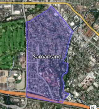
Boundary map of Upper State.
Crime Index for 93105
99
The crime index in 93105 is 99, which is 1.0 times lower than national average.
Market Trends
Historical market data near 405 Santa Anita Rd over selected time period.
Nearby Properties on Santa Anita Rd
- 220 Santa Anita Rd, Santa Barbara, CA 93105 (Samarkand) is a 2,724 square foot, 3 bedroom, 3 bathroom, 0.17 acre property. It was built in 1971 and has an estimate of $2,345,503 with a price per ft² of $861.
- 204 Santa Anita Rd, Santa Barbara, CA 93105 (Samarkand) is a 1,175 square foot, 3 bedroom, 2 bathroom, 0.18 acre property. It was built in 1950 and has an estimate of $1,508,441 with a price per ft² of $1,284.
- 203 Santa Anita Rd, Santa Barbara, CA 93105 (Oak Park) is a 1,623 square foot, 2 bedroom, 2 bathroom, 0.26 acre property.
- 302 Santa Anita Rd, Santa Barbara, CA 93105 (Samarkand) is a 1,886 square foot, 2 bedroom, 2.5 bathroom, 0.2 acre property. It was built in 1950 and has an estimate of $2,355,825 with a price per ft² of $1,249.
- 418 Santa Anita Rd, Santa Barbara, CA 93105 (Samarkand) is a 1,303 square foot, 2 bedroom, 2 bathroom, 0.22 acre property. It was built in 1947 and has an estimate of $1,679,486 with a price per ft² of $1,289.
- 406 Santa Anita Rd, Santa Barbara, CA 93105 (Samarkand) is a 1,244 square foot, 3 bedroom, 1.5 bathroom, 0.2 acre property. It was built in 1950 and has an estimate of $1,657,030 with a price per ft² of $1,332.
- 213 Santa Anita Rd, Santa Barbara, CA 93105 (Samarkand) is a 1,158 square foot, 2 bedroom, 2 bathroom, 0.18 acre property. It was built in 1949 and has an estimate of $1,678,623 with a price per ft² of $1,450.
- 417 Santa Anita Rd, Santa Barbara, CA 93105 (Samarkand) is a 1,675 square foot, 3 bedroom, 2 bathroom, 0.26 acre property. It was built in 1951 and has an estimate of $1,885,646 with a price per ft² of $1,126.
- 405 Santa Anita Rd, Santa Barbara, CA 93105 (Samarkand) is a 1,298 square foot, 3 bedroom, 2 bathroom, 0.3 acre property. It was built in 1951 and has an estimate of $1,862,769 with a price per ft² of $1,435.
- 323 Santa Anita Rd, Santa Barbara, CA 93105 (Samarkand) is a 2,185 square foot, 3 bedroom, 3 bathroom, 0.26 acre property. It was built in 1958 and has an estimate of $2,456,081 with a price per ft² of $1,124.
- 215 Santa Anita Rd, Santa Barbara, CA 93105 (Samarkand) is a 2,546 square foot, 4 bedroom, 4.25 bathroom, 0.23 acre property. It was built in 1947 and has an estimate of $2,311,197 with a price per ft² of $908.
- 209 Santa Anita Rd, Santa Barbara, CA 93105 (Samarkand) is a 1,596 square foot, 3 bedroom, 2 bathroom, 0.71 acre property. It was built in 1950 and has an estimate of $2,393,090 with a price per ft² of $1,499.
- 201 Santa Anita Rd, Santa Barbara, CA 93105 (Oak Park) is a 1,181 square foot, 2 bedroom, 2 bathroom, 0.25 acre property. It was built in 1957 and has an estimate of $1,648,101 with a price per ft² of $1,396.
- 211 Santa Anita Rd, Santa Barbara, CA 93105 (Samarkand) is a 2,445 square foot, 3 bedroom, 2 bathroom, 0.25 acre property. It was built in 1947 and has an estimate of $2,224,422 with a price per ft² of $910.
- 205 Santa Anita Rd, Santa Barbara, CA 93105 (Samarkand) is a 2,200 square foot, 3 bedroom, 3 bathroom, 0.23 acre property. It was built in 1963 and has an estimate of $2,136,536 with a price per ft² of $971.
- 203 Santa Anita Rd, Santa Barbara, CA 93105 (Oak Park) is a 1,623 square foot, 2 bedroom, 2 bathroom, 0.46 acre property. It was built in 1957 and has an estimate of $2,099,286 with a price per ft² of $1,293.