450 Bauer Rd
Laytonville, CA 95454
- -Bed
- -Bath
- -Living Area
- 2.4acLot Size
- -Pool
- -Car
- -Year Built
- -DOM
- 1Permit
Property Valuations
Latest estimates for 450 Bauer Rd based on TopHap automated valuation model (AVM).
TopHap Estimate
$173,000
Updated 3 months ago
450 Bauer Rd is valued at $173,000 by TopHap AVM 3 months ago.
Permits
450 Bauer Rd has 1 permit records.
Current Ownership
Information about the current owner(s).
Taxes Billed
Taxes billed in 2020$1,396.90From latest Total Assessed Value1.16%Total Assessed Value$120,936=Land+
Assessed Value$116,155Additions
Assessed Value$4,781
In 2020, taxes billed for 450 Bauer Rd were $1,396.9, which is 1.16% from latest Total Assessed Value of $120,936.
Property History
450 Bauer Rd has undefined property events records (listings, deeds, permits, tax, foreclosure, loan).
Environment
Environmental factors around 450 Bauer Rd
Hazard Risks
Earthquake607Particulates114Nat'l Avg100Air Pollution89Ozone88Carb Mono67Lead42Hail0Hurricane0Tornado0Weather0Wind0
7 hazards (Carbon Monoxide, Earthquake Risk, Air Pollution Index, Ozone Index, Lead Index, Particulate Matter, National Average) are above the national average around 450 Bauer Rd.
Walkability Index
8 /20
Most Walkable
20-18
Very Walkable
17-15
Somewhat Walkable
14-10
Car Dependent
9-0
450 Bauer Rd has a walkability score of 8 out of 20, which means that it is in a car dependent area.
Noise Level
56 dB
Quiet Suburban Residential 0-49
Suburban Residential 50-54
Urban Residential 55-59
Noisy Urban Residential 60-64
Very Noisy Urban Residential 65+
Noise at 450 Bauer Rd is around 56dBs, which is comparable to a Urban Residential area.
Temperature
Seasonal temperature sampled over multiple years
Winter
Average
Low
34°F
High
51°F
Summer
Average
Low
54°F
High
78°F
In the winter at 450 Bauer Rd, temperatures range from 34.21°F to 51.4°F with an average of 42.81°F. In the summer, the temperature ranges from 53.76°F to 77.96°F with and average of 65.86°F.
School Information
Public/private schools serving 450 Bauer Rd
Public Schools
Nearby public schools serving 450 Bauer Rd have ratings undefined, and undefined.
Neighborhood
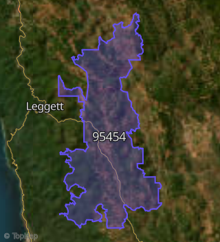
This property is located in Laytonville.
Seasonal Housing units 95454
77%of housing is for seasonal rent.
Daytime Population for 95454
-10%of people during work hours.
Boundary map of Laytonville.
Crime Index for 95454
173
The crime index in 95454 is 173, which is 1.7 times higher than national average.
Market Trends
Historical market data near 450 Bauer Rd over selected time period.
Nearby Properties on Bauer Rd
- 981 Bauer Rd, Laytonville, CA 95454 is a 1.45 acre property. It has an estimate of $469,600.
- 991 Bauer Rd, Laytonville, CA 95454 is a 1.03 acre property.
- 985 Bauer Rd, Laytonville, CA 95454 is a 0.93 acre property.
- 561 Bauer Rd, Laytonville, CA 95454 is a 0.7 acre property.
- 500 Bauer Rd, Laytonville, CA 95454 is a 0.52 acre property. It has an estimate of $386,300.
- 450 Bauer Rd, Laytonville, CA 95454 is a 2.44 acre property. It has an estimate of $305,500.
- 1180 Bauer Rd, Laytonville, CA 95454 is a 35.52 acre property.
- 1180 Bauer Rd, Laytonville, CA 95454 is a 14.91 acre property.
- 1180 Bauer Rd, Laytonville, CA 95454 is a 13.53 acre property.
- 1180 Bauer Rd, Laytonville, CA 95454 is a 14.92 acre property.
- 2000 Bauer Rd, Laytonville, CA 95454 is a 10.09 acre property.
- 2000 Bauer Rd, Laytonville, CA 95454 is a 15.2 acre property.
- 1180 Bauer Rd, Laytonville, CA 95454 is a 8.94 acre property.
- 2000 Bauer Rd, Laytonville, CA 95454 is a 29.38 acre property.
- 1600 Bauer Rd, Laytonville, CA 95454 is a 8.12 acre property.
- 900 Bauer Rd, Laytonville, CA 95454 is a 0.85 acre property. It has an estimate of $408,000.
- 901 Bauer Rd, Laytonville, CA 95454 is a 2.05 acre property. It has an estimate of $340,000.
- 690 Bauer Rd, Laytonville, CA 95454 is a 1.01 acre property. It has an estimate of $342,400.
- 1000 Bauer Rd, Laytonville, CA 95454 is a 0.46 acre property. It has an estimate of $218,400.
- 886 Bauer Rd, Laytonville, CA 95454 is a 1.11 acre property. It has an estimate of $230,000.
- 1050 Bauer Rd, Laytonville, CA 95454 is a 0.3 acre property. It has an estimate of $249,000.
- 1091 Bauer Rd, Laytonville, CA 95454 is a 6.56 acre property. It has an estimate of $253,900.
- 800 Bauer Rd, Laytonville, CA 95454 is a 1.07 acre property. It has an estimate of $207,248.
- 701 Bauer Rd, Laytonville, CA 95454 is a 1.82 acre property. It has an estimate of $361,100.
- 1001 Bauer Rd, Laytonville, CA 95454 is a 3.03 acre property. It has an estimate of $346,800.
- View more properties on Bauer Rd