452 Lillian Ave
Stockton, CA 95215
- 3Beds
- 1Bath
- 1,351ft²Living Area
- 0.9acLot Size
- -Pool
- 2Car
- 1949Year Built
- -DOM
- 2Permits
Property Valuations
Latest estimates for 452 Lillian Ave based on TopHap automated valuation model (AVM).
TopHap Estimate
$63,159
$46/ft²
-$10K below Sold Price
Updated 3 months ago
Last Sold Price
$73,500
$54/ft²
20 months ago
452 Lillian Ave is valued at $63,159 by TopHap AVM 3 months ago.
452 Lillian Ave was last sold in 2022 for $73,500.
Permits
452 Lillian Ave has 2 permit records.
Current Ownership
Information about the current owner(s).
Taxes Billed
Taxes billed in 2023$5,831.33From latest Total Assessed Value1.91%Total Assessed Value$306,099=Land+
Assessed Value$91,556Additions
Assessed Value$214,543
In 2023, taxes billed for 452 Lillian Ave were $5,831.33, which is 1.91% from latest Total Assessed Value of $306,099.
Property History
452 Lillian Ave has undefined property events records (listings, deeds, permits, tax, foreclosure, loan).
Environment
Environmental factors around 452 Lillian Ave
Hazard Risks
Earthquake131Nat'l Avg100Particulates97Air Pollution84Carb Mono82Ozone82Lead41Tornado32Weather8Hail0Hurricane0Wind0
9 hazards (Carbon Monoxide, Earthquake Risk, Tornado Index, Air Pollution Index, Ozone Index, Weather Risk, Lead Index, Particulate Matter, National Average) are above the national average around 452 Lillian Ave.
Walkability Index
12 /20
Most Walkable
20-18
Very Walkable
17-15
Somewhat Walkable
14-10
Car Dependent
9-0
452 Lillian Ave has a walkability score of 12 out of 20, which means that it is in a somewhat walkable area.
Noise Level
35 dB
Quiet Suburban Residential 0-49
Suburban Residential 50-54
Urban Residential 55-59
Noisy Urban Residential 60-64
Very Noisy Urban Residential 65+
Noise at 452 Lillian Ave is around 35dBs, which is comparable to a Quiet Suburban Residential area.
Temperature
Seasonal temperature sampled over multiple years
Winter
Average
Low
38°F
High
56°F
Summer
Average
Low
57°F
High
91°F
In the winter at 452 Lillian Ave, temperatures range from 38.1°F to 56.39°F with an average of 47.25°F. In the summer, the temperature ranges from 57.23°F to 90.93°F with and average of 74.08°F.
School Information
Public/private schools serving 452 Lillian Ave
Public Schools
Nearby public schools serving 452 Lillian Ave have ratings undefined, undefined, undefined, undefined, and undefined.
Neighborhood
This property is located in Garden Acres, Stockton, CA 95215.
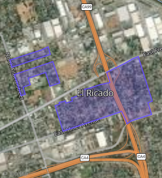
Boundary map of Garden Acres.
Crime Index for 95215
86
The crime index in 95215 is 86, which is 0.9 times lower than national average.
Market Trends
Historical market data near 452 Lillian Ave over selected time period.
Nearby Properties on Lillian Ave
- 316 Lillian Ave, Stockton, CA 95215 (El Ricado) is a 805 square foot, 2 bedroom, 1 bathroom, 0.19 acre property. It was built in 1947 and has an estimate of $272,775 with a price per ft² of $339.
- 627 Lillian Ave, Stockton, CA 95215 (El Ricado) is a 1,481 square foot, 2 bedroom, 1 bathroom, 0.94 acre property. It was built in 1931 and has an estimate of $258,291 with a price per ft² of $223.
- 544 Lillian Ave, Stockton, CA 95215 (El Ricado) is a 0.47 acre property. It has an estimate of $376,000.
- 706 Lillian Ave, Stockton, CA 95215 (El Ricado) is a 1,100 square foot, 2 bedroom, 2 bathroom, 0.94 acre property. It was built in 1920 and has an estimate of $334,954 with a price per ft² of $305.
- 336 Lillian Ave, Stockton, CA 95215 (El Ricado) is a 1,183 square foot, 3 bedroom, 1 bathroom, 0.17 acre property. It was built in 1946 and has an estimate of $336,125 with a price per ft² of $284.
- 530 Lillian Ave, Stockton, CA 95215 (El Ricado) is a 3,638 square foot, 9 bedroom, 6 bathroom, 0.7 acre property. It was built in 1993 and has an estimate of $498,699 with a price per ft² of $137.
- 650 Lillian Ave, Stockton, CA 95215 (El Ricado) is a 865 square foot, 2 bedroom, 1 bathroom, 0.38 acre property. It was built in 1955 and has an estimate of $297,369 with a price per ft² of $344.
- 641 Lillian Ave, Stockton, CA 95215 (El Ricado) is a 1,584 square foot, 2 bedroom, 1 bathroom, 0.65 acre property. It was built in 1918 and has an estimate of $227,779 with a price per ft² of $144.
- 612 Lillian Ave, Stockton, CA 95215 (El Ricado) is a 1,587 square foot, 2 bedroom, 1 bathroom, 0.94 acre property. It was built in 1936 and has an estimate of $282,003 with a price per ft² of $178.
- 550 Lillian Ave, Stockton, CA 95215 (El Ricado) is a 928 square foot, 2 bedroom, 1 bathroom, 0.7 acre property. It was built in 1932 and has an estimate of $308,853 with a price per ft² of $333.
- 451 Lillian Ave, Stockton, CA 95215 (El Ricado) is a 1,057 square foot, 2 bedroom, 1 bathroom, 0.94 acre property. It was built in 1936 and has an estimate of $230,703 with a price per ft² of $218.
- 452 Lillian Ave, Stockton, CA 95215 (El Ricado) is a 1,351 square foot, 3 bedroom, 1 bathroom, 0.93 acre property. It was built in 1949 and has an estimate of $407,269 with a price per ft² of $301.
- 319 Lillian Ave, Stockton, CA 95215 (El Ricado) is a 1,038 square foot, 3 bedroom, 1 bathroom, 0.28 acre property. It was built in 1948 and has an estimate of $352,929 with a price per ft² of $340.
- 328 Lillian Ave, Stockton, CA 95215 (El Ricado) is a 1,541 square foot, 3 bedroom, 1 bathroom, 0.18 acre property. It was built in 1947 and has an estimate of $315,455 with a price per ft² of $205.
- 638 Lillian Ave, Stockton, CA 95215 (El Ricado) is a 2,508 square foot, 3 bedroom, 2 bathroom, 0.55 acre property. It was built in 2000 and has an estimate of $579,168 with a price per ft² of $231.
- 518 Lillian Ave, Stockton, CA 95215 (El Ricado) is a 1,676 square foot, 4 bedroom, 1 bathroom, 0.47 acre property. It was built in 1974 and has an estimate of $371,841 with a price per ft² of $222.
- 510 Lillian Ave, Stockton, CA 95215 (El Ricado) is a 1,594 square foot, 3 bedroom, 1 bathroom, 0.47 acre property. It was built in 1975 and has an estimate of $362,519 with a price per ft² of $227.
- 348 Lillian Ave, Stockton, CA 95215 (El Ricado) is a 1,160 square foot, 3 bedroom, 1 bathroom, 0.94 acre property. It was built in 1936 and has an estimate of $376,017 with a price per ft² of $324.
- 605 Lillian Ave, Stockton, CA 95215 (El Ricado) is a 1,992 square foot, 3 bedroom, 3 bathroom, 0.94 acre property. It was built in 1936 and has an estimate of $443,654 with a price per ft² of $223.
- 531 Lillian Ave, Stockton, CA 95215 (El Ricado) is a 1,216 square foot, 3 bedroom, 1 bathroom, 0.48 acre property. It was built in 1924 and has an estimate of $269,327 with a price per ft² of $221.
- 527 Lillian Ave, Stockton, CA 95215 (El Ricado) is a 936 square foot, 2 bedroom, 1 bathroom, 0.46 acre property. It was built in 1967 and has an estimate of $331,744 with a price per ft² of $354.
- 515 Lillian Ave, Stockton, CA 95215 (El Ricado) is a 1,733 square foot, 3 bedroom, 2 bathroom, 0.47 acre property. It was built in 1948 and has an estimate of $324,623 with a price per ft² of $187.
- 503 Lillian Ave, Stockton, CA 95215 (El Ricado) is a 1,698 square foot, 3 bedroom, 1 bathroom, 0.47 acre property. It was built in 1953 and has an estimate of $292,458 with a price per ft² of $172.
- 427 Lillian Ave, Stockton, CA 95215 (El Ricado) is a 2,257 square foot, 4 bedroom, 3 bathroom, 0.47 acre property. It was built in 2006 and has an estimate of $603,588 with a price per ft² of $267.
- 415 Lillian Ave, Stockton, CA 95215 (El Ricado) is a 2,081 square foot, 2 bedroom, 2 bathroom, 0.46 acre property. It was built in 1954 and has an estimate of $311,139 with a price per ft² of $150.
- View more properties on Lillian Ave