485 Winchester Dr
Watsonville, CA 95076
- 3Beds
- 3Baths
- 1,469ft²Living Area
- 1,002ft²Lot Size
- -Pool
- -Car
- 1987Year Built
- -DOM
- -Permit
Property Valuations
Latest estimates for 485 Winchester Dr based on TopHap automated valuation model (AVM).
TopHap Estimate
$672,500
$457/ft²
+$413K above Sold Price
Updated 3 months ago
Last Sold Price
$260,000
$177/ft²
13 years ago
485 Winchester Dr is valued at $672,500 by TopHap AVM 3 months ago.
485 Winchester Dr was last sold in 2010 for $260,000.
Current Ownership
Information about the current owner(s).
Taxes Billed
Taxes billed in 2023$3,788.82From latest Total Assessed Value1.17%Total Assessed Value$322,582=Land+
Assessed Value$179,902Additions
Assessed Value$142,680
In 2023, taxes billed for 485 Winchester Dr were $3,788.82, which is 1.17% from latest Total Assessed Value of $322,582.
Property History
485 Winchester Dr has undefined property events records (listings, deeds, permits, tax, foreclosure, loan).
Environment
Environmental factors around 485 Winchester Dr
Hazard Risks
Earthquake510Particulates102Nat'l Avg100Air Pollution84Ozone82Carb Mono76Lead43Tornado13Weather2Hail0Hurricane0Wind0
9 hazards (Carbon Monoxide, Earthquake Risk, Tornado Index, Air Pollution Index, Ozone Index, Weather Risk, Lead Index, Particulate Matter, National Average) are above the national average around 485 Winchester Dr.
Walkability Index
16 /20
Most Walkable
20-18
Very Walkable
17-15
Somewhat Walkable
14-10
Car Dependent
9-0
485 Winchester Dr has a walkability score of 16 out of 20, which means that it is in a very walkable area.
Temperature
Seasonal temperature sampled over multiple years
Winter
Average
Low
39°F
High
61°F
Summer
Average
Low
51°F
High
75°F
In the winter at 485 Winchester Dr, temperatures range from 39.48°F to 61.46°F with an average of 50.47°F. In the summer, the temperature ranges from 51.25°F to 74.77°F with and average of 63.01°F.
School Information
Public/private schools serving 485 Winchester Dr
Public Schools
Nearby public schools serving 485 Winchester Dr have ratings undefined, undefined, and undefined.
Neighborhood
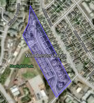
This property is located in Winchester Acres, Watsonville, CA 95076.
Seasonal Housing units 95076
51%of housing is for seasonal rent.
Daytime Population for 95076
-10%of people during work hours.
Boundary map of Winchester Acres.
Crime Index for 95076
73
The crime index in 95076 is 73, which is 0.7 times lower than national average.
Market Trends
Historical market data near 485 Winchester Dr over selected time period.
Nearby Properties on Winchester Dr
- 491 Winchester Dr, Watsonville, CA 95076 (Winchester Acres) is a 1,469 square foot, 3 bedroom, 2.5 bathroom, 0.02 acre property. It was built in 1987 and has an estimate of $627,089 with a price per ft² of $427.
- 406 Winchester Dr, Watsonville, CA 95076 (Winchester Acres) is a 1,143 square foot, 2 bedroom, 2 bathroom, 0.02 acre property. It was built in 1983 and has an estimate of $382,269 with a price per ft² of $334.
- 438 Winchester Dr, Watsonville, CA 95076 (Winchester Acres) is a 1,143 square foot, 2 bedroom, 2 bathroom, 0.03 acre property. It was built in 1983 and has an estimate of $481,530 with a price per ft² of $421.
- 436 Winchester Dr, Watsonville, CA 95076 (Winchester Acres) is a 1,143 square foot, 2 bedroom, 2 bathroom, 0.03 acre property. It was built in 1989 and has an estimate of $467,607 with a price per ft² of $409.
- 408 Winchester Dr, Watsonville, CA 95076 (Winchester Acres) is a 1,000 square foot, 2 bedroom, 2 bathroom, 0.03 acre property. It was built in 1983 and has an estimate of $497,101 with a price per ft² of $429.
- 402 Winchester Dr, Watsonville, CA 95076 (Winchester Acres) is a 926 square foot, 1 bedroom, 1 bathroom, 0.02 acre property. It was built in 1983 and has an estimate of $387,480 with a price per ft² of $418.
- 412 Winchester Dr, Watsonville, CA 95076 (Winchester Acres) is a 926 square foot, 1 bedroom, 1 bathroom, 0.02 acre property. It was built in 1983 and has an estimate of $393,667 with a price per ft² of $425.
- 414 Winchester Dr, Watsonville, CA 95076 (Winchester Acres) is a 1,360 square foot, 3 bedroom, 2 bathroom, 0.03 acre property. It was built in 1983 and has an estimate of $535,582 with a price per ft² of $394.
- 418 Winchester Dr, Watsonville, CA 95076 (Winchester Acres) is a 1,143 square foot, 2 bedroom, 2 bathroom, 0.03 acre property. It was built in 1983 and has an estimate of $480,642 with a price per ft² of $421.
- 416 Winchester Dr, Watsonville, CA 95076 (Winchester Acres) is a 1,143 square foot, 2 bedroom, 2 bathroom, 0.02 acre property. It was built in 1983 and has an estimate of $468,579 with a price per ft² of $410.
- 424 Winchester Dr, Watsonville, CA 95076 (Winchester Acres) is a 1,143 square foot, 3 bedroom, 2 bathroom, 0.03 acre property. It was built in 1983 and has an estimate of $505,076 with a price per ft² of $442.
- 422 Winchester Dr, Watsonville, CA 95076 (Winchester Acres) is a 926 square foot, 1 bedroom, 1 bathroom, 0.03 acre property. It was built in 1983 and has an estimate of $402,651 with a price per ft² of $435.
- 426 Winchester Dr, Watsonville, CA 95076 (Winchester Acres) is a 1,143 square foot, 2 bedroom, 2 bathroom, 0.03 acre property. It was built in 1983 and has an estimate of $485,123 with a price per ft² of $424.
- 485 Winchester Dr, Watsonville, CA 95076 (Winchester Acres) is a 1,469 square foot, 3 bedroom, 2.5 bathroom, 0.02 acre property. It was built in 1987 and has an estimate of $626,312 with a price per ft² of $426.
- 443 Winchester Dr, Watsonville, CA 95076 (Winchester Acres) is a 1,188 square foot, 2 bedroom, 2.5 bathroom, 0.01 acre property. It was built in 1982 and has an estimate of $502,337 with a price per ft² of $423.
- 453 Winchester Dr, Watsonville, CA 95076 (Winchester Acres) is a 1,174 square foot, 2 bedroom, 2 bathroom, 0.01 acre property. It was built in 1982 and has an estimate of $502,786 with a price per ft² of $428.
- 483 Winchester Dr, Watsonville, CA 95076 (Winchester Acres) is a 1,469 square foot, 3 bedroom, 2 bathroom, 0.03 acre property. It was built in 1987 and has an estimate of $593,640 with a price per ft² of $411.
- 451 Winchester Dr, Watsonville, CA 95076 (Winchester Acres) is a 1,099 square foot, 2 bedroom, 2 bathroom, 0.01 acre property. It was built in 1983 and has an estimate of $490,516 with a price per ft² of $493.
- 457 Winchester Dr, Watsonville, CA 95076 (Winchester Acres) is a 1,024 square foot, 2 bedroom, 2 bathroom, 0.01 acre property. It was built in 1982 and has an estimate of $480,548 with a price per ft² of $469.
- 456 Winchester Dr, Watsonville, CA 95076 (Winchester Acres) is a 1,143 square foot, 2 bedroom, 2 bathroom, 0.02 acre property. It was built in 1984 and has an estimate of $459,972 with a price per ft² of $438.
- 467 Winchester Dr, Watsonville, CA 95076 (Winchester Acres) is a 1,024 square foot, 2 bedroom, 2 bathroom, 0.01 acre property. It was built in 1982 and has an estimate of $491,992 with a price per ft² of $480.
- 486 Winchester Dr, Watsonville, CA 95076 (Winchester Acres) is a 1,272 square foot, 2 bedroom, 2.5 bathroom, 0.03 acre property. It was built in 2000 and has an estimate of $560,318 with a price per ft² of $441.
- 488 Winchester Dr, Watsonville, CA 95076 (Winchester Acres) is a 1,272 square foot, 2 bedroom, 2.25 bathroom, 0.03 acre property. It was built in 1987 and has an estimate of $460,276 with a price per ft² of $362.
- 494 Winchester Dr, Watsonville, CA 95076 (Winchester Acres) is a 1,469 square foot, 3 bedroom, 2.5 bathroom, 0.02 acre property. It was built in 2000 and has an estimate of $625,164 with a price per ft² of $426.
- 496 Winchester Dr, Watsonville, CA 95076 (Winchester Acres) is a 1,501 square foot, 3 bedroom, 2.5 bathroom, 0.03 acre property. It was built in 1987 and has an estimate of $611,764 with a price per ft² of $408.
- View more properties on Winchester Dr