486 Braemar Ranch Ln
Santa Barbara, CA 93109
- -Bed
- -Bath
- -Living Area
- 6,534ft²Lot Size
- -Pool
- -Car
- -Year Built
- -DOM
- 4Permits
Permits
486 Braemar Ranch Ln has 4 permit records.
Current Ownership
Information about the current owner(s).
Taxes Billed
Taxes billed in 2023$4,294.36From latest Total Assessed Value1.08%Total Assessed Value$397,849=Land+
Assessed Value$389,026Additions
Assessed Value$8,823
In 2023, taxes billed for 486 Braemar Ranch Ln were $4,294.36, which is 1.08% from latest Total Assessed Value of $397,849.
Property History
486 Braemar Ranch Ln has undefined property events records (listings, deeds, permits, tax, foreclosure, loan).
Environment
Environmental factors around 486 Braemar Ranch Ln
Hazard Risks
Earthquake413Nat'l Avg100Ozone100Particulates100Lead99Carb Mono95Air Pollution93Tornado8Weather5Hurricane2Wind1Hail0
11 hazards (Carbon Monoxide, Earthquake Risk, Tornado Index, Hurricane Index, Air Pollution Index, Ozone Index, Wind Index, Weather Risk, Lead Index, Particulate Matter, National Average) are above the national average around 486 Braemar Ranch Ln.
Walkability Index
12 /20
Most Walkable
20-18
Very Walkable
17-15
Somewhat Walkable
14-10
Car Dependent
9-0
486 Braemar Ranch Ln has a walkability score of 12 out of 20, which means that it is in a somewhat walkable area.
Temperature
Seasonal temperature sampled over multiple years
Winter
Average
Low
43°F
High
65°F
Summer
Average
Low
56°F
High
74°F
In the winter at 486 Braemar Ranch Ln, temperatures range from 43.35°F to 64.7°F with an average of 54.03°F. In the summer, the temperature ranges from 55.85°F to 73.72°F with and average of 64.79°F.
School Information
Public/private schools serving 486 Braemar Ranch Ln
Public Schools
Nearby public schools serving 486 Braemar Ranch Ln have ratings undefined, undefined, and undefined.
Neighborhood
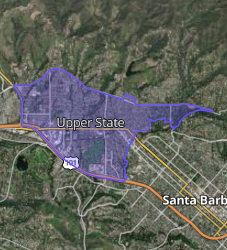
This property is located in Upper State, Santa Barbara, CA 93109.
Seasonal Housing units 93109
46%of housing is for seasonal rent.
Daytime Population for 93109
-1%of people during work hours.
Boundary map of Upper State.
Crime Index for 93109
116
The crime index in 93109 is 116, which is 1.2 times higher than national average.
Market Trends
Historical market data near 486 Braemar Ranch Ln over selected time period.
Nearby Properties on Braemar Ranch Ln
- 476 Braemar Ranch Ln, Santa Barbara, CA 93109 (Campanila) is a 2,897 square foot, 4 bedroom, 2.25 bathroom, 1.2 acre property. It was built in 1979 and has an estimate of $5,131,520 with a price per ft² of $1,771.
- 475 Braemar Ranch Ln, Santa Barbara, CA 93109 (Campanila) is a 2,069 square foot, 3 bedroom, 2.5 bathroom, 1.26 acre property. It was built in 1977 and has an estimate of $3,934,521 with a price per ft² of $1,902.
- 525 Braemar Ranch Ln, Santa Barbara, CA 93109 (Campanila) is a 3,243 square foot, 4 bedroom, 3 bathroom, 3.24 acre property. It was built in 1977 and has an estimate of $5,850,295 with a price per ft² of $1,804.
- 515 Braemar Ranch Ln, Santa Barbara, CA 93109 (Campanila) is a 3,451 square foot, 4 bedroom, 3 bathroom, 1.5 acre property. It was built in 1978 and has an estimate of $6,423,952 with a price per ft² of $1,861.
- 485 Braemar Ranch Ln, Santa Barbara, CA 93109 (Campanila) is a 3,399 square foot, 4 bedroom, 4.25 bathroom, 1.41 acre property. It was built in 1977 and has an estimate of $5,643,948 with a price per ft² of $1,660.
- 486 Braemar Ranch Ln, Santa Barbara, CA 93109 (Campanila) is a 3,857 square foot, 3 bedroom, 4.25 bathroom, 1.5 acre property. It was built in 1979 and has an estimate of $6,811,836 with a price per ft² of $1,766.
- 466 Braemar Ranch Ln, Santa Barbara, CA 93109 (Campanila) is a 2,967 square foot, 2 bedroom, 3 bathroom, 1.18 acre property. It was built in 1980 and has an estimate of $5,265,155 with a price per ft² of $1,775.
- 600 Braemar Ranch Ln, Santa Barbara, CA 93109 (Campanila) is a 4,580 square foot, 4 bedroom, 6.25 bathroom, 2.67 acre property. It was built in 1983 and has an estimate of $7,710,031 with a price per ft² of $1,683.
- 516 Braemar Ranch Ln, Santa Barbara, CA 93109 (Campanila) is a 4,715 square foot, 6 bedroom, 4 bathroom, 1.77 acre property. It was built in 1980 and has an estimate of $6,168,373 with a price per ft² of $1,308.
- 456 Braemar Ranch Ln, Santa Barbara, CA 93109 (Campanila) is a 3,890 square foot, 3 bedroom, 3.25 bathroom, 1.23 acre property. It was built in 1982 and has an estimate of $6,555,245 with a price per ft² of $1,685.
- 575 Braemar Ranch Ln, Santa Barbara, CA 93109 (Campanila) is a 5,946 square foot, 4 bedroom, 4 bathroom, 2.6 acre property. It was built in 1981 and has an estimate of $10,228,515 with a price per ft² of $1,720.
- 486 Braemar Ranch Ln, Santa Barbara, CA 93109 (Upper State) is a 0.15 acre property.