49 Humphrey Rd
Santa Barbara, CA 93108
- 3Beds
- 2Baths
- 1,556ft²Living Area
- 9,147ft²Lot Size
- -Pool
- -Car
- 1902Year Built
- -DOM
- -Permit
Property Valuations
Latest estimates for 49 Humphrey Rd based on TopHap automated valuation model (AVM).
TopHap Estimate
$4,938,000
$3,173/ft²
+$3M above Sold Price
Updated 3 months ago
Last Sold Price
$1,825,000
$1,173/ft²
15 years ago
49 Humphrey Rd is valued at $4,938,000 by TopHap AVM 3 months ago.
49 Humphrey Rd was last sold in 2008 for $1,825,000.
Current Ownership
Information about the current owner(s).
Taxes Billed
Taxes billed in 2023$24,888.04From latest Total Assessed Value1.1%Total Assessed Value$2,258,900=Land+
Assessed Value$1,856,636Additions
Assessed Value$402,264
In 2023, taxes billed for 49 Humphrey Rd were $24,888.04, which is 1.10% from latest Total Assessed Value of $2,258,900.
Property History
49 Humphrey Rd has undefined property events records (listings, deeds, permits, tax, foreclosure, loan).
Environment
Environmental factors around 49 Humphrey Rd
Hazard Risks
Earthquake514Carb Mono117Nat'l Avg100Particulates100Ozone99Air Pollution99Lead96Weather6Hurricane4Tornado3Wind2Hail0
11 hazards (Carbon Monoxide, Earthquake Risk, Tornado Index, Hurricane Index, Air Pollution Index, Ozone Index, Wind Index, Weather Risk, Lead Index, Particulate Matter, National Average) are above the national average around 49 Humphrey Rd.
Walkability Index
10 /20
Most Walkable
20-18
Very Walkable
17-15
Somewhat Walkable
14-10
Car Dependent
9-0
49 Humphrey Rd has a walkability score of 10 out of 20, which means that it is in a somewhat walkable area.
Temperature
Seasonal temperature sampled over multiple years
Winter
Average
Low
44°F
High
64°F
Summer
Average
Low
55°F
High
75°F
In the winter at 49 Humphrey Rd, temperatures range from 44.08°F to 64.28°F with an average of 54.18°F. In the summer, the temperature ranges from 55.24°F to 75.11°F with and average of 65.18°F.
School Information
Public/private schools serving 49 Humphrey Rd
Public Schools
Nearby public schools serving 49 Humphrey Rd have ratings undefined, undefined, and undefined.
Neighborhood
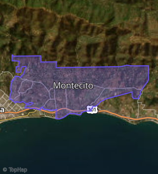
This property is located in Montecito, Santa Barbara, CA 93108.
Seasonal Housing units 93108
60%of housing is for seasonal rent.
Daytime Population for 93108
+32%of people during work hours.
Boundary map of Montecito.
Crime Index for 93108
147
The crime index in 93108 is 147, which is 1.5 times higher than national average.
Market Trends
Historical market data near 49 Humphrey Rd over selected time period.
Nearby Properties on Humphrey Rd
- 45 Humphrey Rd, Santa Barbara, CA 93108 (Montecito) is a 1,567 square foot, 3 bedroom, 2 bathroom, 0.31 acre property. It was built in 1902 and has an estimate of $3,273,723 with a price per ft² of $2,089.
- 49 Humphrey Rd, Santa Barbara, CA 93108 (Montecito) is a 1,556 square foot, 3 bedroom, 2 bathroom, 0.21 acre property. It was built in 1902 and has an estimate of $2,834,596 with a price per ft² of $1,822.
- 31 Humphrey Rd, Santa Barbara, CA 93108 (Montecito) is a 1,577 square foot, 3 bedroom, 2 bathroom, 0.18 acre property. It was built in 1912 and has an estimate of $3,155,144 with a price per ft² of $2,001.
- 57 Humphrey Rd, Santa Barbara, CA 93108 (Montecito) is a 1,550 square foot, 3 bedroom, 2 bathroom, 0.17 acre property. It was built in 1913 and has an estimate of $3,380,274 with a price per ft² of $2,181.
- 43 Humphrey Rd, Santa Barbara, CA 93108 (Montecito) is a 1,028 square foot, 3 bedroom, 2 bathroom, 0.28 acre property. It was built in 1912 and has an estimate of $3,468,060 with a price per ft² of $3,374.
- 59 Humphrey Rd, Santa Barbara, CA 93108 (Montecito) is a 1,545 square foot, 3 bedroom, 2 bathroom, 0.18 acre property. It was built in 1914 and has an estimate of $3,135,538 with a price per ft² of $2,029.
- 47 Humphrey Rd, Santa Barbara, CA 93108 (Montecito) is a 792 square foot, 2 bedroom, 1 bathroom, 0.14 acre property. It was built in 1902 and has an estimate of $2,101,413 with a price per ft² of $2,653.
- 62 Humphrey Rd, Santa Barbara, CA 93108 (Montecito) is a 3,909 square foot, 4 bedroom, 4.25 bathroom, 0.54 acre property. It was built in 1916 and has an estimate of $5,091,026 with a price per ft² of $1,347.
- 18 Humphrey Rd, Santa Barbara, CA 93108 (Montecito) is a 0.15 acre property. It has an estimate of $393,700.
- 32 Humphrey Rd, Santa Barbara, CA 93108 (Montecito) is a 1,272 square foot, 3 bedroom, 2 bathroom, 0.22 acre property. It was built in 1951 and has an estimate of $2,337,376 with a price per ft² of $1,838.
- 76 Humphrey Rd, Santa Barbara, CA 93108 (Montecito) is a 3,420 square foot, 4 bedroom, 4.25 bathroom, 0.28 acre property. It was built in 1999 and has an estimate of $4,868,076 with a price per ft² of $1,423.
- 37 Humphrey Rd, Santa Barbara, CA 93108 (Montecito) is a 1,968 square foot, 4 bedroom, 2 bathroom, 0.45 acre property. It was built in 1920 and has an estimate of $2,740,308 with a price per ft² of $1,392.
- 33 Humphrey Rd, Santa Barbara, CA 93108 (Montecito) is a 1,727 square foot, 3 bedroom, 2 bathroom, 0.19 acre property. It was built in 1922 and has an estimate of $2,959,560 with a price per ft² of $1,714.
- 31 1/2 Humphrey Rd, Santa Barbara, CA 93108 (Montecito) is a 2,306 square foot, 3 bedroom, 2 bathroom, 0.47 acre property. It was built in 1912 and has an estimate of $3,934,759 with a price per ft² of $1,706.
- 105 Humphrey Rd, Santa Barbara, CA 93108 (Montecito) is a 1 acre property. It has an estimate of $2,110,000.
- 91 Humphrey Rd, Santa Barbara, CA 93108 (Montecito) is a 880 square foot, 2 bedroom, 1 bathroom, 0.13 acre property. It was built in 1934 and has an estimate of $1,710,684 with a price per ft² of $1,944.
- 89 Humphrey Rd, Santa Barbara, CA 93108 (Montecito) is a 916 square foot, 2 bedroom, 1 bathroom, 0.09 acre property. It was built in 1920 and has an estimate of $2,009,178 with a price per ft² of $2,193.
- 87 Humphrey Rd, Santa Barbara, CA 93108 (Montecito) is a 2,247 square foot, 4 bedroom, 4.25 bathroom, 0.13 acre property. It was built in 1927 and has an estimate of $3,812,000 with a price per ft² of $1,696.
- 73 Humphrey Rd, Santa Barbara, CA 93108 (Montecito) is a 3,415 square foot and 0.49 acre property. It has an estimate of $2,100,000 with a price per ft² of $615.
- 69 Humphrey Rd, Santa Barbara, CA 93108 (Montecito) is a 0.25 acre property. It has an estimate of $1,575,000.
- 63 Humphrey Rd, Santa Barbara, CA 93108 (Montecito) is a 1,204 square foot, 2 bedroom, 2.25 bathroom, 0.19 acre property. It was built in 1927 and has an estimate of $2,312,785 with a price per ft² of $1,921.
- 82 Humphrey Rd, Santa Barbara, CA 93108 (Montecito) is a 2,024 square foot, 1 bedroom, 3 bathroom, 0.17 acre property. It was built in 2016 and has an estimate of $3,838,051 with a price per ft² of $1,896.
- 90 Humphrey Rd, Santa Barbara, CA 93108 (Montecito) is a 1,552 square foot, 3 bedroom, 2 bathroom, 0.17 acre property. It was built in 1950 and has an estimate of $3,855,338 with a price per ft² of $2,484.
- 94 Humphrey Rd, Santa Barbara, CA 93108 (Montecito) is a 2,167 square foot, 3 bedroom, 2 bathroom, 0.52 acre property. It was built in 1952 and has an estimate of $3,256,370 with a price per ft² of $1,503.