53619 Woaka Poyah
North Fork, CA 93643
- 3Beds
- 2Baths
- 1,988ft²Living Area
- 0.5acLot Size
- -Pool
- 3Car
- 1984Year Built
- -DOM
- -Permit
Property Valuations
Latest estimates for 53619 Woaka Poyah based on TopHap automated valuation model (AVM).
TopHap Estimate
$446,700
$224/ft²
+$165K above Sold Price
Updated 3 months ago
Last Sold Price
$282,000
$142/ft²
20 years ago
53619 Woaka Poyah is valued at $446,700 by TopHap AVM 3 months ago.
53619 Woaka Poyah was last sold in 2004 for $282,000.
Current Ownership
Information about the current owner(s).
Taxes Billed
Taxes billed in 2023$4,176.08From latest Total Assessed Value1.08%Total Assessed Value$385,357=Land+
Assessed Value$150,316Additions
Assessed Value$235,041
In 2023, taxes billed for 53619 Woaka Poyah were $4,176.08, which is 1.08% from latest Total Assessed Value of $385,357.
Property History
53619 Woaka Poyah has undefined property events records (listings, deeds, permits, tax, foreclosure, loan).
Environment
Environmental factors around 53619 Woaka Poyah
Hazard Risks
Earthquake150Particulates108Nat'l Avg100Carb Mono91Air Pollution86Ozone83Lead46Wind4Hail2Tornado1Hurricane0Weather0
10 hazards (Carbon Monoxide, Earthquake Risk, Hail Index, Tornado Index, Air Pollution Index, Ozone Index, Wind Index, Lead Index, Particulate Matter, National Average) are above the national average around 53619 Woaka Poyah.
Walkability Index
5 /20
Most Walkable
20-18
Very Walkable
17-15
Somewhat Walkable
14-10
Car Dependent
9-0
53619 Woaka Poyah has a walkability score of 5 out of 20, which means that it is in a car dependent area.
Temperature
Seasonal temperature sampled over multiple years
Winter
Average
Low
30°F
High
51°F
Summer
Average
Low
54°F
High
82°F
In the winter at 53619 Woaka Poyah, temperatures range from 29.95°F to 50.6°F with an average of 40.28°F. In the summer, the temperature ranges from 54.05°F to 81.92°F with and average of 67.99°F.
School Information
Public/private schools serving 53619 Woaka Poyah
Public Schools
Nearby public schools serving 53619 Woaka Poyah have ratings undefined, and undefined.
Neighborhood
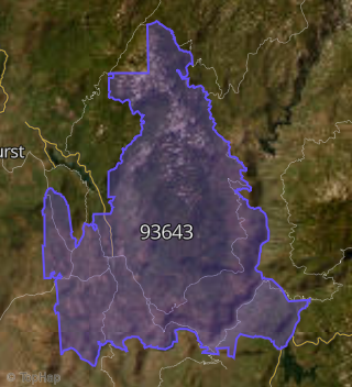
This property is located in North Fork.
Seasonal Housing units 93643
62%of housing is for seasonal rent.
Daytime Population for 93643
-19%of people during work hours.
Boundary map of North Fork.
Crime Index for 93643
172
The crime index in 93643 is 172, which is 1.7 times higher than national average.
Market Trends
Historical market data near 53619 Woaka Poyah over selected time period.
Nearby Properties on Woaka Poyah
- 53619 Woaka Poyah, North Fork, CA 93643 is a 1,988 square foot, 3 bedroom, 2 bathroom, 0.34 acre property. It was built in 1984 and has an estimate of $449,142 with a price per ft² of $226.
- 53592 Woaka Poyah, North Fork, CA 93643 (Teaford Meadows Lakes) is a 1,292 square foot, 3 bedroom, 2 bathroom, 0.23 acre property. It was built in 1992 and has an estimate of $561,059 with a price per ft² of $434.
- 53484 Woaka Poyah, North Fork, CA 93643 (Teaford Meadows Lakes) is a 1,500 square foot, 3 bedroom, 2 bathroom, 0.26 acre property. It was built in 2003 and has an estimate of $451,331 with a price per ft² of $301.
- 53489 Woaka Poyah, North Fork, CA 93643 (Teaford Meadows Lakes) is a 1,584 square foot, 3 bedroom, 2 bathroom, 0.22 acre property. It was built in 1980 and has an estimate of $432,074 with a price per ft² of $273.
- 53503 Woaka Poyah, North Fork, CA 93643 (Teaford Meadows Lakes) is a 1,328 square foot, 3 bedroom, 2 bathroom, 0.19 acre property. It was built in 1973 and has an estimate of $371,352 with a price per ft² of $280.
- 53519 Woaka Poyah, North Fork, CA 93643 (Teaford Meadows Lakes) is a 1,310 square foot, 3 bedroom, 2 bathroom, 0.24 acre property. It was built in 1977 and has an estimate of $331,546 with a price per ft² of $253.
- 53614 Woaka Poyah, North Fork, CA 93643 is a 2,134 square foot, 4 bedroom, 3 bathroom, 0.24 acre property. It was built in 1997 and has an estimate of $662,344 with a price per ft² of $310.
- 53607 Woaka Poyah, North Fork, CA 93643 (Teaford Meadows Lakes) is a 2,109 square foot, 3 bedroom, 2 bathroom, 0.4 acre property. It was built in 1980 and has an estimate of $470,798 with a price per ft² of $223.