55 Airport Rd B
Freedom, CA 95019
- 2Beds
- 1Bath
- 864ft²Living Area
- 0.5acLot Size
- -Pool
- 1Car
- 1974Year Built
- -DOM
- -Permit
Property Valuations
Latest estimates for 55 Airport Rd B based on TopHap automated valuation model (AVM).
TopHap Estimate
$581,750
$673/ft²
-$68K below Sold Price
Updated 3 months ago
Last Sold Price
$650,000
$752/ft²
18 years ago
55 Airport Rd B is valued at $581,750 by TopHap AVM 3 months ago.
55 Airport Rd B was last sold in 2005 for $650,000.
Current Ownership
Information about the current owner(s).
Taxes Billed
Taxes billed in 2023$8,851.92From latest Total Assessed Value1.18%Total Assessed Value$751,803=Land+
Assessed Value$693,975Additions
Assessed Value$57,828
In 2023, taxes billed for 55 Airport Rd B were $8,851.92, which is 1.18% from latest Total Assessed Value of $751,803.
Property History
55 Airport Rd B has undefined property events records (listings, deeds, permits, tax, foreclosure, loan).
Environment
Environmental factors around 55 Airport Rd B
Hazard Risks
Earthquake552Nat'l Avg100Particulates99Air Pollution84Ozone79Carb Mono75Lead42Tornado11Weather7Hail0Hurricane0Wind0
9 hazards (Carbon Monoxide, Earthquake Risk, Tornado Index, Air Pollution Index, Ozone Index, Weather Risk, Lead Index, Particulate Matter, National Average) are above the national average around 55 Airport Rd B.
Walkability Index
14 /20
Most Walkable
20-18
Very Walkable
17-15
Somewhat Walkable
14-10
Car Dependent
9-0
55 Airport Rd B has a walkability score of 14 out of 20, which means that it is in a somewhat walkable area.
Temperature
Seasonal temperature sampled over multiple years
Winter
Average
Low
40°F
High
61°F
Summer
Average
Low
52°F
High
72°F
In the winter at 55 Airport Rd B, temperatures range from 39.71°F to 61.25°F with an average of 50.48°F. In the summer, the temperature ranges from 51.73°F to 71.6°F with and average of 61.67°F.
School Information
Public/private schools serving 55 Airport Rd B
Public Schools
Nearby public schools serving 55 Airport Rd B have ratings undefined, undefined, and undefined.
Neighborhood
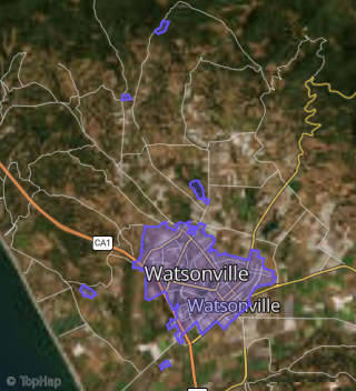
This property is located in Watsonville.
Seasonal Housing units 95019
13%of housing is for seasonal rent.
Daytime Population for 95019
-35%of people during work hours.
Boundary map of Watsonville.
Crime Index for 95019
114
The crime index in 95019 is 114, which is 1.1 times higher than national average.
Market Trends
Historical market data near 55 Airport Rd B over selected time period.
Nearby Properties on Airport Rd
- 26 Airport Rd, Freedom, CA 95019 is a 1,065 square foot, 2 bedroom, 1 bathroom, 0.49 acre property. It was built in 1956 and has an estimate of $797,614 with a price per ft² of $749.
- 55 Airport Rd, Freedom, CA 95019 is a 864 square foot, 2 bedroom, 1 bathroom, 0.47 acre property. It was built in 1974 and has an estimate of $687,500 with a price per ft² of $796.
- 37 Airport Rd, Freedom, CA 95019 is a 2,161 square foot, 4 bedroom, 3 bathroom, 0.14 acre property. It was built in 2011 and has an estimate of $838,578 with a price per ft² of $388.
- 23 Airport Rd # A, Freedom, CA 95019 is a 1,451 square foot, 3 bedroom, 2 bathroom, 0.19 acre property. It was built in 1978 and has an estimate of $790,082 with a price per ft² of $545.
- 41 Airport Rd # C, Freedom, CA 95019 is a 1,037 square foot, 2 bedroom, 1 bathroom, 0.24 acre property. It was built in 1940 and has an estimate of $636,668 with a price per ft² of $614.
- 51 Airport Rd, Freedom, CA 95019 is a 1,046 square foot, 2 bedroom, 1 bathroom, 0.47 acre property. It was built in 1946 and has an estimate of $665,346 with a price per ft² of $636.
- 24 Airport Rd, Freedom, CA 95019 is a 820 square foot, 2 bedroom, 1 bathroom, 0.49 acre property. It was built in 1938 and has an estimate of $637,454 with a price per ft² of $777.
- 56 Airport Rd, Freedom, CA 95019 is a 1,119 square foot, 1 bedroom, 1 bathroom, 0.2 acre property. It was built in 1932 and has an estimate of $518,217 with a price per ft² of $463.
- 62 Airport Rd, Freedom, CA 95019 is a 1,411 square foot and 0.21 acre property. It was built in 1955 and has an estimate of $392,476 with a price per ft² of $278.
- 12 Airport Rd, Freedom, CA 95019 is a 1,240 square foot, 3 bedroom, 2 bathroom, 0.26 acre property. It was built in 1962 and has an estimate of $739,754 with a price per ft² of $597.
- 23 Airport Rd # B, Freedom, CA 95019 is a 1,924 square foot, 3 bedroom, 3 bathroom, 0.19 acre property. It was built in 1979 and has an estimate of $856,963 with a price per ft² of $445.
- 23 Airport Rd # C, Freedom, CA 95019 is a 1,806 square foot, 3 bedroom, 2 bathroom, 0.25 acre property. It was built in 1981 and has an estimate of $789,911 with a price per ft² of $437.
- 21 Airport Rd, Freedom, CA 95019 is a 1,251 square foot, 3 bedroom, 1 bathroom, 0.16 acre property. It was built in 1967 and has an estimate of $675,677 with a price per ft² of $540.
- 13 Airport Rd, Freedom, CA 95019 is a 1,382 square foot, 3 bedroom, 2 bathroom, 0.16 acre property. It was built in 1966 and has an estimate of $822,492 with a price per ft² of $595.
- 11 Airport Rd, Freedom, CA 95019 is a 1,303 square foot, 3 bedroom, 2 bathroom, 0.16 acre property. It was built in 1964 and has an estimate of $787,713 with a price per ft² of $605.
- 9 Airport Rd, Freedom, CA 95019 is a 1,348 square foot, 3 bedroom, 1.5 bathroom, 0.16 acre property. It was built in 1963 and has an estimate of $740,268 with a price per ft² of $549.
- 23 Airport Rd, Freedom, CA 95019 is a 1,505 square foot, 4 bedroom, 1 bathroom, 0.35 acre property. It was built in 1938 and has an estimate of $816,042 with a price per ft² of $542.
- 63 Airport Rd, Freedom, CA 95019 is a 960 square foot, 2 bedroom, 1 bathroom, 0.23 acre property. It was built in 1949 and has an estimate of $569,928 with a price per ft² of $594.
- 20 Airport Rd, Freedom, CA 95019 is a 4,314 square foot and 0.5 acre property. It was built in 1936 and has an estimate of $1,038,994 with a price per ft² of $241.
- 16 Airport Rd, Freedom, CA 95019 is a 932 square foot, 2 bedroom, 1 bathroom, 0.24 acre property. It was built in 1930 and has an estimate of $629,403 with a price per ft² of $841.
- 36 Airport Rd, Freedom, CA 95019 is a 908 square foot, 2 bedroom, 1 bathroom, 1 acre property. It was built in 1929 and has an estimate of $691,484 with a price per ft² of $762.
- 65 Airport Rd, Freedom, CA 95019 is a 3,809 square foot and 0.98 acre property. It was built in 1930 and has an estimate of $1,031,789 with a price per ft² of $271.
- 59 Airport Rd, Freedom, CA 95019 is a 2,332 square foot, 3 bedroom, 2 bathroom, 0.46 acre property. It was built in 1909 and has an estimate of $1,079,751 with a price per ft² of $463.
- 61 Airport Rd, Freedom, CA 95019 is a 3,055 square foot, 4 bedroom, 2 bathroom, 0.24 acre property. It was built in 2013 and has an estimate of $1,170,920 with a price per ft² of $383.
- 30 Airport Rd, Freedom, CA 95019 is a 2,467 square foot, 3 bedroom, 2 bathroom, 0.17 acre property. It was built in 1936 and has an estimate of $665,734 with a price per ft² of $270.
- View more properties on Airport Rd