632 Denise Dr
Woodland, CA 95776
- 4Beds
- 2Baths
- 1,293ft²Living Area
- 5,500ft²Lot Size
- -Pool
- -Car
- 1960Year Built
- -DOM
- -Permit
Property Valuations
Latest estimates for 632 Denise Dr based on TopHap automated valuation model (AVM).
TopHap Estimate
$449,640
$347/ft²
Updated 3 months ago
632 Denise Dr is valued at $449,640 by TopHap AVM 3 months ago.
Current Ownership
Information about the current owner(s).
Taxes Billed
Taxes billed in 2023$488.58From latest Total Assessed Value0.93%Total Assessed Value$52,775=Land+
Assessed Value$11,954Additions
Assessed Value$40,821
In 2023, taxes billed for 632 Denise Dr were $488.58, which is 0.93% from latest Total Assessed Value of $52,775.
Property History
632 Denise Dr has undefined property events records (listings, deeds, permits, tax, foreclosure, loan).
Environment
Environmental factors around 632 Denise Dr
Hazard Risks
Earthquake154Nat'l Avg100Particulates94Ozone82Air Pollution81Carb Mono71Lead41Tornado6Hail5Weather1Hurricane0Wind0
10 hazards (Carbon Monoxide, Earthquake Risk, Hail Index, Tornado Index, Air Pollution Index, Ozone Index, Weather Risk, Lead Index, Particulate Matter, National Average) are above the national average around 632 Denise Dr.
Walkability Index
15 /20
Most Walkable
20-18
Very Walkable
17-15
Somewhat Walkable
14-10
Car Dependent
9-0
632 Denise Dr has a walkability score of 15 out of 20, which means that it is in a very walkable area.
Noise Level
57 dB
Quiet Suburban Residential 0-49
Suburban Residential 50-54
Urban Residential 55-59
Noisy Urban Residential 60-64
Very Noisy Urban Residential 65+
Noise at 632 Denise Dr is around 57dBs, which is comparable to a Urban Residential area.
Temperature
Seasonal temperature sampled over multiple years
Winter
Average
Low
39°F
High
56°F
Summer
Average
Low
57°F
High
93°F
In the winter at 632 Denise Dr, temperatures range from 38.62°F to 56.17°F with an average of 47.4°F. In the summer, the temperature ranges from 56.85°F to 92.89°F with and average of 74.87°F.
School Information
Public/private schools serving 632 Denise Dr
Public Schools
Nearby public schools serving 632 Denise Dr have ratings undefined, undefined, and undefined.
Neighborhood
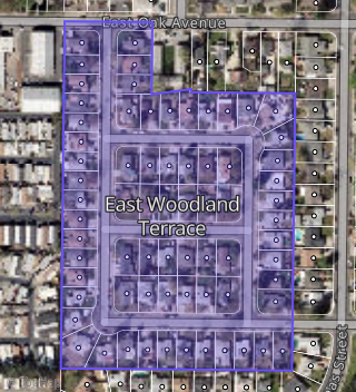
This property is located in East Woodland Terrace, Woodland, CA 95776.
Seasonal Housing units 95776
33%of housing is for seasonal rent.
Daytime Population for 95776
-1%of people during work hours.
Boundary map of East Woodland Terrace.
Crime Index for 95776
55
The crime index in 95776 is 55, which is 0.6 times lower than national average.
Market Trends
Historical market data near 632 Denise Dr over selected time period.
Nearby Properties on Denise Dr
- 628 Denise Dr, Woodland, CA 95776 (East Woodland Terrace) is a 1,008 square foot, 3 bedroom, 1 bathroom, 0.13 acre property. It was built in 1960 and has an estimate of $395,893 with a price per ft² of $393.
- 641 Denise Dr, Woodland, CA 95776 (East Woodland Terrace) is a 1,498 square foot, 3 bedroom, 2 bathroom, 0.17 acre property. It was built in 1961 and has an estimate of $483,429 with a price per ft² of $323.
- 633 Denise Dr, Woodland, CA 95776 (East Woodland Terrace) is a 1,008 square foot, 3 bedroom, 2 bathroom, 0.17 acre property. It was built in 1960 and has an estimate of $382,296 with a price per ft² of $379.
- 612 Denise Dr, Woodland, CA 95776 (East Woodland Terrace) is a 1,008 square foot, 3 bedroom, 1 bathroom, 0.13 acre property. It was built in 1961 and has an estimate of $395,565 with a price per ft² of $392.
- 608 Denise Dr, Woodland, CA 95776 (East Woodland Terrace) is a 1,008 square foot, 3 bedroom, 2 bathroom, 0.13 acre property. It was built in 1961 and has an estimate of $395,200 with a price per ft² of $392.
- 616 Denise Dr, Woodland, CA 95776 (Fairway Estates) is a 1,008 square foot, 3 bedroom, 2 bathroom, 0.13 acre property. It was built in 1960 and has an estimate of $396,810 with a price per ft² of $394.
- 604 Denise Dr, Woodland, CA 95776 (East Woodland Terrace) is a 1,369 square foot, 4 bedroom, 1 bathroom, 0.13 acre property. It was built in 1960 and has an estimate of $434,868 with a price per ft² of $318.
- 613 Denise Dr, Woodland, CA 95776 (East Woodland Terrace) is a 1,008 square foot, 3 bedroom, 2 bathroom, 0.16 acre property. It was built in 1961 and has an estimate of $386,272 with a price per ft² of $383.
- 609 Denise Dr, Woodland, CA 95776 (East Woodland Terrace) is a 1,008 square foot, 3 bedroom, 1 bathroom, 0.13 acre property. It was built in 1961 and has an estimate of $397,772 with a price per ft² of $395.
- 605 Denise Dr, Woodland, CA 95776 (East Woodland Terrace) is a 1,008 square foot, 3 bedroom, 2 bathroom, 0.13 acre property. It was built in 1960 and has an estimate of $397,142 with a price per ft² of $394.
- 620 Denise Dr, Woodland, CA 95776 (East Woodland Terrace) is a 1,008 square foot, 3 bedroom, 1 bathroom, 0.13 acre property. It was built in 1960 and has an estimate of $397,688 with a price per ft² of $395.
- 624 Denise Dr, Woodland, CA 95776 (East Woodland Terrace) is a 1,008 square foot, 3 bedroom, 2 bathroom, 0.13 acre property. It was built in 1960 and has an estimate of $399,744 with a price per ft² of $397.
- 632 Denise Dr, Woodland, CA 95776 (Casa Del Sol) is a 1,293 square foot, 4 bedroom, 2 bathroom, 0.13 acre property. It was built in 1960 and has an estimate of $445,438 with a price per ft² of $344.
- 636 Denise Dr, Woodland, CA 95776 (East Woodland Terrace) is a 1,464 square foot, 4 bedroom, 2 bathroom, 0.13 acre property. It was built in 1960 and has an estimate of $435,983 with a price per ft² of $298.
- 625 Denise Dr, Woodland, CA 95776 (East Woodland Terrace) is a 1,008 square foot, 3 bedroom, 1 bathroom, 0.17 acre property. It was built in 1960 and has an estimate of $389,580 with a price per ft² of $386.
- 640 Denise Dr, Woodland, CA 95776 (East Woodland Terrace) is a 1,008 square foot, 3 bedroom, 1 bathroom, 0.13 acre property. It was built in 1960 and has an estimate of $392,699 with a price per ft² of $390.
- 644 Denise Dr, Woodland, CA 95776 (East Woodland Terrace) is a 1,288 square foot, 3 bedroom, 2 bathroom, 0.13 acre property. It was built in 1960 and has an estimate of $451,412 with a price per ft² of $350.
- 648 Denise Dr, Woodland, CA 95776 (East Woodland Terrace) is a 1,008 square foot, 3 bedroom, 1 bathroom, 0.13 acre property. It was built in 1960 and has an estimate of $388,977 with a price per ft² of $386.
- 651 Denise Dr, Woodland, CA 95776 (East Woodland Terrace) is a 1,242 square foot, 3 bedroom, 1 bathroom, 0.17 acre property. It was built in 1961 and has an estimate of $452,005 with a price per ft² of $364.
- 650 Denise Dr, Woodland, CA 95776 (East Woodland Terrace) is a 1,281 square foot, 4 bedroom, 2 bathroom, 0.13 acre property. It was built in 1960 and has an estimate of $440,212 with a price per ft² of $344.
- 654 Denise Dr, Woodland, CA 95776 (East Woodland Terrace) is a 1,243 square foot, 3 bedroom, 2 bathroom, 0.14 acre property. It was built in 1960 and has an estimate of $430,299 with a price per ft² of $346.
- 660 Denise Dr, Woodland, CA 95776 (East Woodland Terrace) is a 1,008 square foot, 3 bedroom, 2 bathroom, 0.22 acre property. It was built in 1960 and has an estimate of $412,798 with a price per ft² of $410.