633 Tahoe Dr
Lodi, CA 95242
- 3Beds
- 2Baths
- 1,310ft²Living Area
- 4,988ft²Lot Size
- -Pool
- 2Car
- 1974Year Built
- -DOM
- -Permit
Property Valuations
Latest estimates for 633 Tahoe Dr based on TopHap automated valuation model (AVM).
TopHap Estimate
$478,500
$365/ft²
+$317K above Sold Price
Updated 3 months ago
Last Sold Price
$162,000
$124/ft²
22 years ago
633 Tahoe Dr is valued at $478,500 by TopHap AVM 3 months ago.
633 Tahoe Dr was last sold in 2001 for $162,000.
Current Ownership
Information about the current owner(s).
Taxes Billed
Taxes billed in 2023$2,425.86From latest Total Assessed Value1.05%Total Assessed Value$230,015=Land+
Assessed Value$68,151Additions
Assessed Value$161,864
In 2023, taxes billed for 633 Tahoe Dr were $2,425.86, which is 1.05% from latest Total Assessed Value of $230,015.
Property History
633 Tahoe Dr has undefined property events records (listings, deeds, permits, tax, foreclosure, loan).
Environment
Environmental factors around 633 Tahoe Dr
Hazard Risks
Earthquake126Particulates102Nat'l Avg100Ozone85Air Pollution83Carb Mono79Lead40Tornado28Weather8Hail0Hurricane0Wind0
9 hazards (Carbon Monoxide, Earthquake Risk, Tornado Index, Air Pollution Index, Ozone Index, Weather Risk, Lead Index, Particulate Matter, National Average) are above the national average around 633 Tahoe Dr.
Walkability Index
7 /20
Most Walkable
20-18
Very Walkable
17-15
Somewhat Walkable
14-10
Car Dependent
9-0
633 Tahoe Dr has a walkability score of 7 out of 20, which means that it is in a car dependent area.
Temperature
Seasonal temperature sampled over multiple years
Winter
Average
Low
38°F
High
57°F
Summer
Average
Low
56°F
High
90°F
In the winter at 633 Tahoe Dr, temperatures range from 38.18°F to 56.55°F with an average of 47.37°F. In the summer, the temperature ranges from 56.36°F to 89.67°F with and average of 73.02°F.
School Information
Public/private schools serving 633 Tahoe Dr
Public Schools
Nearby public schools serving 633 Tahoe Dr have ratings undefined, undefined, and undefined.
Neighborhood
This property is located in West Lake, Lodi, CA 95242.
Seasonal Housing units 95242
24%of housing is for seasonal rent.
Daytime Population for 95242
-6%of people during work hours.
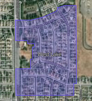
Boundary map of West Lake.
Crime Index for 95242
87
The crime index in 95242 is 87, which is 0.9 times lower than national average.
Market Trends
Historical market data near 633 Tahoe Dr over selected time period.
Nearby Properties on Tahoe Dr
- 600 Tahoe Dr, Lodi, CA 95242 (West Lake) is a 0.14 acre property. It has an estimate of $221,300.
- 612 Tahoe Dr, Lodi, CA 95242 (West Lake) is a 1,824 square foot, 3 bedroom, 2 bathroom, 0.13 acre property. It was built in 1972 and has an estimate of $496,620 with a price per ft² of $272.
- 642 Tahoe Dr, Lodi, CA 95242 (West Lake) is a 1,578 square foot, 3 bedroom, 2 bathroom, 0.14 acre property. It was built in 1972 and has an estimate of $472,787 with a price per ft² of $300.
- 632 Tahoe Dr, Lodi, CA 95242 (West Lake) is a 1,342 square foot, 3 bedroom, 1 bathroom, 0.13 acre property. It was built in 1971 and has an estimate of $416,757 with a price per ft² of $311.
- 700 Tahoe Dr, Lodi, CA 95242 (West Lake) is a 1,315 square foot, 3 bedroom, 2 bathroom, 0.17 acre property. It was built in 1972 and has an estimate of $470,399 with a price per ft² of $358.
- 626 Tahoe Dr, Lodi, CA 95242 (West Lake) is a 1,335 square foot, 3 bedroom, 2 bathroom, 0.14 acre property. It was built in 1972 and has an estimate of $464,087 with a price per ft² of $348.
- 708 Tahoe Dr, Lodi, CA 95242 (West Lake) is a 1,318 square foot, 3 bedroom, 2 bathroom, 0.19 acre property. It was built in 1972 and has an estimate of $468,184 with a price per ft² of $355.
- 641 Tahoe Dr, Lodi, CA 95242 (West Lake) is a 1,310 square foot, 3 bedroom, 2 bathroom, 0.11 acre property. It was built in 1974 and has an estimate of $458,752 with a price per ft² of $350.
- 707 Tahoe Dr, Lodi, CA 95242 (West Lake) is a 1,054 square foot, 3 bedroom, 2 bathroom, 0.18 acre property. It was built in 1972 and has an estimate of $403,850 with a price per ft² of $383.
- 620 Tahoe Dr, Lodi, CA 95242 (West Lake) is a 1,248 square foot, 3 bedroom, 1 bathroom, 0.14 acre property. It was built in 1972 and has an estimate of $427,656 with a price per ft² of $343.
- 603 Tahoe Dr, Lodi, CA 95242 (West Lake) is a 1,303 square foot, 3 bedroom, 2 bathroom, 0.36 acre property. It was built in 1975 and has an estimate of $495,430 with a price per ft² of $380.
- 607 Tahoe Dr, Lodi, CA 95242 (West Lake) is a 1,286 square foot, 3 bedroom, 2 bathroom, 0.15 acre property. It was built in 1973 and has an estimate of $517,847 with a price per ft² of $403.
- 611 Tahoe Dr, Lodi, CA 95242 (West Lake) is a 1,415 square foot, 3 bedroom, 2 bathroom, 0.16 acre property. It was built in 1973 and has an estimate of $491,217 with a price per ft² of $347.
- 619 Tahoe Dr, Lodi, CA 95242 (West Lake) is a 1,286 square foot, 3 bedroom, 2 bathroom, 0.15 acre property. It was built in 1973 and has an estimate of $526,344 with a price per ft² of $409.
- 627 Tahoe Dr, Lodi, CA 95242 (West Lake) is a 1,291 square foot, 3 bedroom, 2 bathroom, 0.16 acre property. It was built in 1975 and has an estimate of $501,719 with a price per ft² of $389.
- 633 Tahoe Dr, Lodi, CA 95242 (West Lake) is a 1,310 square foot, 3 bedroom, 2 bathroom, 0.11 acre property. It was built in 1974 and has an estimate of $452,905 with a price per ft² of $346.
- 701 Tahoe Dr, Lodi, CA 95242 (West Lake) is a 1,310 square foot, 3 bedroom, 2 bathroom, 0.11 acre property. It was built in 1974 and has an estimate of $477,749 with a price per ft² of $365.