656 Foster Ct 1
Hayward, CA 94544
- 3Beds
- 2Baths
- 1,175ft²Living Area
- 1.5acLot Size
- -Pool
- -Car
- 1981Year Built
- -DOM
- -Permit
Property Valuations
Latest estimates for 656 Foster Ct 1 based on TopHap automated valuation model (AVM).
TopHap Estimate
$654,750
$557/ft²
+$320K above Sold Price
Updated 3 months ago
Last Sold Price
$335,000
$285/ft²
7 years ago
656 Foster Ct 1 is valued at $654,750 by TopHap AVM 3 months ago.
656 Foster Ct 1 was last sold in 2016 for $335,000.
Current Ownership
Information about the current owner(s).
Taxes Billed
Taxes billed in 2023$4,703.08From latest Total Assessed Value1.26%Total Assessed Value$373,692=Land+
Assessed Value$117,127Additions
Assessed Value$256,565
In 2023, taxes billed for 656 Foster Ct 1 were $4,703.08, which is 1.26% from latest Total Assessed Value of $373,692.
Property History
656 Foster Ct 1 has undefined property events records (listings, deeds, permits, tax, foreclosure, loan).
Environment
Environmental factors around 656 Foster Ct 1
Hazard Risks
Earthquake615Particulates101Nat'l Avg100Carb Mono98Ozone90Air Pollution87Lead42Tornado3Weather2Wind2Hail0Hurricane0
10 hazards (Carbon Monoxide, Earthquake Risk, Tornado Index, Air Pollution Index, Ozone Index, Wind Index, Weather Risk, Lead Index, Particulate Matter, National Average) are above the national average around 656 Foster Ct 1.
Walkability Index
13 /20
Most Walkable
20-18
Very Walkable
17-15
Somewhat Walkable
14-10
Car Dependent
9-0
656 Foster Ct 1 has a walkability score of 13 out of 20, which means that it is in a somewhat walkable area.
Noise Level
55 dB
Quiet Suburban Residential 0-49
Suburban Residential 50-54
Urban Residential 55-59
Noisy Urban Residential 60-64
Very Noisy Urban Residential 65+
Noise at 656 Foster Ct 1 is around 55dBs, which is comparable to a Urban Residential area.
Temperature
Seasonal temperature sampled over multiple years
Winter
Average
Low
42°F
High
58°F
Summer
Average
Low
54°F
High
77°F
In the winter at 656 Foster Ct 1, temperatures range from 41.59°F to 57.9°F with an average of 49.75°F. In the summer, the temperature ranges from 54.4°F to 76.58°F with and average of 65.49°F.
School Information
Public/private schools serving 656 Foster Ct 1
Public Schools
Nearby public schools serving 656 Foster Ct 1 have ratings undefined, undefined, and undefined.
Neighborhood
This property is located in Harder Tennyson, Hayward, CA 94544.
Seasonal Housing units 94544
15%of housing is for seasonal rent.
Daytime Population for 94544
-12%of people during work hours.
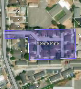
Boundary map of Harder-Tennyson.
Crime Index for 94544
77
The crime index in 94544 is 77, which is 0.8 times lower than national average.
Market Trends
Historical market data near 656 Foster Ct 1 over selected time period.
Nearby Properties on Foster Ct
- 631 Foster Ct #Apt 1, Hayward, CA 94544 (Stone Pine) is a 1,175 square foot, 3 bedroom, 2.25 bathroom, 0.03 acre property. It was built in 1981 and has an estimate of $714,030 with a price per ft² of $608.
- 631 Foster Ct #Apt 2, Hayward, CA 94544 (Stone Pine) is a 1,175 square foot, 3 bedroom, 2.25 bathroom, 0.03 acre property. It was built in 1981 and has an estimate of $718,183 with a price per ft² of $611.
- 631 Foster Ct #Apt 6, Hayward, CA 94544 (Stone Pine) is a 1,125 square foot, 3 bedroom, 2.25 bathroom, 0.03 acre property. It was built in 1981 and has an estimate of $601,294 with a price per ft² of $534.
- 631 Foster Ct #Apt 4, Hayward, CA 94544 (Stone Pine) is a 1,175 square foot, 3 bedroom, 1.5 bathroom, 0.03 acre property. It was built in 1981 and has an estimate of $661,328 with a price per ft² of $563.
- 630 Foster Ct #Apt 3, Hayward, CA 94544 (Stone Pine) is a 1,125 square foot, 2 bedroom, 2.25 bathroom, 0.03 acre property. It was built in 1981 and has an estimate of $584,028 with a price per ft² of $519.
- 630 Foster Ct #Apt 1, Hayward, CA 94544 (Stone Pine) is a 1,125 square foot, 2 bedroom, 2.25 bathroom, 0.03 acre property. It was built in 1981 and has an estimate of $584,028 with a price per ft² of $519.
- 630 Foster Ct #Apt 4, Hayward, CA 94544 (Stone Pine) is a 1,125 square foot, 2 bedroom, 2.25 bathroom, 0.03 acre property. It was built in 1981 and has an estimate of $582,027 with a price per ft² of $517.
- 643 Foster Ct #Apt 1, Hayward, CA 94544 (Stone Pine) is a 1,175 square foot, 3 bedroom, 2.25 bathroom, 0.03 acre property. It was built in 1981 and has an estimate of $665,708 with a price per ft² of $567.
- 643 Foster Ct #Apt 2, Hayward, CA 94544 (Stone Pine) is a 1,175 square foot, 3 bedroom, 2.25 bathroom, 0.03 acre property. It was built in 1981 and has an estimate of $663,427 with a price per ft² of $565.
- 655 Foster Ct #Apt 2, Hayward, CA 94544 (Stone Pine) is a 1,125 square foot, 2 bedroom, 2.25 bathroom, 0.03 acre property. It was built in 1981 and has an estimate of $636,405 with a price per ft² of $566.
- 656 Foster Ct #Apt 4, Hayward, CA 94544 (Stone Pine) is a 1,175 square foot, 3 bedroom, 2.25 bathroom, 0.03 acre property. It was built in 1981 and has an estimate of $718,425 with a price per ft² of $611.
- 656 Foster Ct #Apt 3, Hayward, CA 94544 (Stone Pine) is a 1,175 square foot, 3 bedroom, 1.5 bathroom, 0.03 acre property. It was built in 1981 and has an estimate of $660,977 with a price per ft² of $563.
- 656 Foster Ct #Apt 2, Hayward, CA 94544 (Stone Pine) is a 1,175 square foot, 3 bedroom, 1.5 bathroom, 0.03 acre property. It was built in 1981 and has an estimate of $660,977 with a price per ft² of $563.
- 656 Foster Ct #Apt 1, Hayward, CA 94544 (Stone Pine) is a 1,175 square foot, 3 bedroom, 1.5 bathroom, 0.03 acre property. It was built in 1981 and has an estimate of $581,593 with a price per ft² of $495.
- 655 Foster Ct #Apt 1, Hayward, CA 94544 (Stone Pine) is a 1,125 square foot, 2 bedroom, 1.5 bathroom, 0.03 acre property. It was built in 1981 and has an estimate of $534,844 with a price per ft² of $475.
- 643 Foster Ct #Apt 4, Hayward, CA 94544 (Stone Pine) is a 1,175 square foot, 3 bedroom, 2.25 bathroom, 0.03 acre property. It was built in 1981 and has an estimate of $665,355 with a price per ft² of $566.
- 643 Foster Ct #Apt 3, Hayward, CA 94544 (Stone Pine) is a 1,175 square foot, 3 bedroom, 1.5 bathroom, 0.03 acre property. It was built in 1981 and has an estimate of $660,977 with a price per ft² of $563.
- 631 Foster Ct #Apt 5, Hayward, CA 94544 (Stone Pine) is a 1,175 square foot, 3 bedroom, 2.25 bathroom, 0.03 acre property. It was built in 1981 and has an estimate of $666,028 with a price per ft² of $567.
- 631 Foster Ct #Apt 3, Hayward, CA 94544 (Stone Pine) is a 1,175 square foot, 3 bedroom, 2.25 bathroom, 0.03 acre property. It was built in 1981 and has an estimate of $666,028 with a price per ft² of $567.
- 630 Foster Ct #Apt 2, Hayward, CA 94544 (Stone Pine) is a 1,125 square foot, 2 bedroom, 2.25 bathroom, 0.03 acre property. It was built in 1981 and has an estimate of $583,718 with a price per ft² of $519.