680 Randall Rd
Santa Barbara, CA 93108
- 5Beds
- 3.25Baths
- 3,463ft²Living Area
- 1acLot Size
- -Pool
- -Car
- 1977Year Built
- -DOM
- 2Permits
Permits
680 Randall Rd has 2 permit records of total value of $18,117.
Current Ownership
Information about the current owner(s).
Property History
680 Randall Rd has undefined property events records (listings, deeds, permits, tax, foreclosure, loan).
Environment
Environmental factors around 680 Randall Rd
Hazard Risks
Earthquake514Carb Mono117Nat'l Avg100Particulates100Ozone99Air Pollution99Lead96Weather6Hurricane4Tornado3Wind2Hail0
11 hazards (Carbon Monoxide, Earthquake Risk, Tornado Index, Hurricane Index, Air Pollution Index, Ozone Index, Wind Index, Weather Risk, Lead Index, Particulate Matter, National Average) are above the national average around 680 Randall Rd.
Walkability Index
9 /20
Most Walkable
20-18
Very Walkable
17-15
Somewhat Walkable
14-10
Car Dependent
9-0
680 Randall Rd has a walkability score of 9 out of 20, which means that it is in a car dependent area.
Temperature
Seasonal temperature sampled over multiple years
Winter
Average
Low
44°F
High
64°F
Summer
Average
Low
55°F
High
75°F
In the winter at 680 Randall Rd, temperatures range from 44.08°F to 64.28°F with an average of 54.18°F. In the summer, the temperature ranges from 55.24°F to 75.11°F with and average of 65.18°F.
School Information
Public/private schools serving 680 Randall Rd
Public Schools
Nearby public schools serving 680 Randall Rd have ratings undefined, undefined, and undefined.
Neighborhood
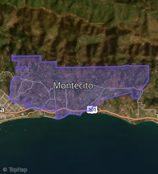
This property is located in Montecito, Santa Barbara, CA 93108.
Seasonal Housing units 93108
60%of housing is for seasonal rent.
Daytime Population for 93108
+32%of people during work hours.
Boundary map of Montecito.
Crime Index for 93108
147
The crime index in 93108 is 147, which is 1.5 times higher than national average.
Market Trends
Historical market data near 680 Randall Rd over selected time period.
Nearby Properties on Randall Rd
- 650 Randall Rd, Santa Barbara, CA 93108 (Montecito) is a 2,844 square foot, 3 bedroom, 2.5 bathroom, 1 acre property. It was built in 1977 and has an estimate of $5,875,871 with a price per ft² of $2,066.
- 680 Randall Rd, Santa Barbara, CA 93108 (Montecito) is a 3,463 square foot, 5 bedroom, 3.25 bathroom, 1 acre property. It was built in 1977 and has an estimate of $6,727,421 with a price per ft² of $1,943.
- 660 Randall Rd, Santa Barbara, CA 93108 (Montecito) is a 3,555 square foot, 2 bedroom, 2.5 bathroom, 1 acre property. It was built in 1971 and has an estimate of $7,219,704 with a price per ft² of $2,031.
- 670 Randall Rd, Santa Barbara, CA 93108 (Montecito) is a 2,739 square foot, 3 bedroom, 2.5 bathroom, 1.01 acre property. It was built in 1977 and has an estimate of $5,712,875 with a price per ft² of $2,086.
- 640 Randall Rd, Santa Barbara, CA 93108 (Montecito) is a 3,204 square foot, 3 bedroom, 4.25 bathroom, 0.96 acre property. It was built in 1971 and has an estimate of $6,226,903 with a price per ft² of $1,943.
- 620 Randall Rd, Santa Barbara, CA 93108 (Montecito) is a 2,844 square foot, 3 bedroom, 2.5 bathroom, 1.3 acre property. It was built in 1977 and has an estimate of $6,204,611 with a price per ft² of $2,182.
- 630 Randall Rd, Santa Barbara, CA 93108 (Montecito) is a 0.99 acre property.