70914 Amaranth
Sisters, OR 97759
- 4Beds
- 4Baths
- 2,500ft²Living Area
- 1acLot Size
- -Pool
- -Car
- 1974Year Built
- -DOM
- 1Permit
Property Valuations
Latest estimates for 70914 Amaranth based on TopHap automated valuation model (AVM).
TopHap Estimate
$955,392
$382/ft²
Updated 3 months ago
70914 Amaranth is valued at $955,392 by TopHap AVM 3 months ago.
Permits
70914 Amaranth has 1 permit records.
Current Ownership
Information about the current owner(s).
Taxes Billed
Taxes billed in 2023$9,157.07From latest Total Assessed Value1.55%Total Assessed Value$590,590=Land+
Assessed Value$0Additions
Assessed Value$0
In 2023, taxes billed for 70914 Amaranth were $9,157.07, which is 1.55% from latest Total Assessed Value of $590,590.
Property History
70914 Amaranth has undefined property events records (listings, deeds, permits, tax, foreclosure, loan).
Environment
Environmental factors around 70914 Amaranth
Hazard Risks
Carb Mono167Lead143Air Pollution116Ozone114Nat'l Avg100Particulates98Earthquake89Hail10Tornado2Weather2Hurricane0Wind0
10 hazards (Carbon Monoxide, Earthquake Risk, Hail Index, Tornado Index, Air Pollution Index, Ozone Index, Weather Risk, Lead Index, Particulate Matter, National Average) are above the national average around 70914 Amaranth.
Walkability Index
2 /20
Most Walkable
20-18
Very Walkable
17-15
Somewhat Walkable
14-10
Car Dependent
9-0
70914 Amaranth has a walkability score of 2 out of 20, which means that it is in a car dependent area.
Temperature
Seasonal temperature sampled over multiple years
Winter
Average
Low
25°F
High
40°F
Summer
Average
Low
44°F
High
74°F
In the winter at 70914 Amaranth, temperatures range from 24.59°F to 40.42°F with an average of 32.51°F. In the summer, the temperature ranges from 43.71°F to 74.02°F with and average of 58.87°F.
School Information
Public/private schools serving 70914 Amaranth
Public Schools
Nearby public schools serving 70914 Amaranth have ratings undefined, undefined, and undefined.
Neighborhood
This property is located in Black Butte Ranch, Sisters, OR 97759.
Seasonal Housing units 97759
91%of housing is for seasonal rent.
Daytime Population for 97759
-2%of people during work hours.
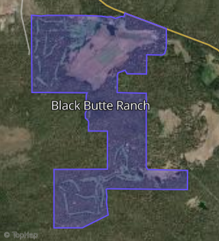
Boundary map of Black Butte Ranch.
Crime Index for 97759
109
The crime index in 97759 is 109, which is 1.1 times higher than national average.
Market Trends
Historical market data near 70914 Amaranth over selected time period.
Nearby Properties on Amaranth
- 70911 Amaranth, Sisters, OR 97759 (Black Butte Ranch) is a 3,783 square foot, 5 bedroom, 4 bathroom, 1.05 acre property. It was built in 1979 and has an estimate of $1,606,739 with a price per ft² of $425.
- 70914 Amaranth, Sisters, OR 97759 (Black Butte Ranch) is a 2,500 square foot, 4 bedroom, 4 bathroom, 1.01 acre property. It was built in 1980 and has an estimate of $1,291,204 with a price per ft² of $516.
- 70919 Amaranth, Sisters, OR 97759 (Black Butte Ranch) is a 2,879 square foot, 4 bedroom, 2 bathroom, 1.04 acre property. It was built in 1988 and has an estimate of $1,673,991 with a price per ft² of $581.