760 Ashford Ct
Vacaville, CA 95687
- 3Beds
- 2Baths
- 2,049ft²Living Area
- 8,739ft²Lot Size
- 1Pool
- 2Car
- 1989Year Built
- -DOM
- 5Permits
Property Valuations
Latest estimates for 760 Ashford Ct based on TopHap automated valuation model (AVM).
TopHap Estimate
$654,750
$319/ft²
+$465K above Sold Price
Updated 3 months ago
Last Sold Price
$190,000
$93/ft²
30 years ago
760 Ashford Ct is valued at $654,750 by TopHap AVM 3 months ago.
760 Ashford Ct was last sold in 1994 for $190,000.
Permits
760 Ashford Ct has 5 permit records of total value of $143,838.
Current Ownership
Information about the current owner(s).
Taxes Billed
Taxes billed in 2022$3,883.94From latest Total Assessed Value1.18%Total Assessed Value$330,362=Land+
Assessed Value$98,026Additions
Assessed Value$232,336
In 2022, taxes billed for 760 Ashford Ct were $3,883.94, which is 1.18% from latest Total Assessed Value of $330,362.
Property History
760 Ashford Ct has undefined property events records (listings, deeds, permits, tax, foreclosure, loan).
Environment
Environmental factors around 760 Ashford Ct
Hazard Risks
Earthquake377Nat'l Avg100Particulates89Ozone87Carb Mono83Air Pollution83Lead45Tornado3Wind2Hail1Weather1Hurricane0
11 hazards (Carbon Monoxide, Earthquake Risk, Hail Index, Tornado Index, Air Pollution Index, Ozone Index, Wind Index, Weather Risk, Lead Index, Particulate Matter, National Average) are above the national average around 760 Ashford Ct.
Walkability Index
10 /20
Most Walkable
20-18
Very Walkable
17-15
Somewhat Walkable
14-10
Car Dependent
9-0
760 Ashford Ct has a walkability score of 10 out of 20, which means that it is in a somewhat walkable area.
Temperature
Seasonal temperature sampled over multiple years
Winter
Average
Low
38°F
High
57°F
Summer
Average
Low
56°F
High
89°F
In the winter at 760 Ashford Ct, temperatures range from 38.47°F to 56.9°F with an average of 47.69°F. In the summer, the temperature ranges from 55.71°F to 89.04°F with and average of 72.38°F.
School Information
Public/private schools serving 760 Ashford Ct
Public Schools
Nearby public schools serving 760 Ashford Ct have ratings undefined, undefined, and undefined.
Neighborhood
This property is located in Ulatis Creek Estates, Vacaville, CA 95687.
Seasonal Housing units 95687
13%of housing is for seasonal rent.
Daytime Population for 95687
-11%of people during work hours.
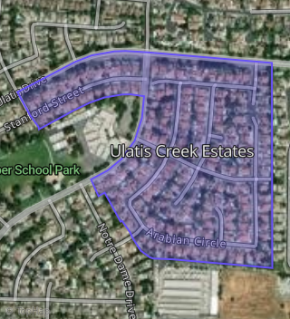
Boundary map of Ulatis Creek Estates.
Crime Index for 95687
71
The crime index in 95687 is 71, which is 0.7 times lower than national average.
Market Trends
Historical market data near 760 Ashford Ct over selected time period.
Nearby Properties on Ashford Ct
- 736 Ashford Ct, Vacaville, CA 95687 (Ulatis Creek Estates) is a 2,360 square foot, 4 bedroom, 3 bathroom, 0.29 acre property. It was built in 1990 and has an estimate of $744,318 with a price per ft² of $315.
- 718 Ashford Ct, Vacaville, CA 95687 (Ulatis Creek Estates) is a 2,360 square foot, 4 bedroom, 3 bathroom, 0.19 acre property. It was built in 1990 and has an estimate of $666,233 with a price per ft² of $282.
- 712 Ashford Ct, Vacaville, CA 95687 (Ulatis Creek Estates) is a 2,066 square foot, 3 bedroom, 2 bathroom, 0.21 acre property. It was built in 1990 and has an estimate of $663,224 with a price per ft² of $321.
- 724 Ashford Ct, Vacaville, CA 95687 (Ulatis Creek Estates) is a 2,366 square foot, 5 bedroom, 3 bathroom, 0.29 acre property. It was built in 1990 and has an estimate of $739,241 with a price per ft² of $312.
- 730 Ashford Ct, Vacaville, CA 95687 (Ulatis Creek Estates) is a 2,649 square foot, 5 bedroom, 3 bathroom, 0.24 acre property. It was built in 1990 and has an estimate of $777,920 with a price per ft² of $294.
- 706 Ashford Ct, Vacaville, CA 95687 (Ulatis Creek Estates) is a 1,804 square foot, 3 bedroom, 2 bathroom, 0.19 acre property. It was built in 1990 and has an estimate of $573,784 with a price per ft² of $318.
- 700 Ashford Ct, Vacaville, CA 95687 (Ulatis Creek Estates) is a 2,066 square foot, 4 bedroom, 2 bathroom, 0.21 acre property. It was built in 1989 and has an estimate of $683,963 with a price per ft² of $331.
- 742 Ashford Ct, Vacaville, CA 95687 (Ulatis Creek Estates) is a 1,804 square foot, 3 bedroom, 2 bathroom, 0.22 acre property. It was built in 1990 and has an estimate of $604,297 with a price per ft² of $335.
- 748 Ashford Ct, Vacaville, CA 95687 (Ulatis Creek Estates) is a 2,066 square foot, 3 bedroom, 2 bathroom, 0.24 acre property. It was built in 1990 and has an estimate of $684,762 with a price per ft² of $331.
- 754 Ashford Ct, Vacaville, CA 95687 (Ulatis Creek Estates) is a 2,360 square foot, 4 bedroom, 3 bathroom, 0.18 acre property. It was built in 1990 and has an estimate of $712,600 with a price per ft² of $302.
- 760 Ashford Ct, Vacaville, CA 95687 (Ulatis Creek Estates) is a 2,049 square foot, 3 bedroom, 2 bathroom, 0.2 acre property. It was built in 1989 and has an estimate of $655,319 with a price per ft² of $320.