808 Riven Rock Rd
Santa Barbara, CA 93108
- 3Beds
- 4Baths
- 3,728ft²Living Area
- 1acLot Size
- -Pool
- -Car
- 1964Year Built
- -DOM
- 10Permits
Property Valuations
Latest estimates for 808 Riven Rock Rd based on TopHap automated valuation model (AVM).
TopHap Estimate
$5,410,250
$1,451/ft²
+$360K above Sold Price
Updated 11 months ago
Last Sold Price
$5,050,000
$1,355/ft²
4 years ago
808 Riven Rock Rd is valued at $5,410,250 by TopHap AVM 11 months ago.
808 Riven Rock Rd was last sold in 2020 for $5,050,000.
Permits
808 Riven Rock Rd has 10 permit records of total value of $428,867.
Current Ownership
Information about the current owner(s).
Taxes Billed
Taxes billed in 2023$56,453.62From latest Total Assessed Value1.06%Total Assessed Value$5,308,449=Land+
Assessed Value$2,102,356Additions
Assessed Value$3,206,093
In 2023, taxes billed for 808 Riven Rock Rd were $56,453.62, which is 1.06% from latest Total Assessed Value of $5,308,449.
Property History
808 Riven Rock Rd has undefined property events records (listings, deeds, permits, tax, foreclosure, loan).
Environment
Environmental factors around 808 Riven Rock Rd
Hazard Risks
Earthquake514Carb Mono117Nat'l Avg100Particulates100Ozone99Air Pollution99Lead96Weather6Hurricane4Tornado3Wind2Hail0
11 hazards (Carbon Monoxide, Earthquake Risk, Tornado Index, Hurricane Index, Air Pollution Index, Ozone Index, Wind Index, Weather Risk, Lead Index, Particulate Matter, National Average) are above the national average around 808 Riven Rock Rd.
Walkability Index
9 /20
Most Walkable
20-18
Very Walkable
17-15
Somewhat Walkable
14-10
Car Dependent
9-0
808 Riven Rock Rd has a walkability score of 9 out of 20, which means that it is in a car dependent area.
Temperature
Seasonal temperature sampled over multiple years
Winter
Average
Low
44°F
High
64°F
Summer
Average
Low
55°F
High
75°F
In the winter at 808 Riven Rock Rd, temperatures range from 44.08°F to 64.28°F with an average of 54.18°F. In the summer, the temperature ranges from 55.24°F to 75.11°F with and average of 65.18°F.
School Information
Public/private schools serving 808 Riven Rock Rd
Public Schools
Nearby public schools serving 808 Riven Rock Rd have ratings undefined, undefined, and undefined.
Neighborhood
This property is located in Montecito, Santa Barbara, CA 93108.
Seasonal Housing units 93108
60%of housing is for seasonal rent.
Daytime Population for 93108
+32%of people during work hours.
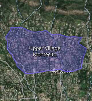
Boundary map of Montecito.
Crime Index for 93108
147
The crime index in 93108 is 147, which is 1.5 times higher than national average.
Market Trends
Historical market data near 808 Riven Rock Rd over selected time period.
Nearby Properties on Riven Rock Rd
- 830 Riven Rock Rd, Santa Barbara, CA 93108 (Upper Village Montecito) is a 5,816 square foot, 6 bedroom, 5.5 bathroom, 1.34 acre property. It was built in 1902 and has an estimate of $13,451,421 with a price per ft² of $2,313.
- 770 Riven Rock Rd, Santa Barbara, CA 93108 (Upper Village Montecito) is a 5,933 square foot, 4 bedroom, 6.25 bathroom, 1.46 acre property. It was built in 2006 and has an estimate of $10,047,024 with a price per ft² of $1,693.
- 780 Riven Rock Rd, Santa Barbara, CA 93108 (Upper Village Montecito) is a 6,610 square foot, 4 bedroom, 6 bathroom, 2.21 acre property. It was built in 2005 and has an estimate of $10,595,615 with a price per ft² of $1,603.
- 757 Riven Rock Rd, Santa Barbara, CA 93108 (Upper Village Montecito) is a 10,302 square foot, 5 bedroom, 8.25 bathroom, 4 acre property. It was built in 1987 and has an estimate of $21,415,150 with a price per ft² of $2,079.
- 705 Riven Rock Rd, Santa Barbara, CA 93108 (Upper Village Montecito) is a 10,245 square foot, 6 bedroom, 8.25 bathroom, 3.4 acre property. It was built in 2003 and has an estimate of $18,284,582 with a price per ft² of $1,820.
- 808 Riven Rock Rd, Santa Barbara, CA 93108 (Upper Village Montecito) is a 5,828 square foot, 5 bedroom, 5.5 bathroom, 1 acre property. It was built in 1964 and has an estimate of $9,097,065 with a price per ft² of $1,561.
- 840 Riven Rock Rd, Santa Barbara, CA 93108 (Upper Village Montecito) is a 3,960 square foot, 3 bedroom, 4.25 bathroom, 0.99 acre property. It was built in 1970 and has an estimate of $6,192,815 with a price per ft² of $1,564.
- 804 Riven Rock Rd, Santa Barbara, CA 93108 (Upper Village Montecito) is a 3,835 square foot, 3 bedroom, 5.25 bathroom, 1.2 acre property. It was built in 1978 and has an estimate of $6,890,143 with a price per ft² of $1,797.
- 860 Riven Rock Rd, Santa Barbara, CA 93108 (Upper Village Montecito) is a 3,059 square foot, 2 bedroom, 3 bathroom, 0.84 acre property. It was built in 1902 and has an estimate of $6,109,825 with a price per ft² of $1,997.
- 880 Riven Rock Rd, Santa Barbara, CA 93108 (Upper Village Montecito) is a 2,741 square foot, 3 bedroom, 3 bathroom, 0.64 acre property. It was built in 1970 and has an estimate of $4,550,384 with a price per ft² of $1,660.
- 801 Riven Rock Rd, Santa Barbara, CA 93108 (Upper Village Montecito) is a 4,652 square foot, 6 bedroom, 4 bathroom, 1.2 acre property. It was built in 1930 and has an estimate of $7,511,948 with a price per ft² of $1,615.
- 787 Riven Rock Rd, Santa Barbara, CA 93108 (Upper Village Montecito) is a 5,211 square foot, 5 bedroom, 5.5 bathroom, 1.52 acre property. It was built in 1960 and has an estimate of $8,854,205 with a price per ft² of $1,699.
- 789 Riven Rock Rd, Santa Barbara, CA 93108 (Upper Village Montecito) is a 3,726 square foot, 3 bedroom, 4.25 bathroom, 1.8 acre property. It was built in 1955 and has an estimate of $8,160,058 with a price per ft² of $2,190.
- 777 Riven Rock Rd, Santa Barbara, CA 93108 (Upper Village Montecito) is a 3,319 square foot, 4 bedroom, 4 bathroom, 1.88 acre property. It was built in 1959 and has an estimate of $8,352,322 with a price per ft² of $2,517.
- 800 Riven Rock Rd, Santa Barbara, CA 93108 (Upper Village Montecito) is a 3,282 square foot, 3 bedroom, 4 bathroom, 3.34 acre property. It was built in 1949 and has an estimate of $7,256,812 with a price per ft² of $2,211.
- 820 Riven Rock Rd, Santa Barbara, CA 93108 (Upper Village Montecito) is a 3,779 square foot, 4 bedroom, 5.25 bathroom, 0.75 acre property. It was built in 1995 and has an estimate of $5,387,051 with a price per ft² of $1,426.
- 733 Riven Rock Rd, Santa Barbara, CA 93108 (Upper Village Montecito) is a 4,064 square foot, 4 bedroom, 4.25 bathroom, 0.88 acre property. It was built in 1983 and has an estimate of $5,539,496 with a price per ft² of $1,363.
- 725 Riven Rock Rd, Santa Barbara, CA 93108 (Upper Village Montecito) is a 3,536 square foot, 2 bedroom, 3.25 bathroom, 1.15 acre property. It was built in 1923 and has an estimate of $8,150,773 with a price per ft² of $2,305.
- 747 Riven Rock Rd, Santa Barbara, CA 93108 (Upper Village Montecito) is a 3.79 acre property. It has an estimate of $3,395,000.
- 760 Riven Rock Rd, Santa Barbara, CA 93108 (Upper Village Montecito) is a 5,789 square foot, 4 bedroom, 5.25 bathroom, 1.64 acre property. It was built in 1990 and has an estimate of $11,085,891 with a price per ft² of $1,915.
- 750 Riven Rock Rd, Santa Barbara, CA 93108 (Upper Village Montecito) is a 6,558 square foot, 4 bedroom, 6.25 bathroom, 2.6 acre property. It was built in 2005 and has an estimate of $13,778,113 with a price per ft² of $2,101.
- 801 Riven Rock Rd, Santa Barbara, CA 93108 (Upper Village Montecito) is a 0.14 acre property.
- 777 Riven Rock Rd, Santa Barbara, CA 93108 (Upper Village Montecito) is a 1.34 acre property.
- 770 Riven Rock Rd, Santa Barbara, CA 93108 (Upper Village Montecito) is a 0.01 acre property.