900 132nd St
Bronx, NY 10454
- -Bed
- -Bath
- 447,145ft²Living Area
- 8acLot Size
- -Pool
- -Car
- 1999Year Built
- -DOM
- 29Permits
Permits
900 132nd St has 29 permit records of total value of $13,626,670.
Current Ownership
Information about the current owner(s).
Taxes Billed
Total Assessed Value$54,664,200=Land+
Assessed Value$7,218,900Additions
Assessed Value$47,445,300
In 2023, taxes billed for 900 132nd St were $0, which is 0.00% from latest Total Assessed Value of $54,664,200.
Property History
900 132nd St has undefined property events records (listings, deeds, permits, tax, foreclosure, loan).
Environment
Environmental factors around 900 132nd St
Hazard Risks
Wind281Carb Mono160Air Pollution122Earthquake120Ozone118Hurricane108Nat'l Avg100Lead100Weather98Particulates87Hail59Tornado52
12 hazards (Carbon Monoxide, Earthquake Risk, Hail Index, Tornado Index, Hurricane Index, Air Pollution Index, Ozone Index, Wind Index, Weather Risk, Lead Index, Particulate Matter, National Average) are above the national average around 900 132nd St.
Walkability Index
12 /20
Most Walkable
20-18
Very Walkable
17-15
Somewhat Walkable
14-10
Car Dependent
9-0
900 132nd St has a walkability score of 12 out of 20, which means that it is in a somewhat walkable area.
Temperature
Seasonal temperature sampled over multiple years
Winter
Average
Low
27°F
High
41°F
Summer
Average
Low
66°F
High
82°F
In the winter at 900 132nd St, temperatures range from 27.43°F to 40.72°F with an average of 34.08°F. In the summer, the temperature ranges from 65.65°F to 82.36°F with and average of 74.01°F.
School Information
Public/private schools serving 900 132nd St
Public Schools
Nearby public schools serving 900 132nd St have ratings undefined, and undefined.
Neighborhood
This property is located in Port Morris, Bronx, NY 10454.
Seasonal Housing units 10454
6%of housing is for seasonal rent.
Daytime Population for 10454
-16%of people during work hours.
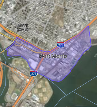
Boundary map of Port Morris.
Crime Index for 10454
145
The crime index in 10454 is 145, which is 1.4 times higher than national average.
Market Trends
Historical market data near 900 132nd St over selected time period.
Nearby Properties on 132nd St
- 900 E 132nd St, Bronx, NY 10454 (Port Morris) is a 8.53 acre property.
- 695 E 132nd St, Bronx, NY 10454 (Port Morris) is a 11,075 square foot and 0.09 acre property.
- 751 E 132nd St, Bronx, NY 10454 (Port Morris) is a 5,500 square foot and 0.18 acre property.
- 637 E 132nd St, Bronx, NY 10454 (Port Morris) is a 10,000 square foot and 0.24 acre property.
- 689 E 132nd St, Bronx, NY 10454 (Port Morris) is a 1,400 square foot and 0.04 acre property. It was built in 1920 and has an estimate of $585,734 with a price per ft² of $418.
- 650 E 132nd St, Bronx, NY 10454 (Port Morris) is a 1,200 square foot and 0.95 acre property.
- 697-699 E 132nd St, Bronx, NY 10454 (Port Morris) is a 7,126 square foot and 0.09 acre property.
- 747 E 132nd St, Bronx, NY 10454 (Port Morris) is a 5,500 square foot and 0.13 acre property.
- 687 E 132nd St, Bronx, NY 10454 (Port Morris) is a 1,400 square foot and 0.04 acre property. It was built in 1920 and has an estimate of $585,734 with a price per ft² of $418.
- 621 E 132nd St # 631, Bronx, NY 10454 (Port Morris) is a 28,250 square foot and 0.6 acre property.
- 759 E 132nd St, Bronx, NY 10454 (Port Morris) is a 5,500 square foot and 0.13 acre property.
- 685 E 132nd St, Bronx, NY 10454 (Port Morris) is a 1,400 square foot and 0.04 acre property. It was built in 1920 and has an estimate of $585,734 with a price per ft² of $418.
- 720 E 132nd St # 780, Bronx, NY 10454 (Port Morris) is a 5.61 acre property.
- 329 E 132nd St, Bronx, NY 10454 (Mott Haven) is a 0.31 acre property.
- 600 E 132nd St, Bronx, NY 10454 (Port Morris) is a 1.25 acre property.
- 620 E 132nd St # 640, Bronx, NY 10454 (Port Morris) is a 0.75 acre property.
- 605 E 132nd St, Bronx, NY 10454 (Port Morris) is a 38,150 square foot and 0.25 acre property.
- 589-591 E 132nd St, Bronx, NY 10454 (Port Morris) is a 5,250 square foot and 0.13 acre property.
- 767 E 132nd St, Bronx, NY 10454 (Port Morris) is a 4,059 square foot and 0.14 acre property.
- 693 E 132nd St, Bronx, NY 10454 (Port Morris) is a 3,750 square foot and 0.06 acre property.
- 691 E 132nd St, Bronx, NY 10454 (Port Morris) is a 1,430 square foot and 0.04 acre property. It was built in 1920 and has an estimate of $589,018 with a price per ft² of $412.
- 469 E 132nd St, Bronx, NY 10454 (Port Morris) is a 8,575 square foot and 0.25 acre property.
- 920 E 132nd St, Bronx, NY 10454 (Port Morris) is a 3.34 acre property.
- 519 E 132nd St # 525, Bronx, NY 10454 (Port Morris) is a 5,316 square foot and 0.2 acre property.
- 517 E 132nd St, Bronx, NY 10454 (Port Morris) is a 14,550 square foot and 0.11 acre property.
- View more properties on 132nd St