912 Anderson Cir
Woodland, CA 95776
- 3Beds
- 2Baths
- 1,333ft²Living Area
- 4,356ft²Lot Size
- -Pool
- 2Car
- 1998Year Built
- -DOM
- -Permit
Property Valuations
Latest estimates for 912 Anderson Cir based on TopHap automated valuation model (AVM).
TopHap Estimate
$493,750
$370/ft²
+$108K above Sold Price
Updated 3 months ago
Last Sold Price
$386,000
$290/ft²
18 years ago
912 Anderson Cir is valued at $493,750 by TopHap AVM 3 months ago.
912 Anderson Cir was last sold in 2005 for $386,000.
Current Ownership
Information about the current owner(s).
Taxes Billed
Taxes billed in 2023$6,391.24From latest Total Assessed Value1.24%Total Assessed Value$517,147=Land+
Assessed Value$294,747Additions
Assessed Value$222,400
In 2023, taxes billed for 912 Anderson Cir were $6,391.24, which is 1.24% from latest Total Assessed Value of $517,147.
Property History
912 Anderson Cir has undefined property events records (listings, deeds, permits, tax, foreclosure, loan).
Environment
Environmental factors around 912 Anderson Cir
Hazard Risks
Earthquake154Nat'l Avg100Particulates94Ozone82Air Pollution81Carb Mono71Lead41Tornado6Hail5Weather1Hurricane0Wind0
10 hazards (Carbon Monoxide, Earthquake Risk, Hail Index, Tornado Index, Air Pollution Index, Ozone Index, Weather Risk, Lead Index, Particulate Matter, National Average) are above the national average around 912 Anderson Cir.
Walkability Index
15 /20
Most Walkable
20-18
Very Walkable
17-15
Somewhat Walkable
14-10
Car Dependent
9-0
912 Anderson Cir has a walkability score of 15 out of 20, which means that it is in a very walkable area.
Noise Level
40 dB
Quiet Suburban Residential 0-49
Suburban Residential 50-54
Urban Residential 55-59
Noisy Urban Residential 60-64
Very Noisy Urban Residential 65+
Noise at 912 Anderson Cir is around 40dBs, which is comparable to a Quiet Suburban Residential area.
Temperature
Seasonal temperature sampled over multiple years
Winter
Average
Low
39°F
High
56°F
Summer
Average
Low
57°F
High
93°F
In the winter at 912 Anderson Cir, temperatures range from 38.62°F to 56.17°F with an average of 47.4°F. In the summer, the temperature ranges from 56.85°F to 92.89°F with and average of 74.87°F.
School Information
Public/private schools serving 912 Anderson Cir
Public Schools
Nearby public schools serving 912 Anderson Cir have ratings undefined, undefined, and undefined.
Neighborhood
This property is located in Gibson Ranch, Woodland, CA 95776.
Seasonal Housing units 95776
33%of housing is for seasonal rent.
Daytime Population for 95776
-1%of people during work hours.
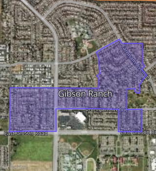
Boundary map of Gibson Ranch.
Crime Index for 95776
55
The crime index in 95776 is 55, which is 0.6 times lower than national average.
Market Trends
Historical market data near 912 Anderson Cir over selected time period.
Nearby Properties on Anderson Cir
- 926 Anderson Cir, Woodland, CA 95776 (Gibson Ranch) is a 1,333 square foot, 3 bedroom, 2 bathroom, 0.1 acre property. It was built in 1998 and has an estimate of $480,615 with a price per ft² of $361.
- 908 Anderson Cir, Woodland, CA 95776 (Gibson Ranch) is a 1,902 square foot, 3 bedroom, 3.25 bathroom, 0.1 acre property. It was built in 1998 and has an estimate of $541,936 with a price per ft² of $285.
- 912 Anderson Cir, Woodland, CA 95776 (Gibson Ranch) is a 1,333 square foot, 3 bedroom, 2 bathroom, 0.1 acre property. It was built in 1998 and has an estimate of $482,714 with a price per ft² of $362.
- 909 Anderson Cir, Woodland, CA 95776 (Gibson Ranch) is a 1,333 square foot, 3 bedroom, 2 bathroom, 0.11 acre property. It was built in 1999 and has an estimate of $457,530 with a price per ft² of $343.
- 994 Anderson Cir, Woodland, CA 95776 (Gibson Ranch) is a 1,902 square foot, 3 bedroom, 3.25 bathroom, 0.11 acre property. It was built in 1999 and has an estimate of $531,539 with a price per ft² of $279.
- 987 Anderson Cir, Woodland, CA 95776 (Gibson Ranch) is a 1,535 square foot, 4 bedroom, 3 bathroom, 0.11 acre property. It was built in 1997 and has an estimate of $469,845 with a price per ft² of $306.
- 991 Anderson Cir, Woodland, CA 95776 (Gibson Ranch) is a 1,426 square foot, 3 bedroom, 2 bathroom, 0.11 acre property. It was built in 1997 and has an estimate of $495,364 with a price per ft² of $347.
- 900 Anderson Cir, Woodland, CA 95776 (Gibson Ranch) is a 1,426 square foot, 4 bedroom, 2 bathroom, 0.12 acre property. It was built in 1998 and has an estimate of $511,472 with a price per ft² of $359.
- 904 Anderson Cir, Woodland, CA 95776 (Gibson Ranch) is a 1,333 square foot, 3 bedroom, 2 bathroom, 0.1 acre property. It was built in 1998 and has an estimate of $485,443 with a price per ft² of $364.
- 998 Anderson Cir, Woodland, CA 95776 (Gibson Ranch) is a 1,333 square foot, 3 bedroom, 2 bathroom, 0.14 acre property. It was built in 1999 and has an estimate of $504,617 with a price per ft² of $379.
- 936 Anderson Cir, Woodland, CA 95776 (Gibson Ranch) is a 1,426 square foot, 3 bedroom, 2 bathroom, 0.21 acre property. It was built in 1998 and has an estimate of $502,960 with a price per ft² of $353.
- 992 Anderson Cir, Woodland, CA 95776 (Gibson Ranch) is a 1,535 square foot, 4 bedroom, 3 bathroom, 0.11 acre property. It was built in 1999 and has an estimate of $479,820 with a price per ft² of $313.
- 997 Anderson Cir, Woodland, CA 95776 (Gibson Ranch) is a 1,426 square foot, 3 bedroom, 2 bathroom, 0.12 acre property. It was built in 1999 and has an estimate of $520,731 with a price per ft² of $365.
- 988 Anderson Cir, Woodland, CA 95776 (Gibson Ranch) is a 1,902 square foot, 3 bedroom, 3.25 bathroom, 0.11 acre property. It was built in 1999 and has an estimate of $520,547 with a price per ft² of $274.
- 993 Anderson Cir, Woodland, CA 95776 (Gibson Ranch) is a 1,333 square foot, 3 bedroom, 2 bathroom, 0.11 acre property. It was built in 1997 and has an estimate of $469,896 with a price per ft² of $353.
- 984 Anderson Cir, Woodland, CA 95776 (Gibson Ranch) is a 1,333 square foot, 3 bedroom, 2 bathroom, 0.11 acre property. It was built in 1999 and has an estimate of $477,059 with a price per ft² of $358.
- 983 Anderson Cir, Woodland, CA 95776 (Gibson Ranch) is a 1,902 square foot, 4 bedroom, 3.25 bathroom, 0.11 acre property. It was built in 1997 and has an estimate of $532,148 with a price per ft² of $280.
- 980 Anderson Cir, Woodland, CA 95776 (Gibson Ranch) is a 1,902 square foot, 3 bedroom, 3.25 bathroom, 0.11 acre property. It was built in 1999 and has an estimate of $531,183 with a price per ft² of $279.
- 905 Anderson Cir, Woodland, CA 95776 (Gibson Ranch) is a 1,426 square foot, 3 bedroom, 2 bathroom, 0.11 acre property. It was built in 1999 and has an estimate of $497,378 with a price per ft² of $349.
- 946 Anderson Cir, Woodland, CA 95776 (Gibson Ranch) is a 1,333 square foot, 3 bedroom, 2 bathroom, 0.11 acre property. It was built in 1998 and has an estimate of $512,752 with a price per ft² of $385.
- 914 Anderson Cir, Woodland, CA 95776 (Gibson Ranch) is a 1,535 square foot, 4 bedroom, 3 bathroom, 0.1 acre property. It was built in 1998 and has an estimate of $486,576 with a price per ft² of $317.
- 918 Anderson Cir, Woodland, CA 95776 (Gibson Ranch) is a 1,426 square foot, 3 bedroom, 2 bathroom, 0.1 acre property. It was built in 1998 and has an estimate of $502,321 with a price per ft² of $352.
- 919 Anderson Cir, Woodland, CA 95776 (Gibson Ranch) is a 1,426 square foot, 4 bedroom, 2 bathroom, 0.11 acre property. It was built in 1999 and has an estimate of $524,643 with a price per ft² of $368.
- 927 Anderson Cir, Woodland, CA 95776 (Gibson Ranch) is a 1,426 square foot, 3 bedroom, 2 bathroom, 0.11 acre property. It was built in 1998 and has an estimate of $499,746 with a price per ft² of $350.
- 950 Anderson Cir, Woodland, CA 95776 (Gibson Ranch) is a 1,333 square foot, 3 bedroom, 2 bathroom, 0.11 acre property. It was built in 1998 and has an estimate of $501,042 with a price per ft² of $376.
- View more properties on Anderson Cir