9433 Kimbrough Ct
Stockton, CA 95209
- 4Beds
- 3Baths
- 1,984ft²Living Area
- 7,000ft²Lot Size
- -Pool
- 2Car
- 1980Year Built
- -DOM
- 4Permits
Property Valuations
Latest estimates for 9433 Kimbrough Ct based on TopHap automated valuation model (AVM).
TopHap Estimate
$488,250
$246/ft²
+$387K above Sold Price
Updated 3 months ago
Last Sold Price
$101,000
$51/ft²
24 years ago
9433 Kimbrough Ct is valued at $488,250 by TopHap AVM 3 months ago.
9433 Kimbrough Ct was last sold in 1999 for $101,000.
Permits
9433 Kimbrough Ct has 4 permit records of total value of $9,850.
Current Ownership
Information about the current owner(s).
Taxes Billed
Taxes billed in 2023$1,617.28From latest Total Assessed Value1.11%Total Assessed Value$146,161=Land+
Assessed Value$32,005Additions
Assessed Value$114,156
In 2023, taxes billed for 9433 Kimbrough Ct were $1,617.28, which is 1.11% from latest Total Assessed Value of $146,161.
Property History
9433 Kimbrough Ct has undefined property events records (listings, deeds, permits, tax, foreclosure, loan).
Environment
Environmental factors around 9433 Kimbrough Ct
Hazard Risks
Earthquake149Particulates101Nat'l Avg100Air Pollution87Ozone82Carb Mono78Lead42Tornado28Weather11Hail0Hurricane0Wind0
9 hazards (Carbon Monoxide, Earthquake Risk, Tornado Index, Air Pollution Index, Ozone Index, Weather Risk, Lead Index, Particulate Matter, National Average) are above the national average around 9433 Kimbrough Ct.
Walkability Index
14 /20
Most Walkable
20-18
Very Walkable
17-15
Somewhat Walkable
14-10
Car Dependent
9-0
9433 Kimbrough Ct has a walkability score of 14 out of 20, which means that it is in a somewhat walkable area.
Temperature
Seasonal temperature sampled over multiple years
Winter
Average
Low
38°F
High
56°F
Summer
Average
Low
57°F
High
90°F
In the winter at 9433 Kimbrough Ct, temperatures range from 38.1°F to 56.48°F with an average of 47.29°F. In the summer, the temperature ranges from 56.63°F to 90.08°F with and average of 73.36°F.
School Information
Public/private schools serving 9433 Kimbrough Ct
Public Schools
Nearby public schools serving 9433 Kimbrough Ct have ratings undefined, undefined, and undefined.
Neighborhood
This property is located in Bear Creek, Stockton, CA 95209.
Seasonal Housing units 95209
16%of housing is for seasonal rent.
Daytime Population for 95209
-26%of people during work hours.
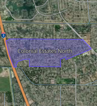
Boundary map of Bear Creek.
Crime Index for 95209
68
The crime index in 95209 is 68, which is 0.7 times lower than national average.
Market Trends
Historical market data near 9433 Kimbrough Ct over selected time period.
Nearby Properties on Kimbrough Ct
- 9434 Kimbrough Ct, Stockton, CA 95209 (Colonial Estates North) is a 1,914 square foot, 4 bedroom, 2 bathroom, 0.17 acre property. It was built in 1980 and has an estimate of $449,614 with a price per ft² of $235.
- 9439 Kimbrough Ct, Stockton, CA 95209 (Colonial Estates North) is a 1,698 square foot, 3 bedroom, 2 bathroom, 0.15 acre property. It was built in 1980 and has an estimate of $436,155 with a price per ft² of $257.
- 9409 Kimbrough Ct, Stockton, CA 95209 (Colonial Estates North) is a 1,698 square foot, 3 bedroom, 2 bathroom, 0.25 acre property. It was built in 1980 and has an estimate of $484,661 with a price per ft² of $285.
- 9410 Kimbrough Ct, Stockton, CA 95209 (Colonial Estates North) is a 2,226 square foot, 4 bedroom, 2 bathroom, 0.3 acre property. It was built in 1980 and has an estimate of $466,866 with a price per ft² of $210.
- 9402 Kimbrough Ct, Stockton, CA 95209 (Colonial Estates North) is a 2,030 square foot, 4 bedroom, 2 bathroom, 0.27 acre property. It was built in 1980 and has an estimate of $428,512 with a price per ft² of $211.
- 9416 Kimbrough Ct, Stockton, CA 95209 (Colonial Estates North) is a 2,195 square foot, 4 bedroom, 2 bathroom, 0.18 acre property. It was built in 1980 and has an estimate of $475,133 with a price per ft² of $216.
- 9440 Kimbrough Ct, Stockton, CA 95209 (Colonial Estates North) is a 1,866 square foot, 4 bedroom, 2 bathroom, 0.16 acre property. It was built in 1980 and has an estimate of $451,428 with a price per ft² of $242.
- 9446 Kimbrough Ct, Stockton, CA 95209 (Colonial Estates North) is a 2,226 square foot, 4 bedroom, 2 bathroom, 0.16 acre property. It was built in 1979 and has an estimate of $468,512 with a price per ft² of $210.
- 9428 Kimbrough Ct, Stockton, CA 95209 (Colonial Estates North) is a 1,485 square foot, 3 bedroom, 2 bathroom, 0.18 acre property. It was built in 1980 and has an estimate of $440,566 with a price per ft² of $297.
- 9415 Kimbrough Ct, Stockton, CA 95209 (Colonial Estates North) is a 1,984 square foot, 4 bedroom, 3 bathroom, 0.2 acre property. It was built in 1980 and has an estimate of $456,870 with a price per ft² of $230.
- 9433 Kimbrough Ct, Stockton, CA 95209 (Colonial Estates North) is a 1,984 square foot, 4 bedroom, 3 bathroom, 0.14 acre property. It was built in 1980 and has an estimate of $451,210 with a price per ft² of $227.
- 9421 Kimbrough Ct, Stockton, CA 95209 (Colonial Estates North) is a 2,226 square foot, 4 bedroom, 2 bathroom, 0.17 acre property. It was built in 1980 and has an estimate of $454,439 with a price per ft² of $204.
- 9445 Kimbrough Ct, Stockton, CA 95209 (Colonial Estates North) is a 1,674 square foot, 3 bedroom, 2 bathroom, 0.14 acre property. It was built in 1979 and has an estimate of $404,574 with a price per ft² of $242.
- 9427 Kimbrough Ct, Stockton, CA 95209 (Colonial Estates North) is a 1,914 square foot, 4 bedroom, 2 bathroom, 0.15 acre property. It was built in 1980 and has an estimate of $410,989 with a price per ft² of $215.
- 9422 Kimbrough Ct, Stockton, CA 95209 (Colonial Estates North) is a 1,655 square foot, 3 bedroom, 2 bathroom, 0.19 acre property. It was built in 1980 and has an estimate of $456,036 with a price per ft² of $276.